Guide Contents
Use this guide to explore Lemon Bay, one of Southwest Florida's most distinctive coastal estuaries—from its natural formation and early history to its wildlife, waterfront communities, beaches, waterways, and boating experiences.
2. Introduction
Protected by Manasota Key, Lemon Bay is a 13-mile estuary spanning Sarasota and Charlotte counties. Its shallow waters, abundant wildlife, waterfront communities, and year-round recreation make it one of Southwest Florida's premier boating destinations.

▶ Watch the aerial video of Stump Pass & Ski Alley on YouTube
Unlike the open waters of Charlotte Harbor or the remote wilderness of Gasparilla Sound, Lemon Bay blends nature with coastal living. Quiet residential canals, waterfront parks, marinas, restaurants, hotels, and vacation homes share the shoreline with mangrove forests, seagrass meadows, dolphins, manatees, and hundreds of species of birds. Visitors can enjoy peaceful paddling through the estuary in the morning, lunch at a waterfront restaurant in the afternoon, and a spectacular Gulf Coast sunset in the evening.
The bay also serves as an important link in Florida's Intracoastal Waterway, connecting boaters to Venice, Englewood, Stump Pass, Gasparilla Pass, Charlotte Harbor, and numerous destinations throughout Southwest Florida.
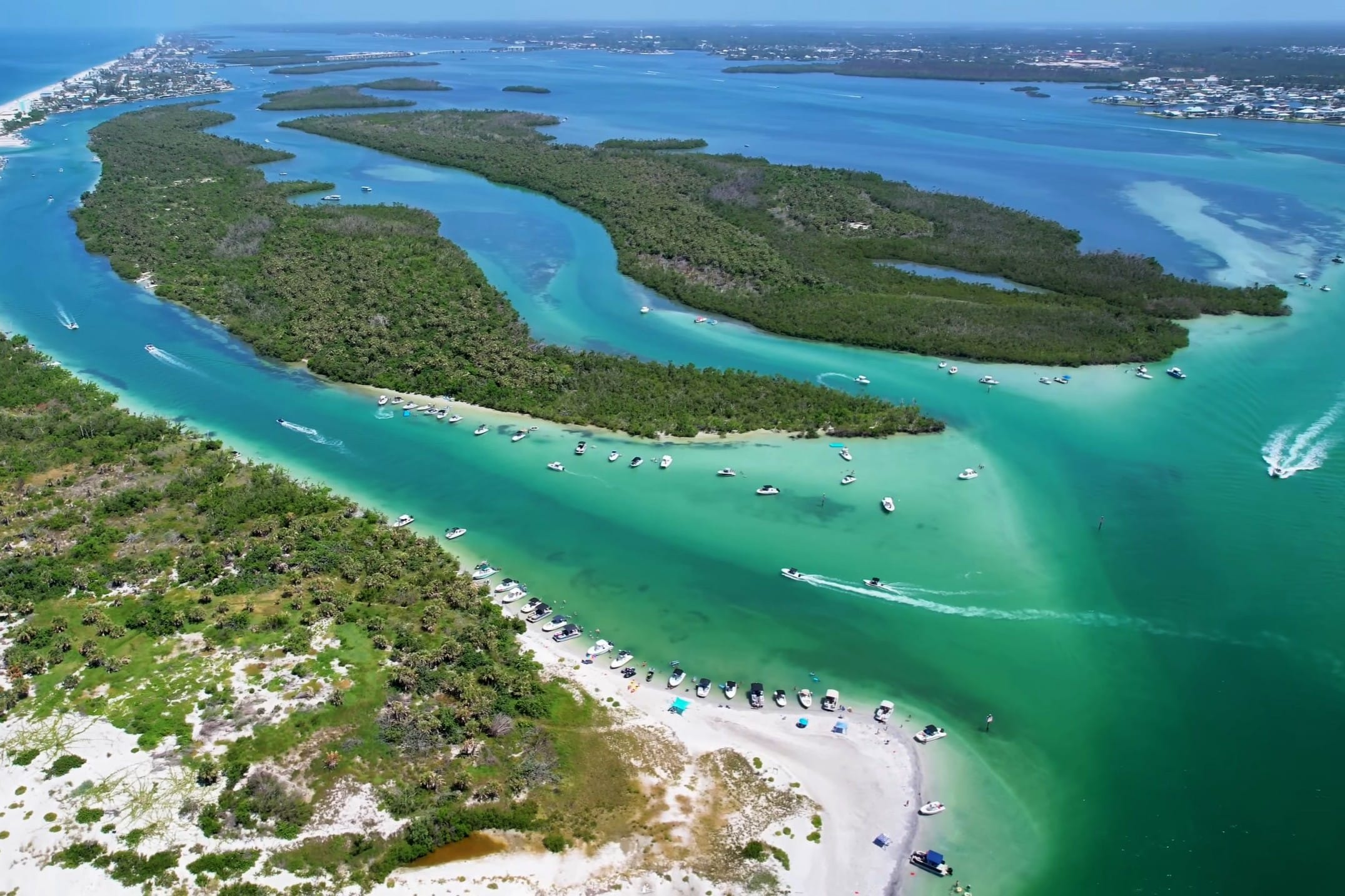
Aerial view of Ski Alley, Stump Pass, and Manasota Key.
Although Lemon Bay is popular with residents and visitors, it remains one of Florida's most productive estuarine ecosystems. Its extensive seagrass beds provide essential habitat for juvenile fish, blue crabs, shrimp, manatees, and many other marine species. Every tide brings Gulf water through Stump Pass and Gasparilla Pass, helping sustain the delicate balance between freshwater and saltwater that defines this remarkable estuary.
As Captain Pavel, I have explored Lemon Bay in every season. I have watched dolphins feed along mangrove shorelines, manatees surface quietly beside the boat, ospreys dive for fish, and brilliant sunsets reflect across calm water. Every trip offers something different. This guide combines the area's history, geography, ecology, and local knowledge to help you discover one of Southwest Florida's most fascinating coastal waterways.
3. Why Lemon Bay Is Unique
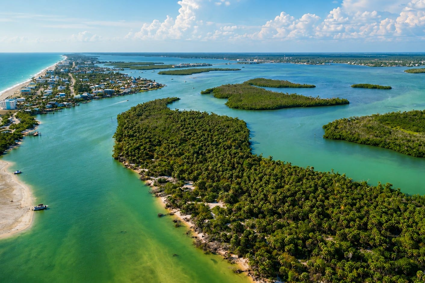
Lemon Bay stretches for approximately 13 miles between the Florida mainland and Manasota Key, a barrier island that protects the estuary from the open Gulf. This aerial view highlights the calm waters, natural shoreline, and unique geography that make Lemon Bay one of Southwest Florida's most important coastal ecosystems.
Several qualities distinguish Lemon Bay from other coastal waterways in Southwest Florida:
- A 13-mile estuary protected by Manasota Key.
- One of Florida's shallowest major estuaries, with much of the bay less than six feet deep.
- Home to productive seagrass meadows and diverse marine life.
- Connected to the Gulf through Stump Pass and Gasparilla Pass.
- Part of Florida's Gulf Intracoastal Waterway.
- Surrounded by waterfront communities, marinas, parks, restaurants, hotels, and vacation accommodations.
- An ideal destination for boating, kayaking, paddleboarding, birdwatching, wildlife photography, and waterfront dining.
Quick Facts
| Feature | Information |
|---|---|
| Location | Southwest Florida |
| Counties | Sarasota and Charlotte |
| Length | 13 miles |
| Average Width | About three-quarters of a mile |
| Average Depth | Generally less than six feet |
| Water Type | Estuary—a mixture of fresh and salt water |
| Barrier Island | Manasota Key |
| Gulf Connections | Stump Pass and Gasparilla Pass |
| Waterway | Gulf Intracoastal Waterway |
| Best Known For | Wildlife, boating, waterfront communities, and coastal scenery |
4. Where Lemon Bay Is
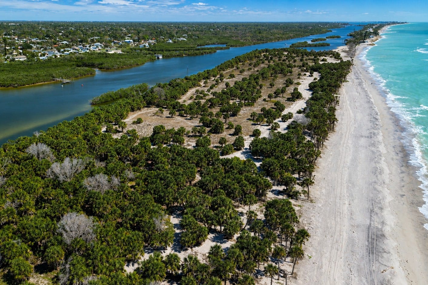
Caspersen Beach marks the northern end of Manasota Key, where the barrier island protects the waters of Lemon Bay from the Gulf. Known for its natural shoreline, coastal dunes, and abundant fossil shark teeth, the beach offers one of Southwest Florida's most unspoiled coastal landscapes.
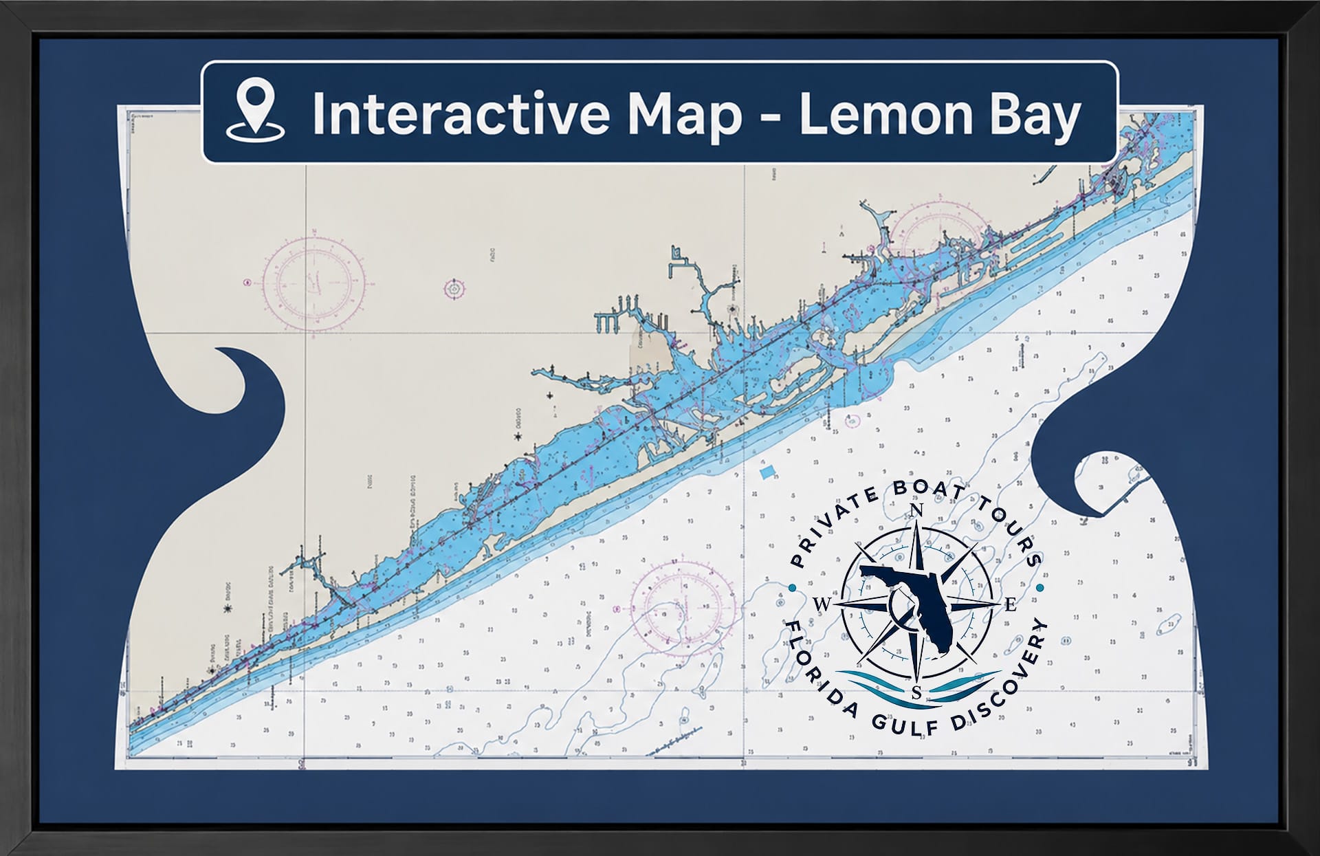
Lemon Bay is a shallow coastal estuary located along Florida's Gulf Coast in Sarasota and Charlotte counties. Extending 13 miles from north to south, the bay lies between the mainland and Manasota Key, a barrier island that protects its waters from the open Gulf of Mexico.
The northern end of Lemon Bay begins near Venice, where freshwater creeks and canals enter the estuary. From there, the bay follows the shoreline south through Englewood and Grove City before reaching Placida and Gasparilla Pass at its southern end. Throughout its length, Lemon Bay forms part of the Gulf Intracoastal Waterway, providing a sheltered route for recreational and cruising boaters traveling along Florida's west coast.
Unlike many bays that open directly to the Gulf, Lemon Bay is separated from open water by Manasota Key. This barrier island shields the estuary from large Gulf waves while allowing tidal exchange through two natural inlets: Stump Pass to the north and Gasparilla Pass to the south. These passes continually circulate seawater into and out of the bay, maintaining the estuarine conditions that support its rich marine ecosystem.
The surrounding landscape combines natural shoreline with developed waterfront communities. Mangrove forests, seagrass flats, and tidal creeks exist alongside marinas, public parks, residential canals, restaurants, and vacation homes. This balance between protected natural habitat and coastal development makes Lemon Bay unique among Southwest Florida's waterways.
Although the estuary averages only about three-quarters of a mile in width, it supports an impressive diversity of recreational opportunities. Boaters, kayakers, paddleboarders, anglers, photographers, and wildlife enthusiasts share the protected waters. Because much of the bay remains shallow, navigation requires attention to marked channels. Those same shallow waters provide important habitat for dolphins, manatees, juvenile fish, and numerous bird species.
For many visitors, Lemon Bay serves as a gateway to Southwest Florida's Gulf Coast. From here, boaters can travel north toward Venice, south through Gasparilla Pass into Gasparilla Sound and Charlotte Harbor, or west through Stump Pass to the Gulf of Mexico.
5. Communities
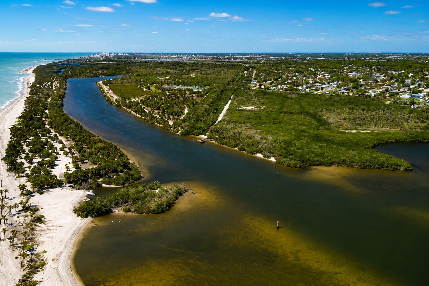
North Lemon Bay near Caspersen Beach showcases the northern section of this 13-mile coastal estuary. Protected by Manasota Key, these shallow waters provide important habitat for dolphins, manatees, wading birds, and juvenile fish while offering some of the most scenic boating and kayaking opportunities along Florida's Gulf Coast.
Lemon Bay is bordered by several distinct waterfront communities, each offering its own character and access to the estuary.
Venice
Venice marks the northern approach to Lemon Bay and is known for its historic downtown, beaches, parks, and boating facilities. Many visitors begin exploring the northern Gulf Coast from here.
Englewood
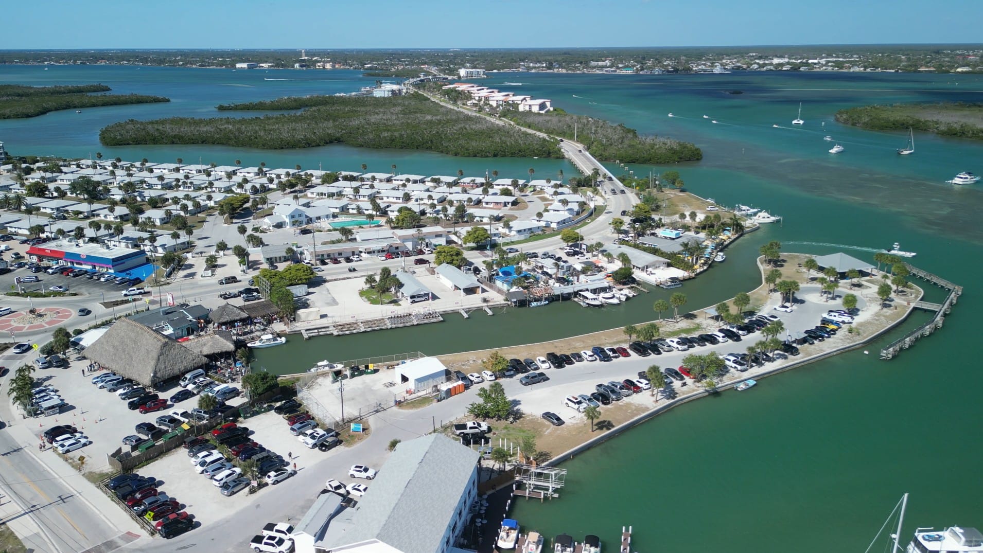
This aerial view showcases SandBar Tiki & Grille on Manasota Key, overlooking the protected waters of Lemon Bay. Located directly across from Englewood Beach, the waterfront restaurant has become a popular gathering place for boaters, beach visitors, and sunset enthusiasts. Its location between the Gulf of America and Lemon Bay reflects the unique geography that makes Manasota Key one of Southwest Florida's premier coastal destinations.
Englewood is the largest community directly associated with Lemon Bay. It serves as the commercial and recreational center of the estuary, with marinas, waterfront restaurants, parks, shops, hotels, and vacation rentals. Englewood Beach on Manasota Key is one of Southwest Florida's best-known public beaches.
Grove City
Grove City occupies the southern portion of the mainland shoreline. This quieter waterfront community provides residential canals, boating access, and convenient proximity to both Lemon Bay and Gasparilla Sound.
Manasota Key
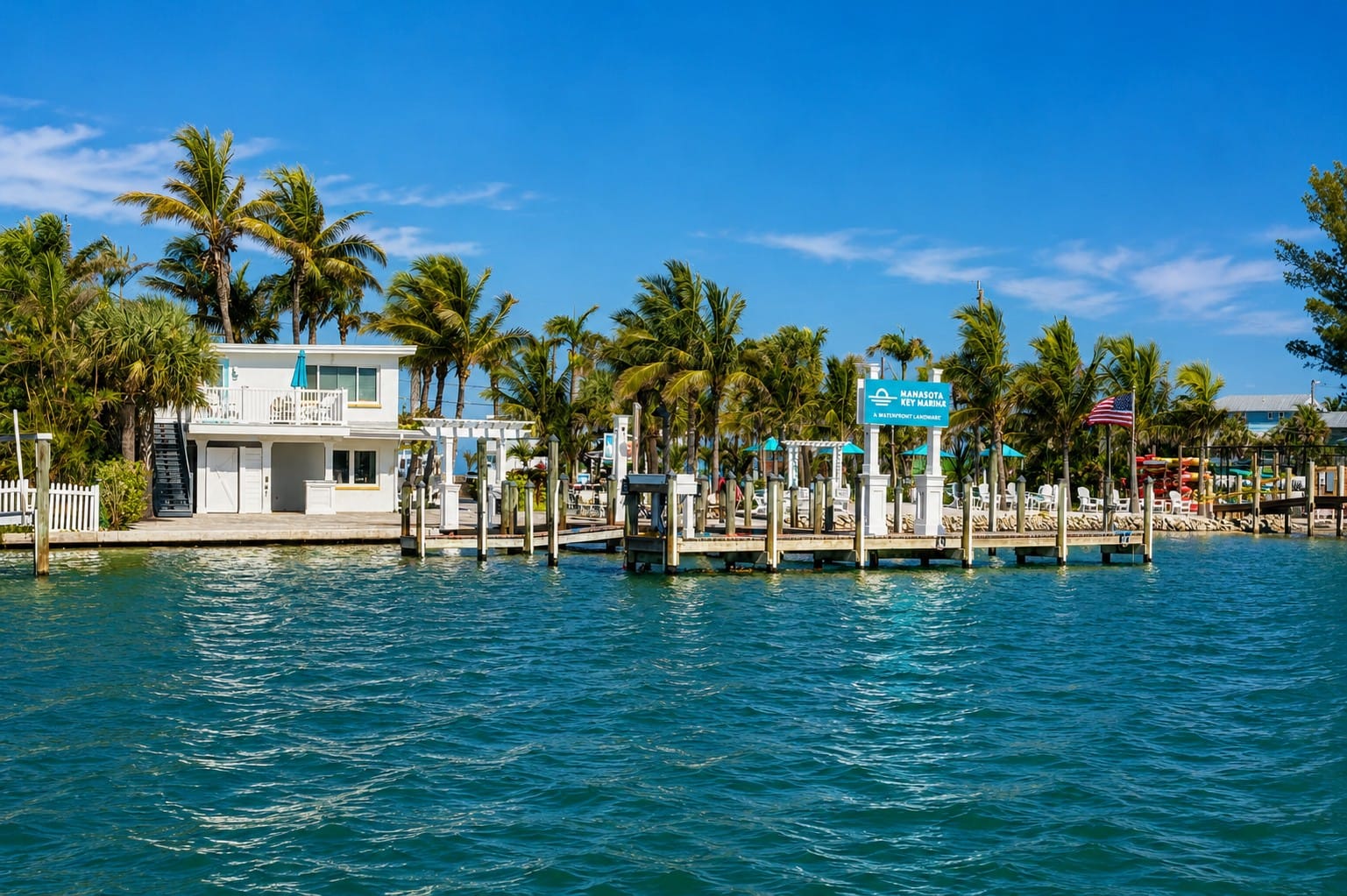
Manasota Key Resort overlooks the protected waters of Lemon Bay, offering direct access to both the estuary and the Gulf of Mexico. Surrounded by mangroves, wildlife, and beautiful waterfront scenery, the resort has welcomed visitors to Manasota Key for decades and continues to be one of the area's best-known waterfront destinations.
Manasota Key forms the western boundary of Lemon Bay. The barrier island protects the estuary from Gulf waves while offering beaches, vacation rentals, waterfront homes, restaurants, and access to both Lemon Bay and the Gulf of Mexico.
Cape Haze
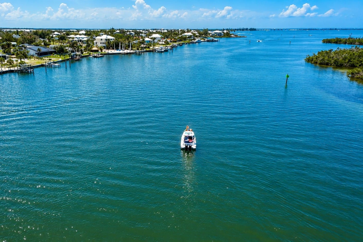
Cape Haze borders the western shoreline of Lemon Bay, where protected waters, mangrove islands, and residential canals create one of Southwest Florida's most scenic boating destinations. This aerial view highlights the natural beauty of the estuary and the sheltered waterways that connect Lemon Bay with Gasparilla Sound and the Intracoastal Waterway.
Cape Haze occupies the southern mainland near Placida and is known for its residential neighborhoods, canals, golf courses, marinas, and convenient access to nearby waterways.
6. Formation and Geology
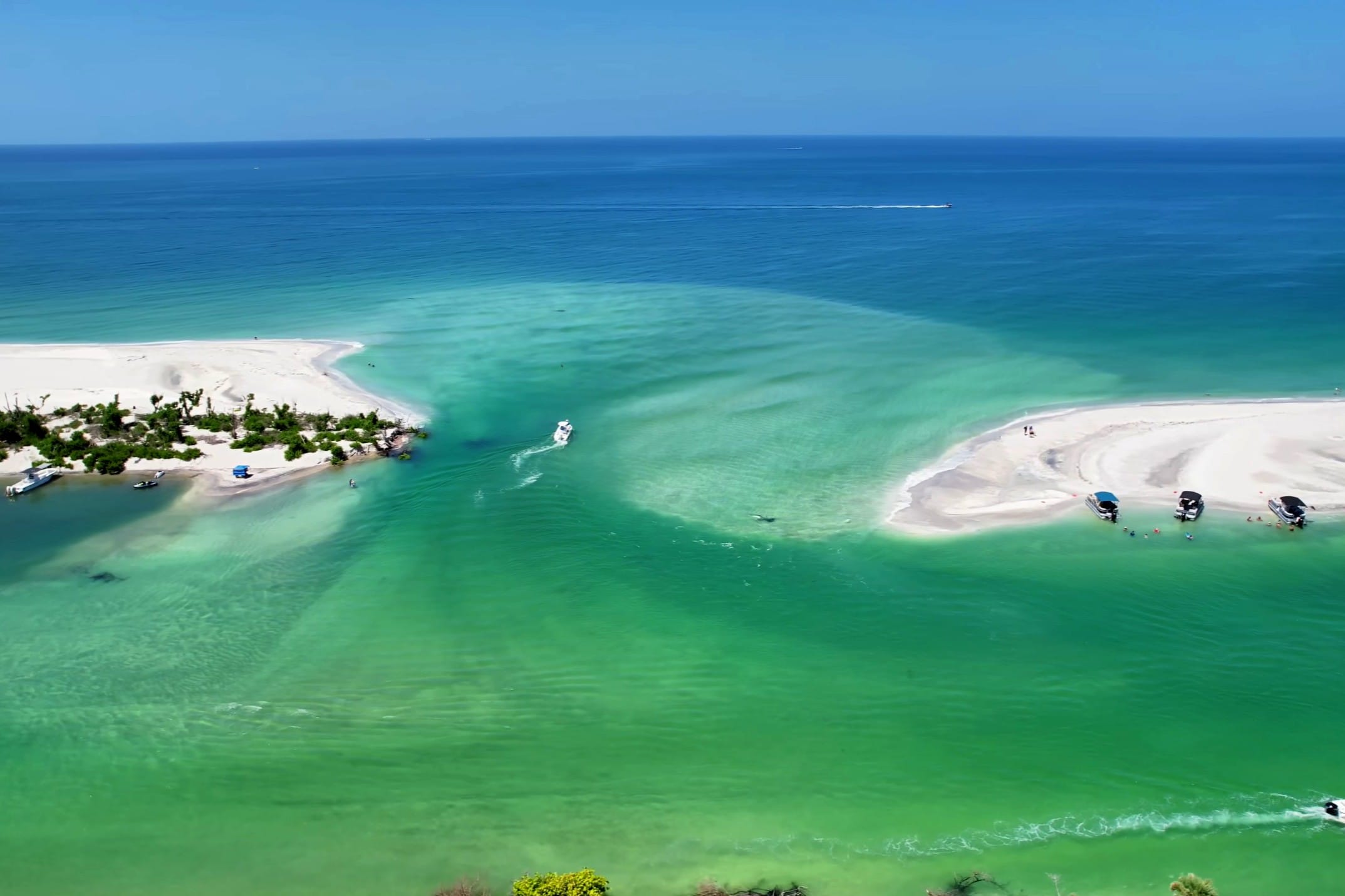
Milton Pass and Ski Alley near Englewood, Florida, photographed after Hurricane Milton reshaped the southern end of Manasota Key. The newly formed inlet temporarily connected the Gulf of Mexico with Lemon Bay, dramatically altering the shoreline and providing a rare opportunity to observe how powerful storms can rapidly transform Florida's barrier islands.
The story of Lemon Bay began thousands of years before the first people arrived on Florida's Gulf Coast. It is a story shaped by changing sea levels, shifting sands, powerful storms, and the continuous forces of wind, waves, and tides.
During the last Ice Age, much of Earth's water was locked in massive glaciers. Sea levels were hundreds of feet lower than they are today, and Florida's Gulf coastline extended many miles farther west. What is now Lemon Bay was dry land crossed by rivers and freshwater streams flowing toward the distant Gulf of Mexico.
As the climate warmed and glaciers melted, sea levels gradually rose. Approximately 6,000 to 8,000 years ago, the rising Gulf flooded low-lying coastal areas, creating bays, lagoons, and estuaries along Florida's west coast. Waves and longshore currents also transported enormous amounts of sand, gradually building the chain of barrier islands that protects much of Southwest Florida.
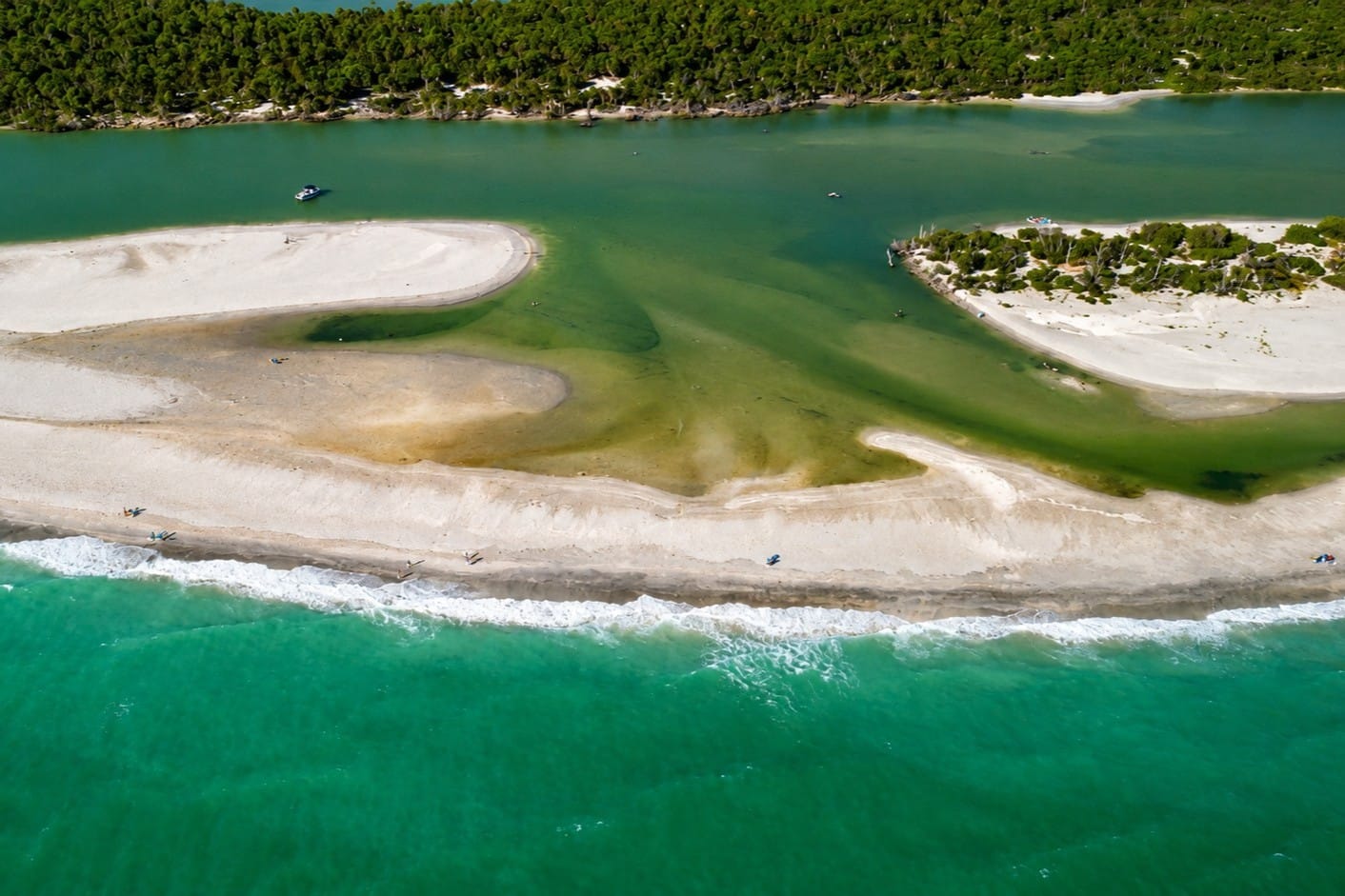
Milton Pass photographed in May 2026, shortly before the inlet naturally closed as shifting sand and coastal currents rebuilt the barrier island. Opened by Hurricane Milton in October 2024, the pass existed for approximately 19 months before waves, tides, and longshore sediment transport sealed the opening and restored the continuous shoreline of Manasota Key.
One of those barrier islands became Manasota Key.
Stretching along the Gulf shoreline, Manasota Key acts as a natural barrier between the open Gulf of Mexico and the calmer waters of Lemon Bay. Instead of allowing powerful Gulf waves to enter directly, the island shields the estuary from much of the surf and storm energy. This protection has helped preserve Lemon Bay as a relatively shallow and sheltered body of water.
Lemon Bay is an estuary—a place where freshwater from inland creeks mixes with saltwater carried inland by the tides. This continual exchange creates one of the most productive types of ecosystems in North America.
Two natural tidal passes connect Lemon Bay with the Gulf of Mexico. Stump Pass provides an opening at the northern end, while Gasparilla Pass connects the southern end with Gasparilla Sound and Charlotte Harbor. Daily tidal exchanges bring oxygen-rich seawater, nutrients, and marine life into the estuary while carrying freshwater toward the Gulf.
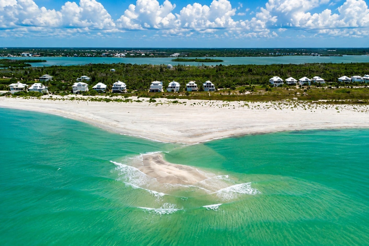
An offshore sandbar lies just beyond the Gulf beach of Little Gasparilla Island, creating a shallow area of calm, clear water that is popular for swimming, shelling, and observing marine life. These sandbars are constantly reshaped by waves, tides, and storms, illustrating the dynamic nature of Florida's barrier island coastline.
Because wave action inside the bay is relatively gentle, sediments settle rather than being constantly stirred. Over thousands of years, this process created the broad, shallow bottom that characterizes Lemon Bay today. Across much of the estuary, water depths rarely exceed six feet, allowing sunlight to reach the bottom.
These shallow conditions support extensive seagrass meadows. Seagrasses are flowering marine plants—not seaweed—that stabilize the bottom, improve water clarity, produce oxygen, and provide food and shelter for marine species. Juvenile fish, blue crabs, shrimp, scallops, and manatees depend on healthy seagrass beds during part of their life cycles.
Dense mangrove forests line many undeveloped areas. Their complex root systems trap sediment, filter runoff, reduce erosion, and provide nursery habitat for fish and crustaceans.
Although Lemon Bay appears peaceful, it remains a dynamic environment. Tropical storms and hurricanes occasionally reshape nearby beaches and tidal passes, while tides, winds, and seasonal rainfall continually influence water levels and salinity. The estuary continues to change, one tide at a time.
7. The First People
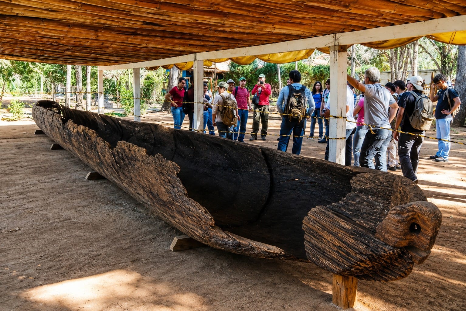
An ancient Calusa dugout canoe, carved from a single tree trunk and preserved at the Florida Museum of Natural History. Dugout canoes were the primary means of transportation for the Calusa, allowing them to travel, fish, trade, and navigate the sheltered waters of Charlotte Harbor, Pine Island Sound, Gasparilla Sound, and Lemon Bay. Similar watercraft have been used in Florida for thousands of years, demonstrating the region's long maritime heritage.
Long before roads, bridges, marinas, or waterfront communities lined the shores of Lemon Bay, the estuary supported generations of Native Americans who understood its rich natural resources. The bay's protected waters, abundant fish, shellfish, and wildlife made it an ideal place to live, travel, and trade.
Archaeological evidence indicates that people were living along Florida's Gulf Coast for thousands of years before European explorers arrived. As sea levels gradually rose and Lemon Bay took shape as an estuary, Native communities adapted to the changing coastline and relied on its shallow waters and productive marine habitats.
By the time Spanish explorers reached Southwest Florida during the sixteenth century, the Calusa had become the dominant people throughout much of the region. Their territory extended across present-day Charlotte Harbor, Pine Island Sound, Gasparilla Sound, Lemon Bay, and neighboring coastal waterways.
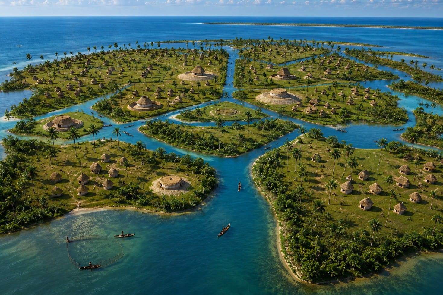
A modern reconstruction of a traditional Calusa village, based on archaeological discoveries and historical research. Built with wooden structures and palm-thatched roofs atop shell mounds, Calusa communities were strategically located along the protected estuaries of Southwest Florida. From villages like these, the Calusa controlled an extensive network of waterways that included Charlotte Harbor, Pine Island Sound, Gasparilla Sound, and Lemon Bay.
Unlike many Native American cultures that depended primarily on farming, the Calusa built their civilization around the sea. Fish, oysters, clams, crabs, shrimp, and other marine resources formed the foundation of their economy. The sheltered waters of Lemon Bay supplied food throughout the year, while nearby mangrove forests and tidal creeks supported abundant wildlife.
The Calusa were skilled canoe builders and navigators. Using large dugout canoes carved from native trees, they traveled through the interconnected network of bays, passes, creeks, and islands that make up Southwest Florida. Lemon Bay was part of an extensive transportation system linking communities from present-day Venice south to Charlotte Harbor and beyond.
Evidence of these early inhabitants remains in the form of shell middens—accumulations of oyster and clam shells mixed with pottery fragments, tools, and charcoal. These archaeological sites provide insight into how Native peoples lived, fished, and adapted to the estuarine environment. Some middens also created elevated living areas in an otherwise low-lying coastal landscape.
Although European diseases, conflict, and colonial expansion eventually led to the decline of the Calusa during the eighteenth century, their legacy remains woven into the history of Southwest Florida.
8. History

A historical illustration depicting a Calusa fishing village along the estuarine waters of Southwest Florida. The Calusa built thriving coastal communities on shell mounds, traveled in dugout canoes, and depended on the abundant fish, shellfish, and marine resources of estuaries such as Lemon Bay, Gasparilla Sound, Pine Island Sound, and Charlotte Harbor. Archaeological research shows that the Calusa developed one of North America's most sophisticated maritime societies without practicing large-scale agriculture.
For thousands of years, Lemon Bay remained a quiet coastal estuary known to Native peoples who depended on its waters for food and transportation. That changed in the early sixteenth century when Spanish explorers began charting Florida's Gulf Coast. Permanent European settlement around Lemon Bay remained limited for centuries because of its isolation, shallow waters, and challenging environment.
During the eighteenth and early nineteenth centuries, Cuban and Spanish fishermen established seasonal fishing ranchos along Florida's southwest coast. These camps were located near productive estuaries where fish could be harvested, salted, and shipped to markets in Havana and other Caribbean ports. Although larger ranchos were concentrated around Charlotte Harbor and Pine Island Sound, Lemon Bay provided sheltered waters, abundant fish, and a convenient route between coastal settlements.
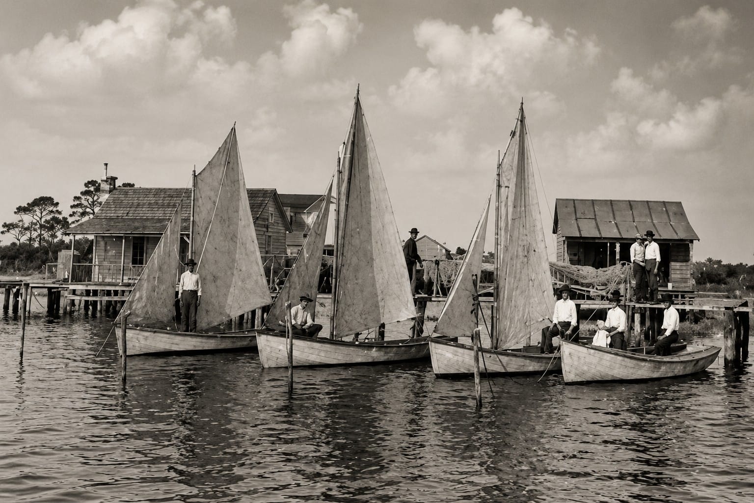
A historical illustration of a Cuban fishing rancho, similar to the seasonal camps that operated along the Southwest Florida coast during the eighteenth and early nineteenth centuries. From these waterfront settlements, Cuban and Spanish fishermen caught, salted, and dried mullet, redfish, grouper, and other species before shipping them to markets in Havana. Fishing ranchos became an important part of the region's early economy and often worked alongside Native people who shared their knowledge of Florida's estuaries and coastal waters.
By the late nineteenth century, American pioneers began settling along the shores of Lemon Bay. Fishing, farming, and cattle ranching became foundations of the local economy. Small docks, boat landings, and homes appeared along the mainland shoreline, while the barrier island that became Manasota Key remained largely undeveloped and accessible only by boat.
Commercial fishing became one of the region's most important industries. Fishermen worked the shallow estuary for mullet and other species using cast nets and traditional techniques. During seasonal mullet runs, Lemon Bay became a busy working waterway supplying fish houses throughout Southwest Florida.
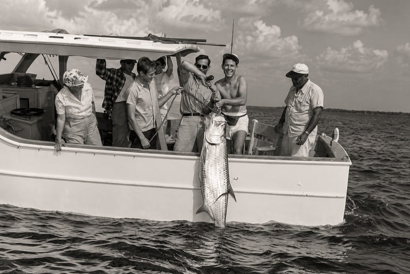
A historic tarpon fishing charter in Boca Grande Pass, where local guides introduced visiting anglers to one of the world's most famous sport fisheries during the late nineteenth and early twentieth centuries. The arrival of wealthy winter visitors helped transform Boca Grande into the "Tarpon Capital of the World," establishing a guiding tradition that continues today. Many of the area's early fishing guides came from commercial fishing families whose knowledge of Charlotte Harbor and Boca Grande Pass had been passed down through generations.
The construction of the Gulf Intracoastal Waterway during the twentieth century transformed Lemon Bay into an important navigation corridor. Dredged channels connected existing waterways into a protected route along Florida's Gulf Coast, allowing vessels to travel between Venice, Englewood, Gasparilla Sound, Charlotte Harbor, and destinations farther south.
Transportation improvements also encouraged the growth of waterfront communities. Bridges connecting the mainland with Manasota Key made the beaches more accessible, while improved highways attracted residents and visitors. Englewood developed into the area's commercial center, offering marinas, restaurants, parks, and services supporting the community and tourism industry.
During the second half of the twentieth century, Lemon Bay evolved from a working waterfront into a desirable coastal destination. Residential canal communities expanded, waterfront homes overlooked the estuary, and vacation rentals welcomed visitors. Conservation efforts also helped protect seagrass beds, mangrove shorelines, and wildlife habitat.
Today, Lemon Bay reflects both its past and present. Commercial fishing remains part of the region's maritime heritage, recreational boating helps define daily life, and waterfront communities continue to exist alongside a valuable estuarine ecosystem.
9. Wildlife
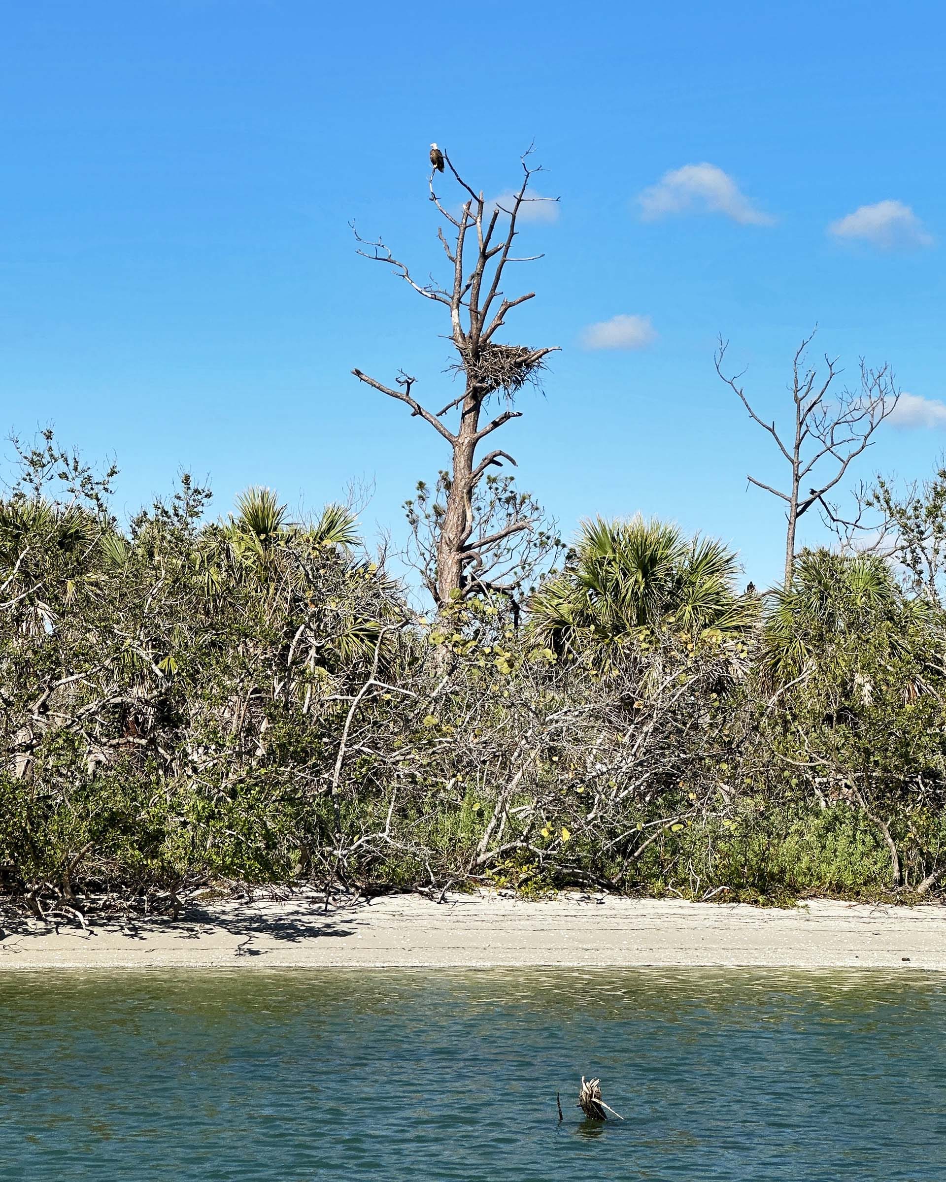
An osprey nest overlooking Ski Alley and Lemon Bay. Ospreys are among Southwest Florida's most recognizable birds of prey and depend almost entirely on fish, making estuaries like Lemon Bay ideal nesting habitat. Pairs often return to the same nest year after year, raising their young near shallow, fish-rich waters where they can hunt efficiently.
Lemon Bay is one of Southwest Florida's richest wildlife habitats. Its shallow waters, seagrass meadows, mangrove shorelines, tidal creeks, and protected estuarine environment support an extraordinary variety of marine life and birds throughout the year.
The bay's shallow depth allows sunlight to reach the bottom across much of the estuary. This sunlight supports extensive seagrass beds that form the foundation of the ecosystem. Often called the nurseries of the sea, these underwater meadows provide food, shelter, and breeding habitat for fish, crustaceans, mollusks, and marine mammals.
Dolphins
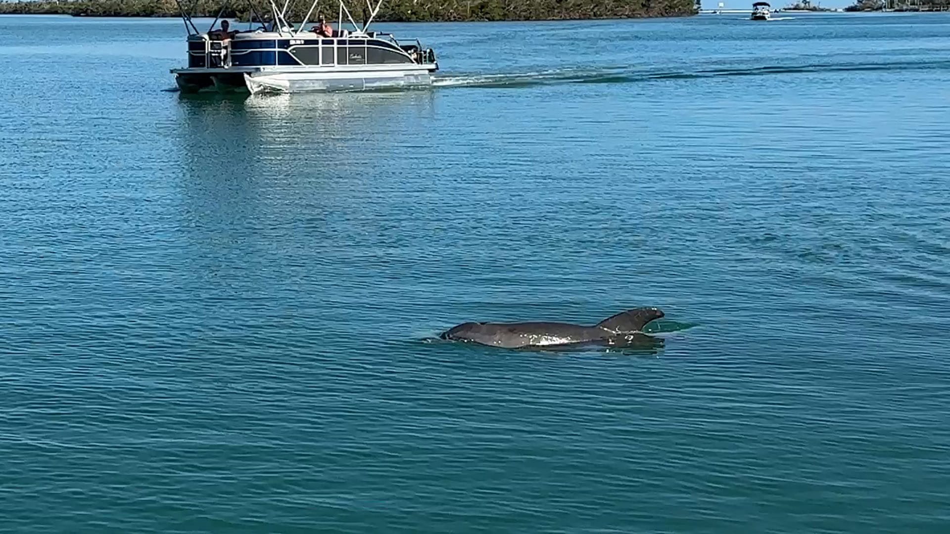
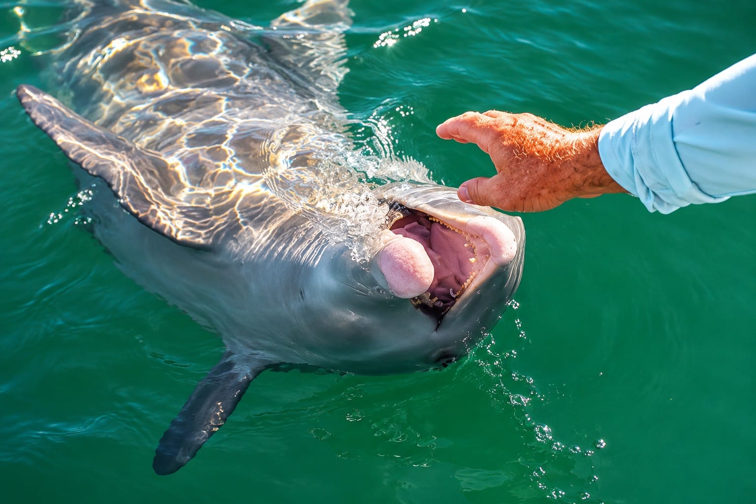
A bottlenose dolphin surfaces beside a pontoon boat in Lemon Bay near Englewood, Florida. Resident dolphins are frequently seen throughout the estuary, where healthy seagrass beds and abundant fish provide ideal feeding habitat. Encounters like this are a highlight for boaters, but observing dolphins responsibly from a safe distance helps protect these intelligent marine mammals and their natural behavior.
Bottlenose dolphins are among the most frequently observed animals in Lemon Bay. They often travel alone, in pairs, or in small family groups while hunting mullet and other fish along mangrove shorelines and grass flats.
Lemon Bay's dolphins frequently hunt in shallow coves and narrow channels, giving patient observers opportunities to watch their natural feeding behavior.
Manatees
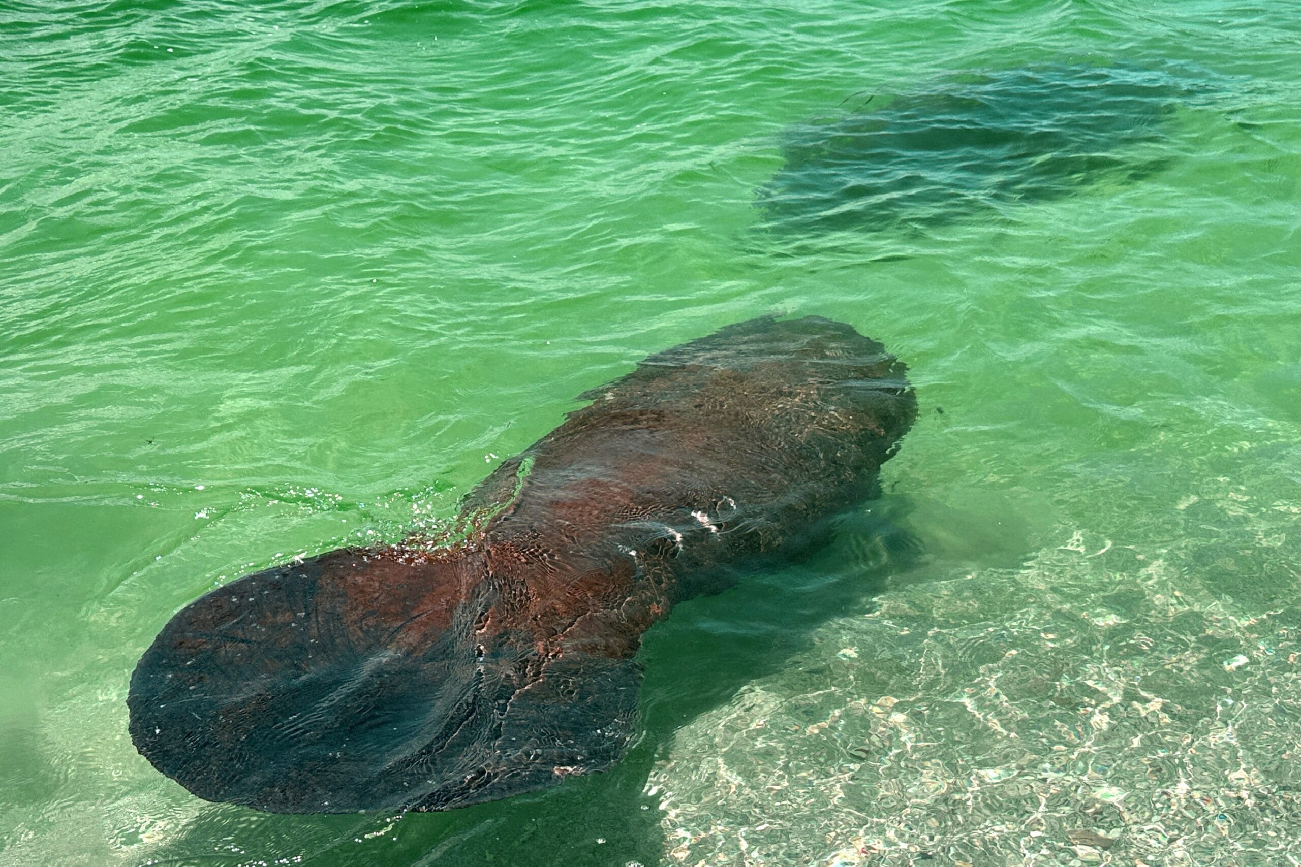
A Florida manatee glides through the calm waters near Stump Pass in Englewood, Florida. Lemon Bay's seagrass beds, estuarine waters, and nearby freshwater sources provide important habitat for these gentle marine mammals throughout much of the year. Manatees are protected by state and federal law, and boaters should always reduce speed in designated manatee zones and observe them from a respectful distance.
West Indian manatees regularly visit Lemon Bay, especially during warmer months. These gentle marine mammals feed primarily on seagrass and other aquatic vegetation found throughout the estuary.
Because Lemon Bay is shallow and protected, manatees often move quietly through residential canals, along mangrove shorelines, and across broad grass flats. Responsible boat operation is essential, particularly in designated slow-speed and manatee protection zones.
Birds
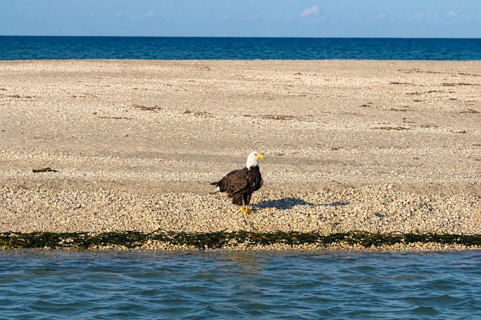
A bald eagle overlooks the waters near Stump Pass in Englewood, Florida. As North America's national bird, the bald eagle depends on healthy coastal ecosystems where fish are abundant. Lemon Bay, Stump Pass, and the surrounding estuaries provide excellent hunting habitat, while nearby tall pines and mangroves offer ideal nesting and roosting sites. Florida supports one of the largest bald eagle populations in the contiguous United States.
Birdwatchers are rewarded throughout the year in Lemon Bay.
Ospreys are frequently seen diving into the bay for fish or nesting on channel markers and utility poles. Brown pelicans patrol the shoreline before plunging into the water after baitfish.
Great blue herons, great egrets, snowy egrets, little blue herons, tricolored herons, ibis, wood storks, anhingas, cormorants, and roseate spoonbills depend on the estuary's shallow waters and wetlands. Migratory birds increase the diversity of species during winter.
Fish and Marine Life
Click the image above to watch the aerial video on YouTube.
Common fish found in and around Lemon Bay include:
- Snook
- Redfish
- Spotted seatrout
- Seasonal tarpon
- Mullet
- Sheepshead
- Black drum
- Mangrove snapper
- Jack crevalle
Blue crabs, shrimp, oysters, scallops, and numerous smaller invertebrates contribute to the estuary's food web and support recreational and commercial fisheries.
A Living Estuary
Freshwater from inland creeks mixes with saltwater entering through Stump Pass and Gasparilla Pass. This exchange delivers nutrients and oxygen while maintaining the conditions needed for seagrasses, mangroves, fish, and wildlife.
Every part of the ecosystem depends on the others. Healthy seagrass supports fish. Fish feed dolphins and birds. Mangroves protect shorelines and provide nursery habitat. Tides continually renew the estuary and connect these habitats into one living system.
10. Life Around Lemon Bay
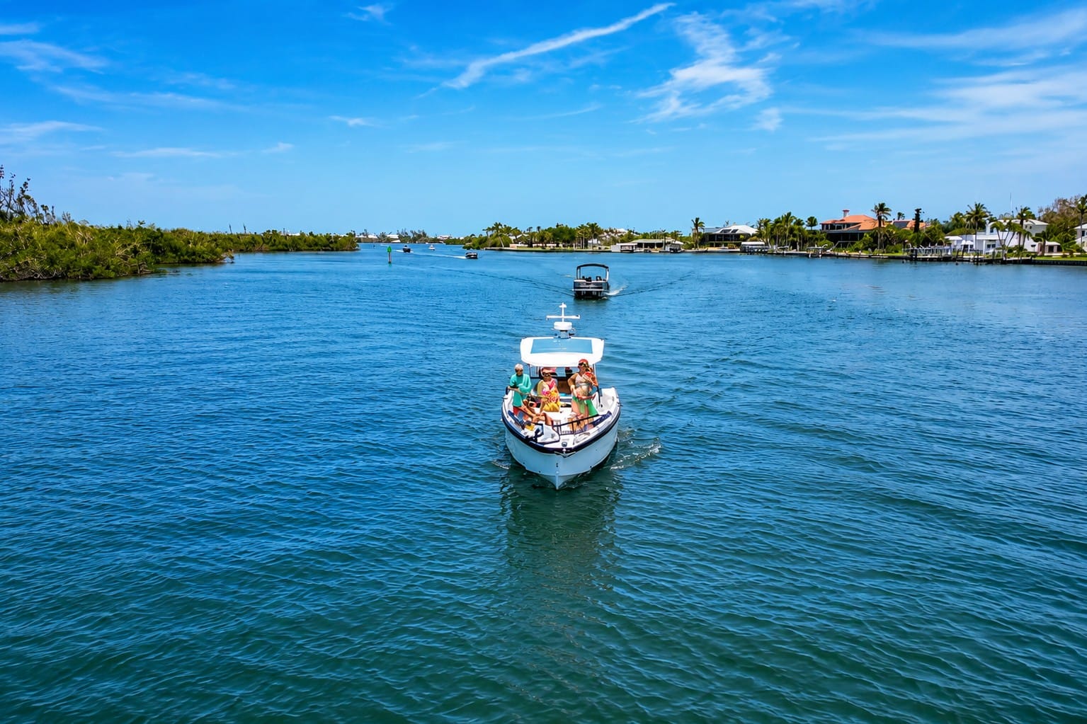
A private boat tour along the shores of Cape Haze offers a unique perspective of Lemon Bay, where mangrove shorelines, shallow seagrass flats, and waterfront homes meet one of Florida's most productive estuaries. The protected waters provide excellent conditions for boating, wildlife viewing, and exploring nearby destinations including Stump Pass, Don Pedro Island, and the southern end of Manasota Key.
Lemon Bay is more than a beautiful estuary. It is the heart of a coastal lifestyle where residents and visitors enjoy boating, fishing, wildlife, and the natural beauty of Southwest Florida. The bay continues to shape everyday life, supporting recreation, tourism, and businesses connected to the water.
For generations, people have depended on Lemon Bay for transportation, fishing, and commerce. Today, it remains a popular destination for recreational boating, kayaking, paddleboarding, birdwatching, shelling, and exploring the protected waters of the estuary.
The Intracoastal Waterway brings cruising boaters through Lemon Bay year-round, while marinas, public boat ramps, waterfront parks, and restaurants make the estuary easily accessible from both land and water. Its calm waters attract boaters of all experience levels, from first-time paddlers to seasoned cruisers.
Wildlife is part of the daily experience on Lemon Bay. Dolphins frequently travel through the estuary, manatees visit its sheltered waters, and ospreys, pelicans, herons, egrets, and many other coastal birds thrive along the shoreline and mangrove islands.
Despite the continued growth of Southwest Florida, Lemon Bay has preserved much of its peaceful Old Florida character. The combination of protected waters, abundant wildlife, and year-round outdoor recreation continues to make the estuary one of the region's most cherished natural resources.
11. Things to Explore
Lemon Bay offers far more than a scenic boat ride. Along its shores and nearby barrier island are parks, beaches, nature preserves, and waterways that create one of Southwest Florida's most diverse coastal destinations.
Stump Pass Beach State Park
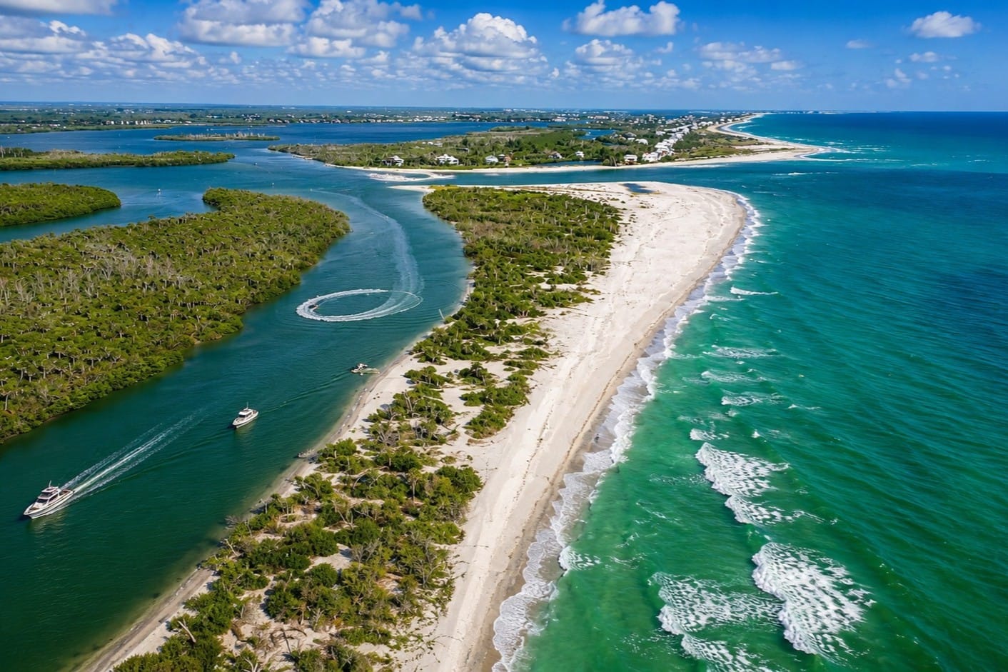
Stump Pass State Park protects the southern tip of Manasota Key, where pristine Gulf beaches, coastal dunes, and mangrove shorelines meet the waters of Lemon Bay. This aerial view showcases one of Southwest Florida's most important natural preserves, providing habitat for shorebirds, sea turtles, dolphins, and countless other coastal species.
Located at the southern end of Manasota Key, Stump Pass Beach State Park protects an important natural inlet connecting Lemon Bay with the Gulf of Mexico.
The park is known for natural beaches, hiking trails, shelling, wildlife, and Gulf sunsets. Stump Pass is continually reshaped by tides and storms, making every visit different. Dolphins, shorebirds, sea turtles, and numerous fish species are commonly observed throughout the area.
Englewood Beach
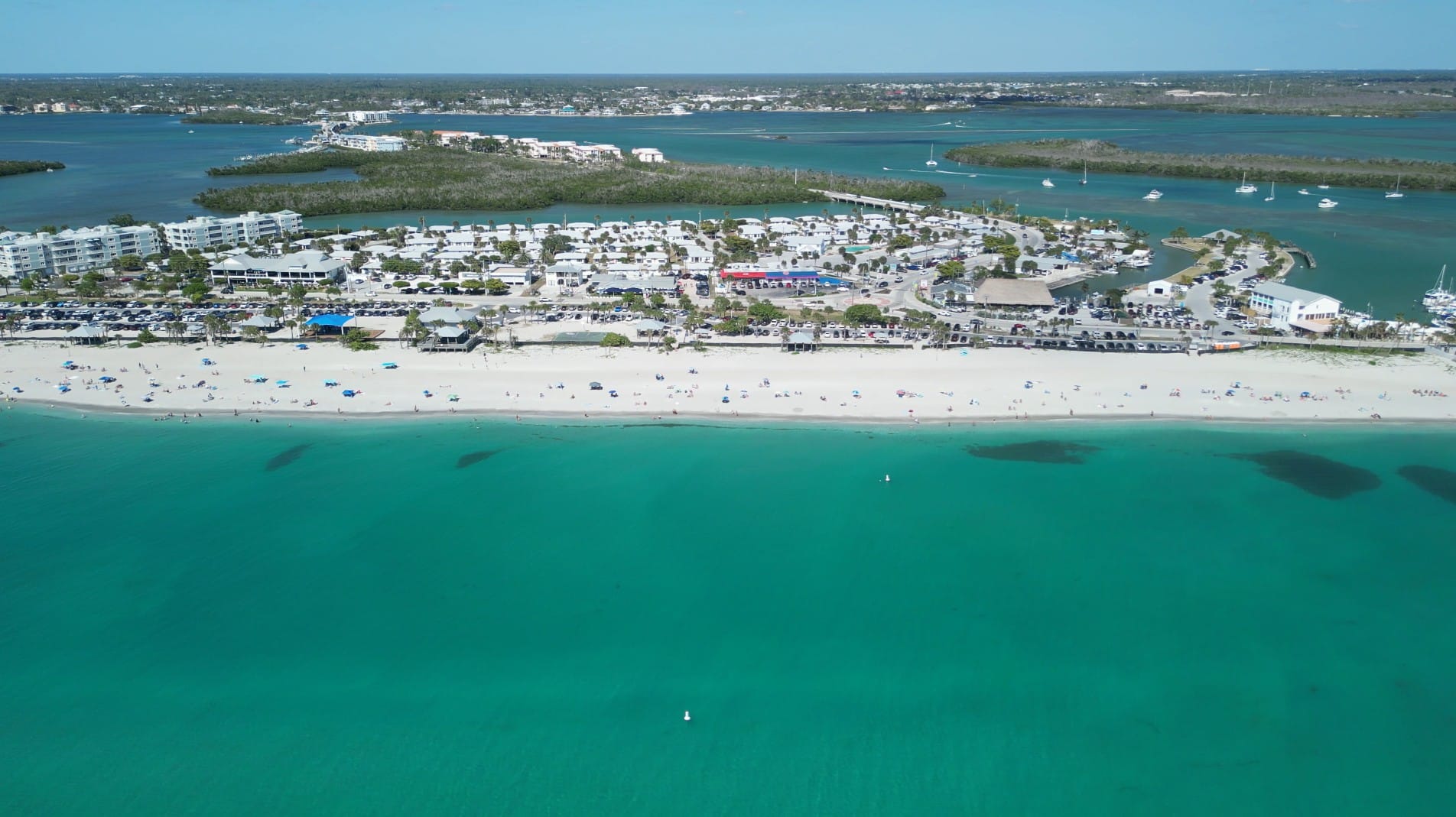
Englewood Beach is the most popular public beach on Manasota Key, offering wide white-sand beaches, turquoise Gulf waters, and easy access to Lemon Bay. This aerial view shows the barrier island, Stump Pass Bridge, marinas, restaurants, and the protected estuary beyond—illustrating why Englewood Beach serves as one of the primary gateways for boating, kayaking, paddleboarding, and exploring Southwest Florida's coastal ecosystems.
Englewood Beach is one of Southwest Florida's best-known public beaches. Located on Manasota Key, it combines public access with restaurants, parks, picnic areas, and Gulf views.
Blind Pass Beach
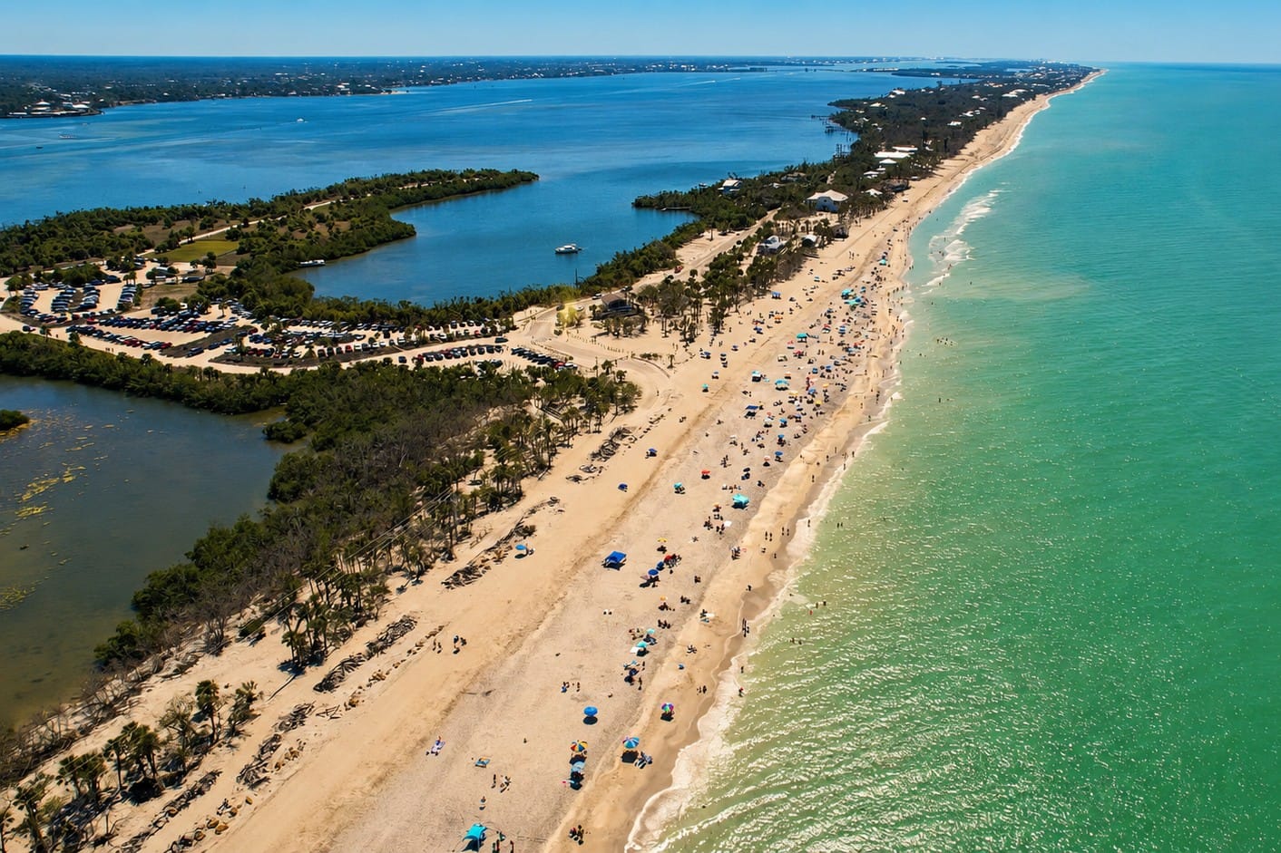
Blind Pass Beach, also known as Middle Beach, is a quiet stretch of shoreline on Manasota Key known for shelling, fossilized shark teeth, birdwatching, and spectacular Gulf sunsets. The aerial view captures the beach's natural setting, with the Gulf of Mexico on one side and Lemon Bay Aquatic Preserve on the other, making it one of Southwest Florida's best locations for kayaking, wildlife viewing, and exploring Florida's barrier island ecosystems.
At the northern end of Manasota Key, Blind Pass Beach offers a quieter coastal experience. Its natural shoreline attracts shell collectors, birdwatchers, photographers, and visitors seeking a less-developed beach.
Caspersen Beach
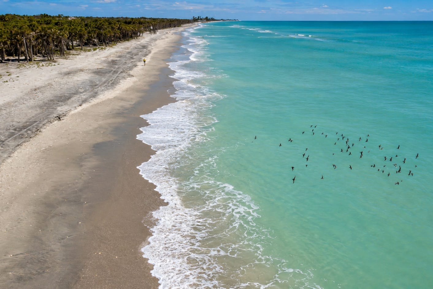
Caspersen Beach is one of Southwest Florida's most natural Gulf Coast beaches, renowned for its undeveloped shoreline, fossilized shark teeth, and abundant coastal wildlife. This aerial view highlights the broad sandy beach, nearshore waters, and flocks of shorebirds that depend on this protected habitat. Together with nearby dunes, tidal flats, and coastal hammock, Caspersen Beach provides an important refuge for migrating birds and native wildlife along Florida's Gulf Coast.
Although Caspersen Beach lies on the Gulf side of Venice rather than directly on Lemon Bay, it is closely connected to the northern estuary.
Known for its natural shoreline and fossil shark teeth, Caspersen Beach offers a different coastal experience. Visitors can combine time at the beach with exploration of northern Lemon Bay.
Ski Alley
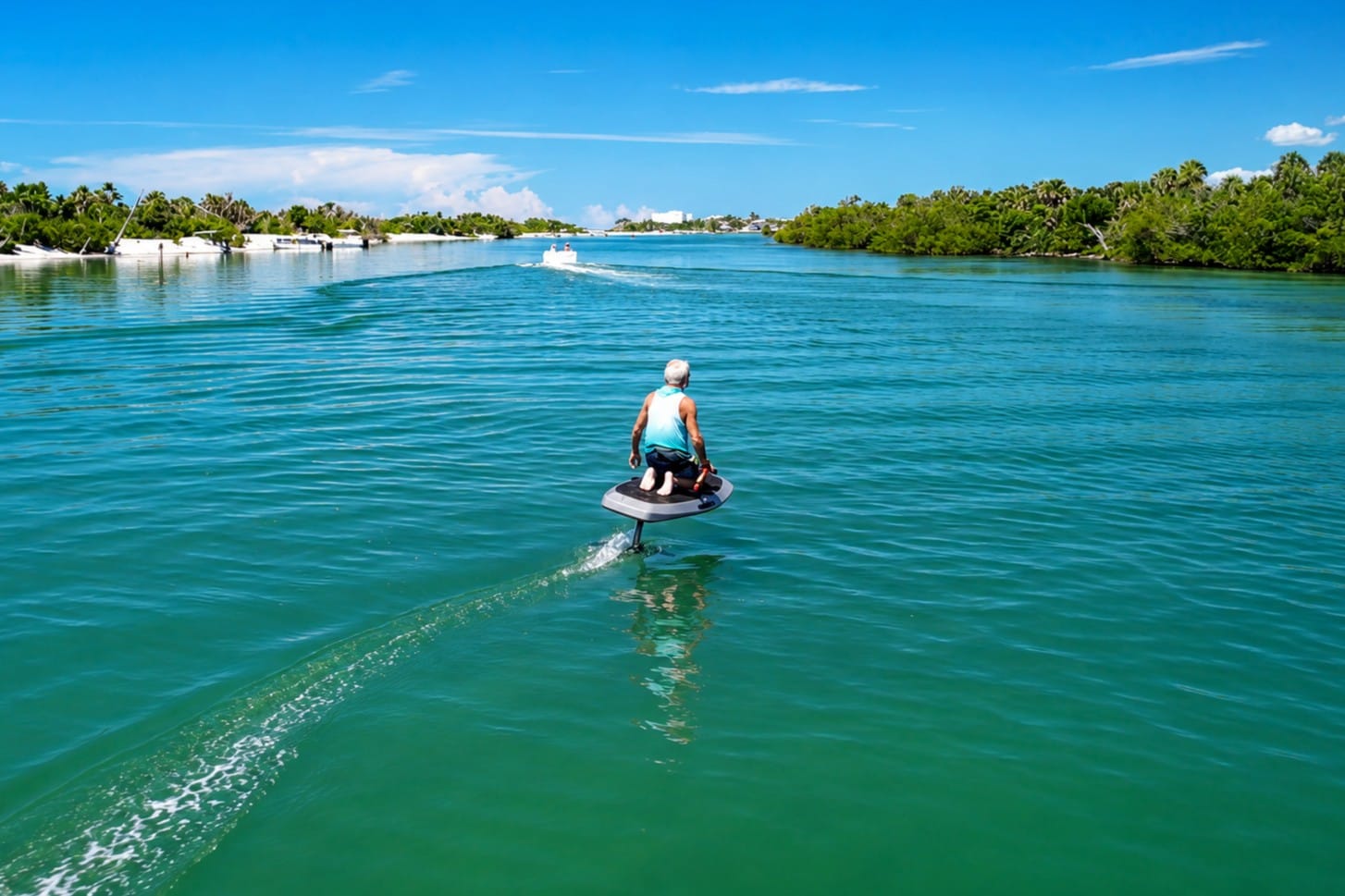
Captain Pavel rides an electric hydrofoil (eFoil) through the calm waters of Ski Alley, a narrow waterway between Stump Pass and Manasota Key. Surrounded by shallow seagrass flats, mangrove shorelines, and abundant marine life, Ski Alley has become one of Southwest Florida's favorite locations for boating, paddleboarding, kayaking, and eFoiling while offering a unique perspective of the dynamic coastal environment around Lemon Bay.
Ski Alley is one of Lemon Bay's best-known local waterways. Its protected waters, scenic surroundings, and convenient location make it popular for recreational boating, paddleboarding, kayaking, and wildlife observation.
Dolphins and manatees frequently visit the area, while calm conditions can provide excellent opportunities for photography.
Lemon Bay Park
Located on the mainland in Englewood, Lemon Bay Park protects more than 200 acres of native coastal habitat. Walking trails, observation areas, kayak launches, and educational exhibits allow visitors to experience the estuary from shore.
Cedar Point Environmental Park
Cedar Point Environmental Park preserves another important section of Lemon Bay's natural shoreline. Trails pass through pine flatwoods, scrub habitat, mangrove forests, and coastal wetlands before reaching scenic views of the estuary.
Hidden Corners of the Estuary
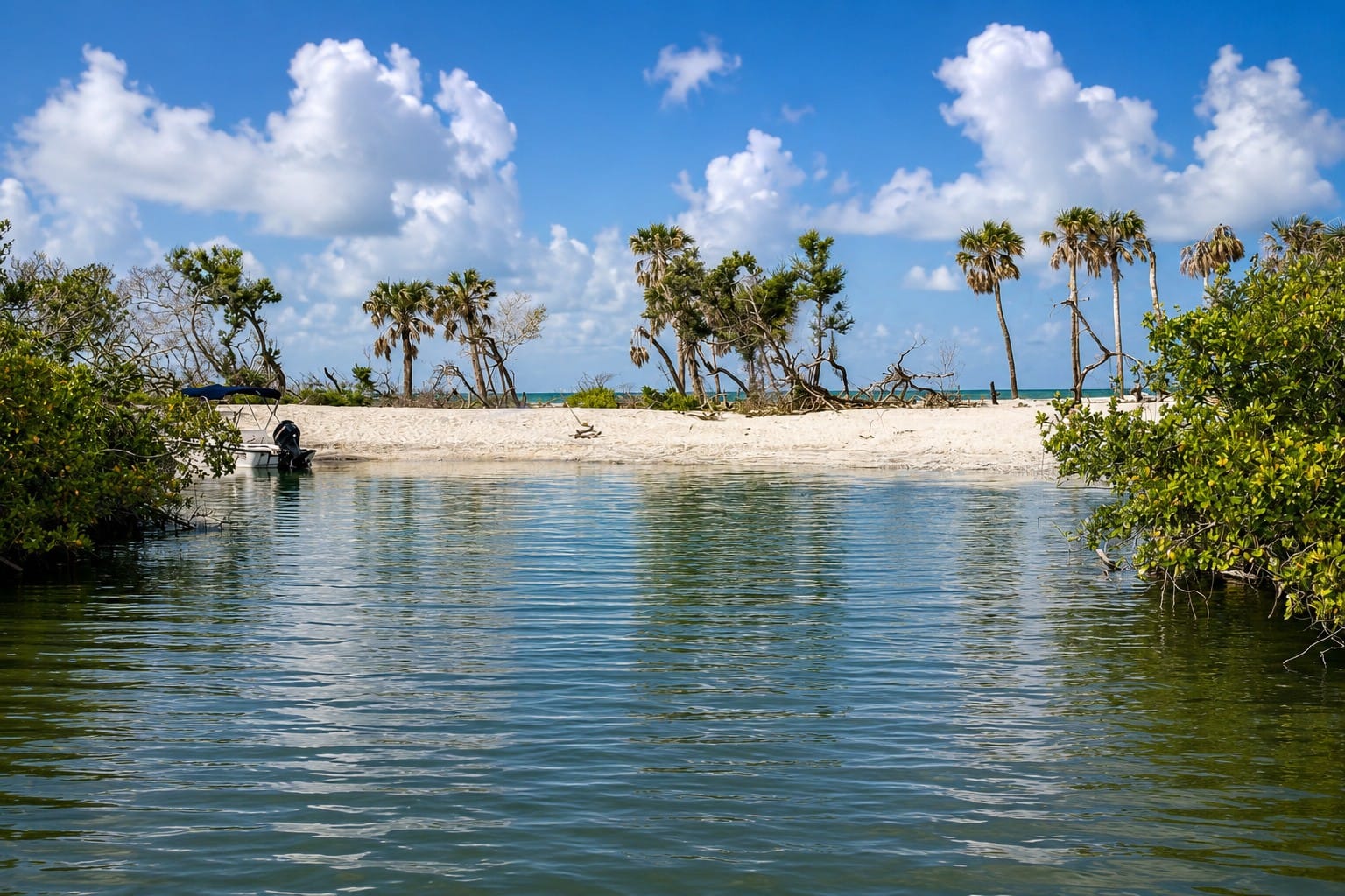
A secluded lagoon at Caspersen Beach provides a peaceful contrast to the nearby Gulf shoreline. Protected by dunes and coastal vegetation, these calm waters support mangroves, juvenile fish, wading birds, and other wildlife while serving as an important transition zone between the Gulf of Mexico and Lemon Bay. Such coastal lagoons contribute to the rich biodiversity that makes Caspersen Beach one of Southwest Florida's most ecologically valuable natural areas.
Some of Lemon Bay's greatest attractions never appear on highway signs. Quiet mangrove shorelines, shallow grass flats, residential canals, small islands, and peaceful anchorages provide opportunities to experience the estuary away from its busiest public areas.
These lesser-known locations often provide memorable wildlife encounters and reveal the quieter character of Lemon Bay.
12. Waterfront Lifestyle
Life on Lemon Bay has always been closely connected to the water. From early Native communities and pioneer fishing settlements to today's waterfront neighborhoods, marinas, and parks, the estuary continues to shape everyday life along Florida's Gulf Coast.
Unlike coastal destinations dominated by high-rise buildings and crowded beaches, Lemon Bay retains a relaxed atmosphere reflecting the character of Old Florida. Waterfront homes overlook calm estuarine waters, neighborhood canals provide direct boating access, and many residents begin or end their day on the water.
Waterfront Dining
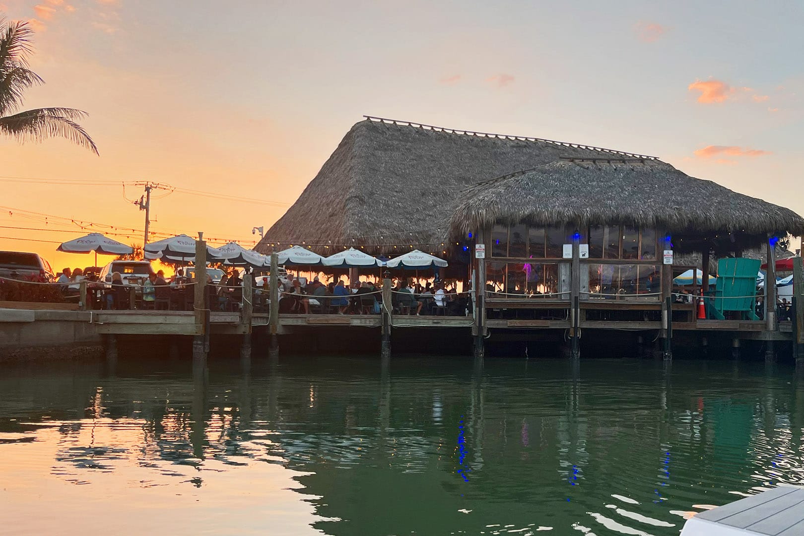
SandBar Tiki & Grille, located across from Englewood Beach on Manasota Key, is one of the area's most popular waterfront gathering places. Overlooking Lemon Bay, the restaurant offers sunset views, live music, fresh seafood, and a relaxed island atmosphere. Its location makes it a favorite stop for both boaters and beachgoers exploring Southwest Florida's Gulf Coast.
One of the pleasures of exploring Lemon Bay is stopping at a waterfront restaurant. Many offer boat docks, outdoor seating, and views across the estuary, allowing visitors to arrive by land or water.
Dining on Lemon Bay is about more than the meal itself. Dolphins passing nearby, pelicans diving for fish, and boats cruising through the Intracoastal Waterway reflect the area's coastal lifestyle.
Marinas and Boating Culture
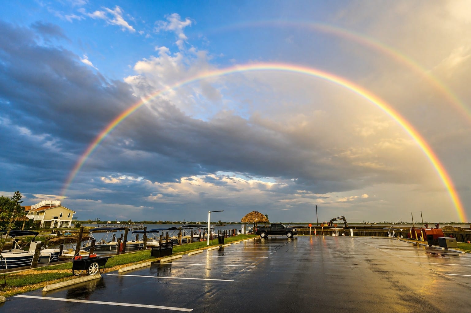
A spectacular double rainbow arches over Royal Palm Marina on Lemon Bay following a passing summer storm. Located in the heart of Old Englewood Village, the marina provides direct access to the Intracoastal Waterway, Stump Pass, and the Gulf of Mexico, making it a popular departure point for recreational boating, fishing, and exploring Southwest Florida's coastal waters.
Boating is part of daily life around Lemon Bay. Public marinas, private docks, neighborhood canals, and boat launches provide access for residents and visitors. Small boats, kayaks, cruising yachts, and paddleboards all share the protected waters.
The Intracoastal Waterway connects these communities, making Lemon Bay an important destination for local and visiting boaters.
Waterfront Neighborhoods
Communities surrounding Lemon Bay have developed with the water in mind. Residential canals, private docks, and waterfront parks allow many homeowners to keep boats close to their homes.
Much of the shoreline still preserves open views of mangroves, seagrass flats, and native vegetation. This balance between development and nature contributes to the bay's distinctive character.
Parks and Public Access
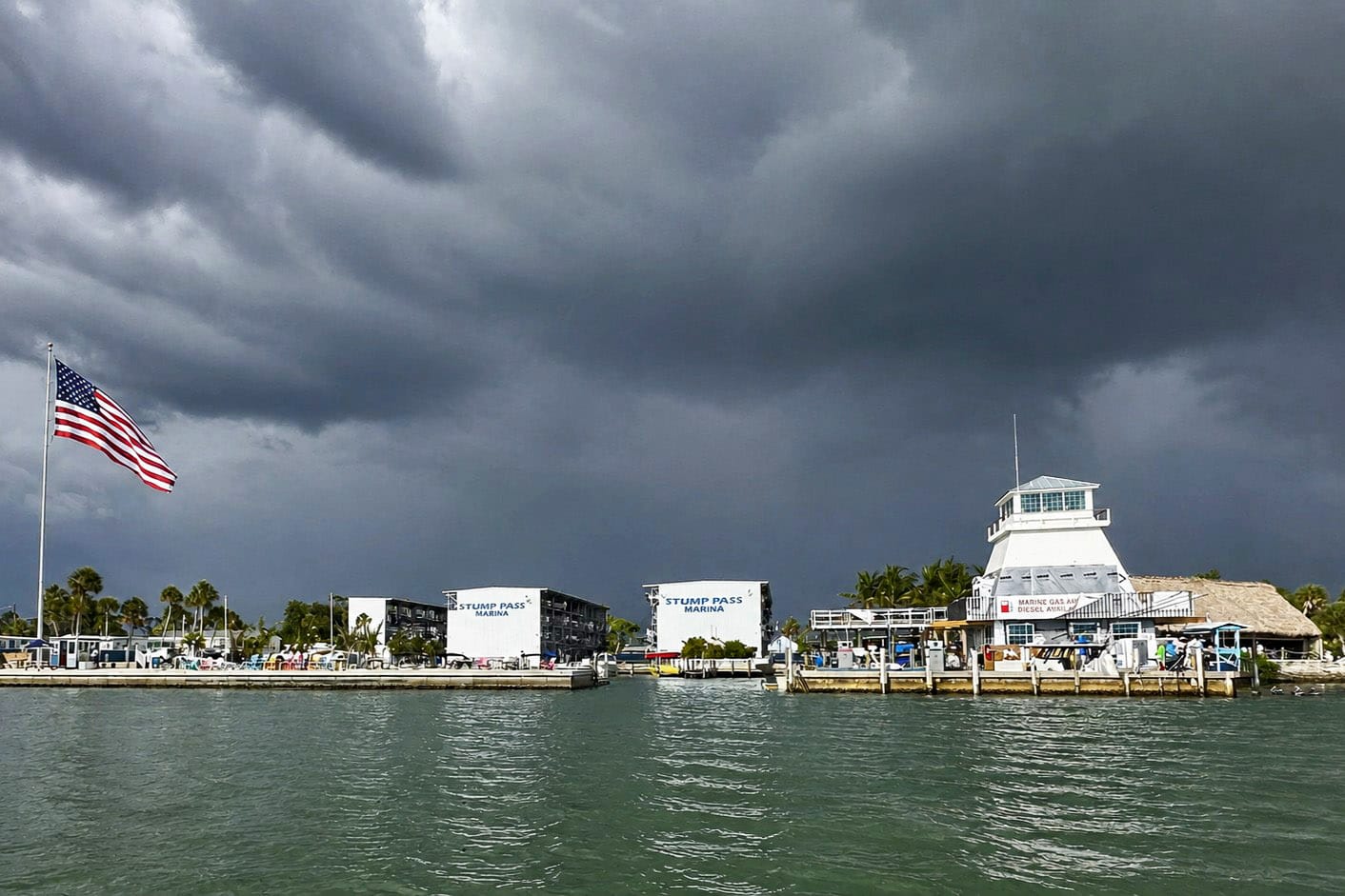
Stump Pass Marina before Hurricane Milton, showing the protected waters of southern Lemon Bay before the dramatic coastal changes of October 2024. For many years, this marina served as a popular departure point for boaters exploring Stump Pass, Manasota Key, and the Gulf of Mexico.
Numerous public parks provide access to Lemon Bay without requiring a boat. Fishing piers, kayak launches, walking trails, picnic areas, observation decks, and waterfront boardwalks allow visitors to experience the estuary from different perspectives.
A Place That Invites You Back

Ski Alley is one of the best places on Lemon Bay for stand-up paddleboarding thanks to its calm, protected waters and scenic mangrove shoreline. Located near Stump Pass State Park, this quiet waterway offers excellent opportunities to observe dolphins, manatees, wading birds, and other coastal wildlife while exploring one of Southwest Florida's most beautiful estuarine environments.
Perhaps Lemon Bay's greatest attraction is its ability to slow the pace of everyday life.
Morning sunrises over the estuary, quiet afternoons on calm water, waterfront dining with family and friends, and sunsets over nearby Gulf beaches encourage visitors to return again and again.
For many people, Lemon Bay becomes more than a destination—it becomes a place they remember long after their vacation has ended.
13. Experience Lemon Bay from the Water
Exploring Lemon Bay by boat offers a perspective that simply is not available from roads or beaches. Quiet mangrove shorelines, shallow seagrass meadows, hidden coves, and abundant wildlife reveal the estuary's true character.
Every trip is different. Changing tides, seasons, and weather create new opportunities to experience dolphins, manatees, shorebirds, and Southwest Florida's coastal scenery.
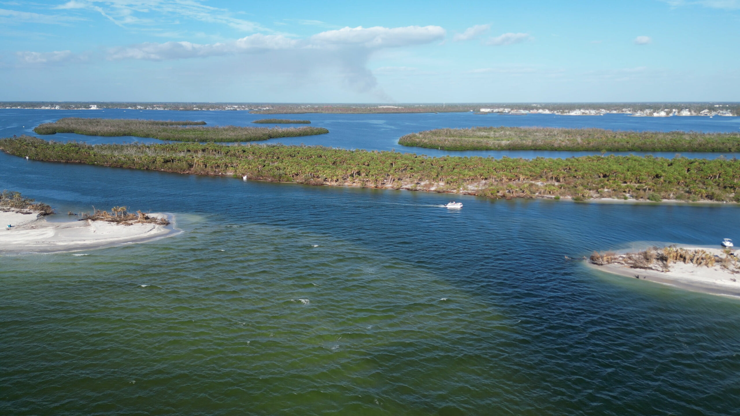
Whether you explore Lemon Bay on a private boat tour, by kayak, paddleboard, or from one of its parks and beaches, spending time on the water is the best way to appreciate this remarkable estuary.
After exploring Lemon Bay in every season and under every kind of weather, one thing has never changed: every trip offers something new.
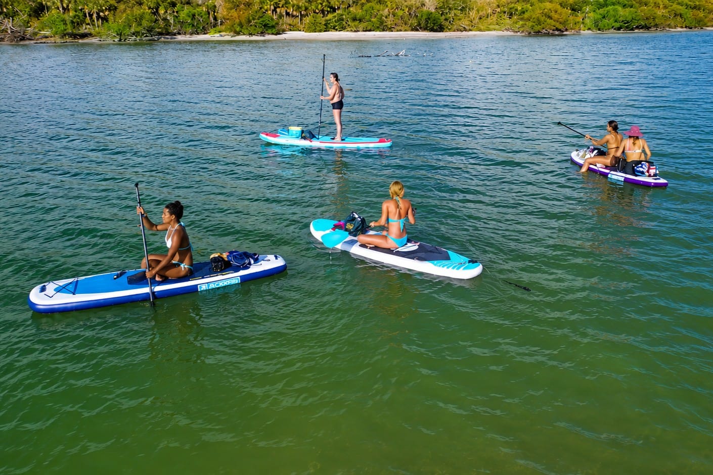
Paddleboarding on Lemon Bay offers a peaceful way to explore the protected waters between the Florida mainland and Manasota Key. The bay's calm conditions, extensive seagrass meadows, and mangrove shorelines make it one of Southwest Florida's premier destinations for paddling, with frequent opportunities to observe dolphins, manatees, wading birds, and other native wildlife while enjoying one of Florida's designated aquatic preserves.
What I appreciate most about Lemon Bay is the balance between nature and coastal living. Healthy natural ecosystems exist alongside welcoming waterfront communities, making it one of Southwest Florida's most enjoyable waterways to explore.
Whether you are visiting for the first time or returning after many years, I hope this guide helps you better understand and appreciate everything Lemon Bay has to offer.
I look forward to welcoming you aboard and sharing Lemon Bay with you.
Fair winds, and see you on the water.
— Captain Pavel
