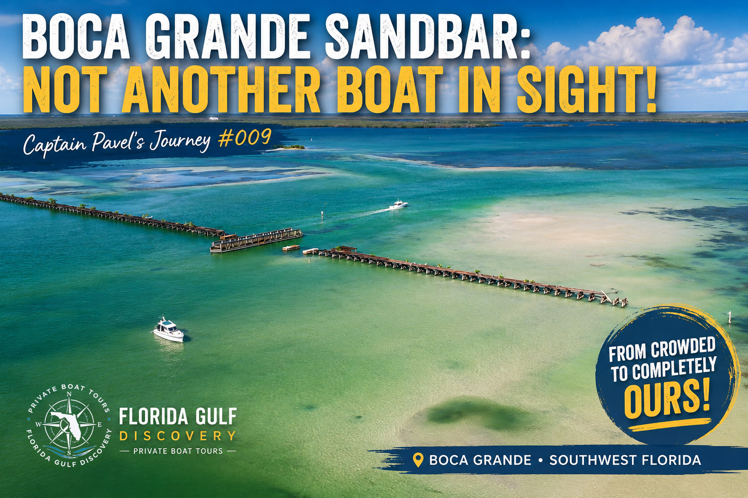
Not Another Boat in Sight!
Watch on YouTube: Fly above Boca Grande Sandbar with Captain Pavel in this 4K drone journey across one of Southwest Florida's most fascinating coastal landscapes. See the sandbar, surrounding channels, shallow turquoise water, Placida Trestle, and Boca Grande Causeway from the air—and watch how dramatically the area changes as the tide falls and evening approaches.
Some days on the water begin with a carefully planned destination, while others begin with only a general direction and become memorable because the water, weather, and a little curiosity change the plan along the way. August 11 was one of those days.
Elena and I left Gasparilla Marina before noon and headed south. Boca Grande Sandbar was along our route, but I had not decided that it would be our destination. I wanted to continue exploring, see what conditions were like farther south, and hopefully find somewhere a little quieter.
When we approached Boca Grande Sandbar that morning, the first thing I noticed was that there wasn't much of a sandbar to see. The sand itself was completely underwater, but there was no question about its location because approximately 20 to 30 boats were anchored over and around it.
For many boaters, that would have been the perfect place to stop. I looked at the gathering, looked farther south, and decided to continue toward Bird Key Sandbar.
At the time, that decision didn't seem particularly important. I certainly didn't expect that when we returned only a few hours later, Boca Grande Sandbar would feel like an entirely different place.
After spending several hours around Bird Key, we started back after 4:00 PM. I decided to stop at Boca Grande Sandbar again before heading home because I wanted to see what was happening there, say hello if anyone I knew was around, and, as always, keep an eye open for dolphins.
The difference was immediately noticeable. Most of the boats were gone, the tide had fallen considerably, and the place already felt quieter.
We decided to stay. As afternoon slowly became evening, the remaining boats left one by one while the water continued to fall. The sandy bottom moved closer to the surface, and eventually the first areas of sand began to appear.
By about 6:00 PM, I looked around and realized there wasn't another boat in sight. For a little while, it was simply our boat, Elena and me, with the old Placida Trestle stretching across the water nearby.
I have visited Boca Grande Sandbar many times, but experiences like this are exactly why I continue exploring familiar places. You can know where a place is on a chart, recognize its channels and landmarks, and still have the water show it to you differently when you return.
That evening, I decided to launch my drone and see the transformation from 400 feet above the water.
Before we go up into the sky, however, we need to return to the beginning of the day, because the story of how a crowded, submerged Boca Grande Sandbar became an empty stretch of exposed sand really began at Gasparilla Marina and Dog Channel.
Leaving Gasparilla Marina
The journey began earlier that morning at Gasparilla Marina on one of those hot and humid Southwest Florida summer days when you can feel the heat building almost as soon as you step outside.
The temperature was already around 83°F, humidity was above 90 percent, and the afternoon temperature would eventually climb to about 95°F. The morning sky was relatively clear and there was no rain.
Weather, however, is only one part of what I consider before heading out on the water.
I also watch the tide.
That was particularly important on this trip because I planned to take Dog Channel on our way toward Boca Grande.
After leaving the marina, I entered the channel and settled into the trip south. One of the things I enjoy about boating here is how quickly the environment changes after leaving the dock. The marina disappears behind the boat, mangrove shorelines replace buildings, small islands appear along the route, and Southwest Florida begins opening up in front of the bow.
From the helm, I am constantly looking ahead. I watch my chart and instruments, but I also pay attention to the water itself because its color, texture, and movement can provide useful information about depth, bottom conditions, and current.
There was sufficient water in Dog Channel for my boat that morning, but that did not mean I could simply follow the route without paying attention. I already knew there were two sections where the available depth could become particularly important for my boat, and I intended to approach both carefully.
The higher stage of the tide was giving me more water to work with that morning.
That was helpful, but Dog Channel was still going to require my full attention.
High Water & Strong Current
After we cleared the shallower portions of Dog Channel and continued toward Boca Grande, the character of the water began to change.
There was plenty of depth beneath the boat now, but what interested me most was the movement of the water.
The current was noticeably strong, and the surface had more energy than the quieter protected water we had traveled through earlier. The closer we came to Boca Grande, the more obvious that movement became.
I also noticed a change in the water itself. Its color was different from some of the darker estuarine water farther inside, and an occasional touch of spray on my lips had the unmistakable saltiness I associate with Gulf water.
Everything I was observing suggested a strong Gulf influence on the water around us that morning.
As we continued toward Boca Grande, I could see that the high water was affecting the entire area. The sandbar was hidden beneath the surface, the current was active, and the surrounding channels were carrying a large volume of water.
The higher water had worked in my favor while navigating Dog Channel, but I knew that advantage was temporary. As the tide fell later in the day, the available depth would decrease and the route I had used in the morning might no longer be the route I wanted to use on the way home.
Watching the water move through the area raised an obvious question for me.
How the Water Moves
I didn't need a tide chart to tell me that a lot of water was moving through the Boca Grande area that morning because I could already see it from the helm. The tide information was useful because it helped explain what I was observing.
Boca Grande Sandbar is part of a much larger interconnected system that includes Charlotte Harbor, Pine Island Sound, Gasparilla Sound, Boca Grande Pass, and the Gulf.
As the tide rises and falls, water moves between these areas through passes and channels, around islands, and across shallow flats. Boca Grande Pass is one of the major openings through which that exchange occurs.
The predicted high tide at Boca Grande Pass that day was approximately 2.22 feet at 11:53 AM, and we were traveling during the higher-water portion of the tidal cycle.
It is important, however, not to confuse a tide prediction with the actual depth beneath a boat.
I therefore use tide information to understand the larger picture, while my chart, instruments, local knowledge, and direct observation of the water help me make actual navigation decisions.
The system also doesn't simply fill and empty like a bathtub. Water has to move through passes and channels, around islands, and across large shallow areas, so the timing and strength of the current can vary from one location to another.
After the predicted high of approximately 2.22 feet around 11:53 AM, the tide at Boca Grande Pass was expected to fall to approximately -0.17 feet at 7:09 PM.
That represents a difference of nearly 2.4 feet between the predicted high and low.
Those numbers became particularly interesting to me because I didn't simply read them on a screen that day.
Tides don't merely change a number on a table. They can change the landscape, the current, the available depth, and sometimes even the route I choose to take home.
Sandbar Before Noon
When we reached Boca Grande Sandbar before noon, there was no exposed sand anywhere in sight.
The sandbar was completely submerged, but its location was easy to identify because approximately 20 to 30 boats were gathered over and around it.
People were anchored, swimming, standing in the water, and enjoying a hot August day. More than a foot of water covered some areas that would become shallow enough to walk across later in the day.
We slowed down and looked around.
Everyone seemed to be having a good time, and we could easily have dropped anchor and joined them, but seeing that many boats in one place usually makes the explorer in me wonder what I might find a little farther down the coast.
I already had Bird Key Sandbar in mind.
Elena and I wanted to see what conditions were like there and hoped we might find somewhere quieter with more room around us.
That freedom to continue exploring is one of the things I enjoy most about boating in Southwest Florida. If one destination is crowded, there may be another sandbar, island, beach, or quiet stretch of shallow water waiting farther ahead.
I pointed the boat south and continued toward Bird Key.
At that moment, Boca Grande Sandbar was simply a place we had passed on our way to another destination, and I had no reason to believe it would eventually become the most memorable part of the day.
When we returned several hours later, however, the scene would be almost unrecognizable.
We hadn't changed the destination.
It would be the same location on the same day, but it would feel like a completely different world.
I am raw html bloc
Several hours later, after spending part of the day around
Bird Key, Elena and I began our trip back toward
Boca Grande.
It was after 4:00 PM, and although the afternoon
remained hot and humid, the day already felt different. The sun was
lower, the light over the water had softened, and the tide had been
falling while we were away.
I expected Boca Grande Sandbar to look different, but I didn't
expect the change to be quite so dramatic.
Only three or four boats remained.
The sandbar was still mostly underwater when we arrived, but the
water was noticeably lower and the strong movement I had watched
earlier was beginning to ease.
Instead of continuing past the sandbar, I slowed down and decided
that we would stay for a while.
Part of that decision came from simple curiosity. I wanted to see
what would happen if we gave the falling tide a little more time.
I was also doing what I almost always do around Boca Grande:
watching the surface for dolphins.
As afternoon moved toward evening, we watched the transformation
happen directly around us.
The sandy bottom became increasingly visible through the shallows,
and areas that had been covered by deeper water earlier were
gradually becoming shallow enough for us to explore on foot.
That was when I realized we had experienced two very different
versions of Boca Grande Sandbar in a single day.
In the morning, it had been a busy gathering place hidden beneath
higher water. By evening, the boats were disappearing, the current
was weakening, and the sand itself was returning.
Nothing about its geographic location had changed. The Placida
Trestle was still beside us, Boca Grande Pass was still nearby, and
the surrounding islands and shoreline were exactly where they had
been that morning.
Yet from the deck of my boat, it felt like we had arrived somewhere
else.
That experience reminded me that a coordinate only tells me
where a place is.
Tide, current, weather, light, and even the number of boats around
you can completely change the experience.
As the water continued to fall, Elena stepped into the shallows and
began exploring around the sandbar.
None of this had been carefully timed. We had simply gone exploring,
spent part of our day at Bird Key, and happened to return while
Boca Grande Sandbar was transforming.
Some of my favorite days on the water happen exactly that way —
not because everything follows a plan, but because I remain curious
enough to stay and see what happens next.
One Sandbar — Two Worlds
Click edit button to change this html
High Tide to Low Tide
By the time we returned from Bird Key, I could already see what the falling tide was doing to Boca Grande Sandbar, but the numbers help show just how significant the change actually was.
On August 11, 2026, the predicted high near Boca Grande was approximately 2.22 feet at 11:53 AM, while the evening low was predicted at approximately -0.17 feet at 7:09 PM.
That represents a difference of nearly 2.4 feet between high and low water.
On paper, 2.4 feet may not sound particularly dramatic, but on a shallow sandbar it can completely change what you see.
When we returned after 4:00 PM, most of the sandbar was still underwater. As we remained there, however, the sandy bottom became easier to see and places that had been covered by deeper water gradually became shallow enough to explore on foot.
Eventually, patches of sand began breaking the surface.
There wasn't one precise moment when I could point toward the water and announce that the sandbar had returned. The transformation happened gradually, minute by minute, while we watched.
That is why tide numbers become much more meaningful to me when I can connect them with something I have actually experienced on the water.
The current was also weakening, although tide height and tidal current are not exactly the same thing. I wasn't trying to determine the precise moment of slack water; I was simply observing what the water was doing around the boat.
At the same time, I was already thinking about our return to Gasparilla Marina.
With the tide approaching its evening low, I knew I didn't want to retrace Dog Channel through the two shallow areas I had carefully navigated that morning.
I had another option: a different and considerably deeper route back to Gasparilla Marina, and that was the route I intended to use.
There was no need to leave yet, however.
The evening low was approaching, the sandbar was continuing to emerge, and the last boats were leaving.
Before long, Elena and I would experience something I hadn't expected when we left the marina that morning:
Sandbar to Ourselves
By 6:00 PM, Boca Grande Sandbar had become a completely different place.
The remaining boats had gradually left, and when I finally looked around the entire area, there wasn't another boat in sight.
After seeing 20 to 30 boats gathered there only a few hours earlier, the quiet felt almost strange. There were no nearby engines, no groups of boats anchored together, and nobody else walking through the shallows.
For a little while, it was simply our boat, Elena and me.
As the tide continued falling, Elena stepped off the boat and began walking through the shallows toward the Placida Trestle.
While she explored the sandbar on foot, I decided to explore the same place from a completely different perspective and prepared my drone for launch.
I climbed to 400 feet, approximately 120 meters, and almost immediately the landscape began to make more sense from above.
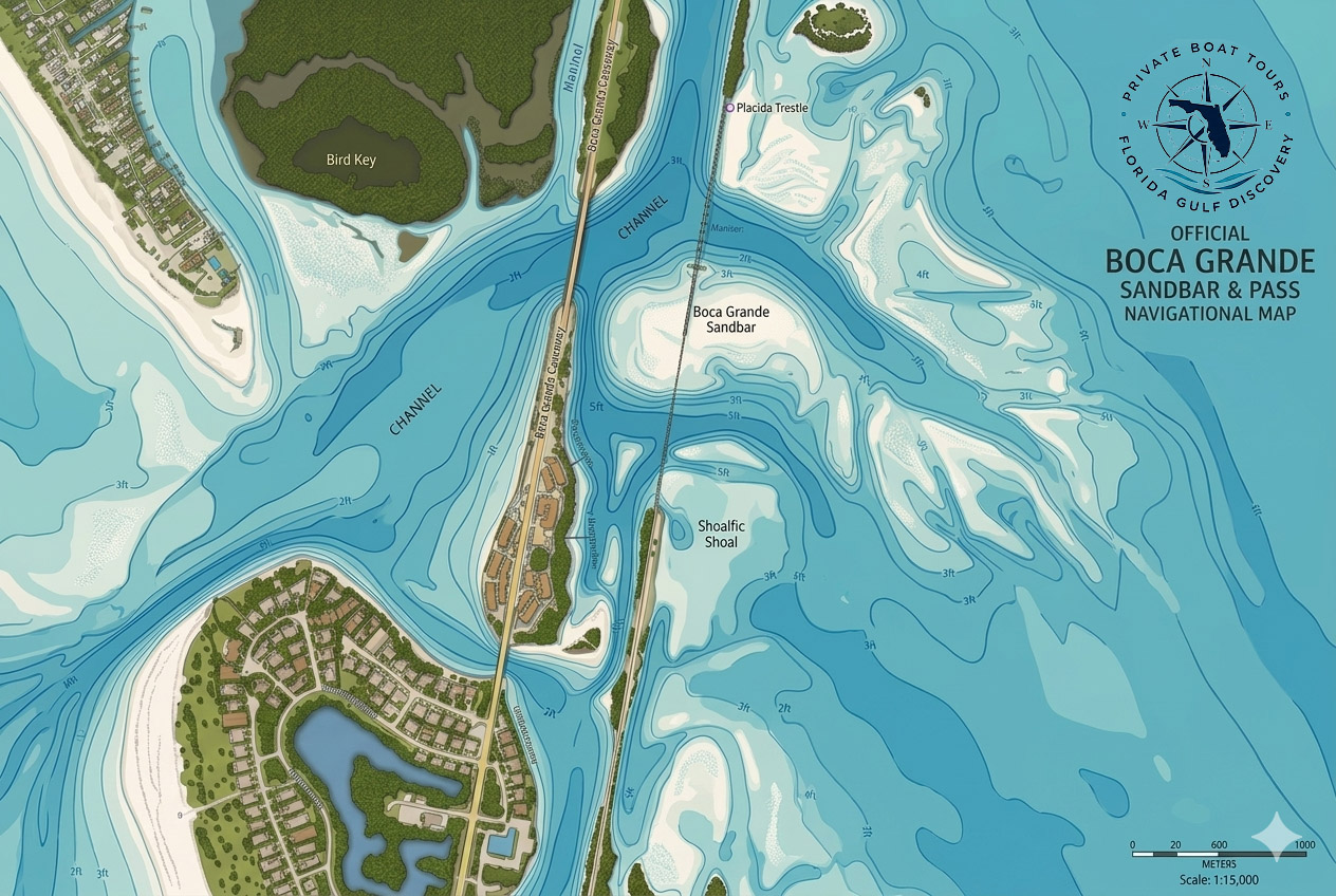
From the helm, I think about channels as routes and shallow water in terms of depth, current, and where I can safely take my boat. From the air, however, all of those separate pieces suddenly became part of one larger picture.
The Boca Grande Sandbar, deeper channels, shallow flats, darker areas of seagrass, the Placida Trestle, and the surrounding waterways formed what looked like an enormous natural map beneath the drone.
In the middle of that landscape was our boat, sitting there by itself.
From 400 feet above the water, I could appreciate how dramatically the tide had changed the area since morning.
Then I noticed something much smaller below me.
Elena was still walking through the shallows toward the trestle, appearing from that altitude like a tiny figure crossing a landscape that had been hidden beneath the water only hours earlier.
As I continued circling the sandbar, trestle, and our boat, another visitor appeared below the drone.
After spending part of the afternoon watching for dolphins from the boat, seeing one from the air was a perfect surprise. A little later, it appeared again.
The entire drone flight lasted approximately 3 minutes and 20 seconds, during which I circled the sandbar, trestle, and our boat twice. I captured Elena walking through the shallows, the patterns created by sand, seagrass, and deeper water, and the dolphin appearing twice.
Partway through the flight, I switched the camera to vertical mode to capture the scene from another perspective.
What impressed me most about the footage, however, wasn't any single feature.
It was the amount of open space surrounding us.
A few hours earlier, I had looked at 20 or 30 boats and decided to continue toward Bird Key because we wanted somewhere quieter.
I never imagined that the quieter place would eventually turn out to be Boca Grande Sandbar itself.
When I finally brought the drone back to the boat, it was getting close to 7:00 PM, and the tide was approaching its evening low.
After spending most of the day exploring, it was time to begin the trip back to Gasparilla Marina.
Because the water was now considerably lower, I chose the different, deeper channel rather than returning through Dog Channel.
Before leaving, I took one more look behind us.
The sandbar was exposed, the water was quiet, and there still wasn't another boat around.
Earlier that morning, Boca Grande Sandbar had belonged to the crowd.
What This Day Taught Me
By the time Elena and I headed back toward Gasparilla Marina, I had spent most of the day watching the same part of Southwest Florida change around us, and that became the biggest lesson of the entire journey.
I have traveled through these waters many times and know Boca Grande Sandbar, Dog Channel, the Placida Trestle, and the surrounding waterways.
Familiarity, however, doesn't stop the tide or prevent conditions from changing.
That morning, the higher water gave me enough depth to navigate Dog Channel. By evening, with the tide approaching its low, I had no reason to take my boat back through the same two shallow areas when a deeper route was available.
That experience reinforced something I have learned many times on the water:
Changing a plan when conditions change isn't a failure of the original plan; it is simply part of good seamanship.
There is no prize for proving that your boat can make it through the shallowest water. For me, being a captain means enjoying the adventure, exploring interesting places, paying attention as conditions change, and bringing everyone safely back again.
A chart can show me where I am, a tide table can tell me what is predicted, and my instruments can tell me what is beneath the boat.
Experience helps me decide what to do with all that information.
The day also reminded me why I continue exploring places I already know.
We could have stopped at Boca Grande Sandbar before noon and joined the crowd, but instead the explorer in me wanted to continue toward Bird Key. Later, we could have headed directly back to Gasparilla Marina, but curiosity brought us to Boca Grande Sandbar one more time.
That small decision gave us the best part of the day.
During those few hours, I experienced the same place from three completely different perspectives.
From the helm, I saw depth, current, channels, and the decisions required to navigate them.
From the sandbar, Elena experienced the warm shallows on foot as the falling tide revealed the sand.
From 400 feet above, the drone showed me how the sandbar, channels, seagrass, Placida Trestle, and surrounding water fit together as one landscape.
It was the same place, but three completely different perspectives.
Maybe that is what being an explorer means to me.
It isn't always about finding somewhere nobody has ever been. Sometimes it means returning to a familiar place at a different tide, at a different hour, or under different conditions and paying enough attention to recognize that it isn't really the same place anymore.
Maps, charts, tide predictions, and experience are all important, but none of them replace curiosity.
If we hadn't continued toward Bird Key that morning, our day would have been different. If we hadn't returned to Boca Grande Sandbar that afternoon, we would have missed its transformation. And if we hadn't stayed a little longer, we would never have watched the last boats disappear, walked across the emerging sandbar, or seen a dolphin from 400 feet above.
That is why I keep exploring Southwest Florida.
Not every journey has to take me somewhere new.
