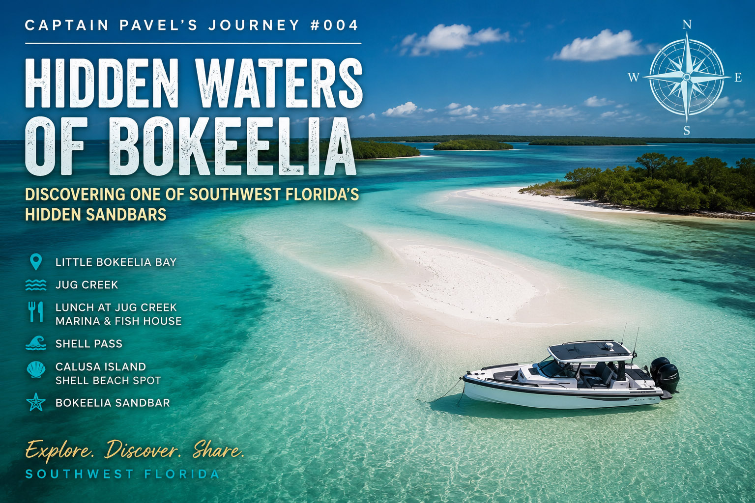
Hidden Waters of Bokeelia – Discovering One of Southwest Florida’s Hidden Sandbars
“Sometimes the best discoveries aren’t marked on a map. They’re found by slowing down, reading the water, and letting curiosity guide the way.”
Captain’s Log
Date: June 2026
Departure: Safe Harbor Pineland Marina, Bokeelia, Florida
Route: Wilson Cut • Little Bokeelia Bay • Jug Creek • Back Bay • Jug Creek Marina & Fish House • Shell Pass • Calusa Island • Pine Island Sound • Bokeelia Sandbar
Conditions: Light southeast breeze, calm water, excellent visibility, sunny skies
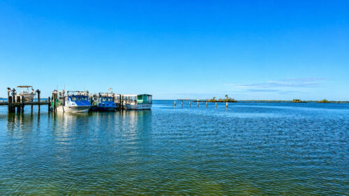
There are still places in Southwest Florida that surprise me.
After spending years exploring these waters, I sometimes think I’ve seen nearly every island, sandbar, and hidden passage. Then a day like this comes along and reminds me why I never stop searching.
This journey began at Safe Harbor Pineland Marina, a peaceful starting point on the western side of Pine Island. Even before leaving the dock, the atmosphere felt different. Unlike the busy marinas found along the coast, Pineland still carries the quiet character of Old Florida. Fishermen prepared their boats, seabirds circled overhead, and the morning sun reflected across the calm waters of Pine Island Sound.
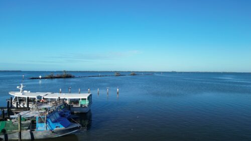
With the Axopar idling away from the marina, the adventure was underway.
Our first course led through Wilson Cut, a narrow passage connecting Pine Island Sound with the protected waters surrounding Bokeelia. The deeper channel soon gave way to broad grass flats, winding creeks, and countless shallow areas that make this region both beautiful and challenging to navigate.
This isn’t the kind of place where you simply point the bow and follow the GPS.
One lesson I’ve learned over the years is that you can’t always rely on your GPS chart alone. Southwest Florida’s shallow waters are constantly changing. Sandbars shift, channels move, and some areas become too shallow long before electronic charts are updated.
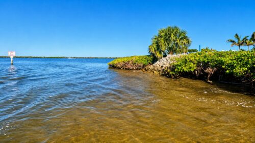
When navigating these waters, I often reduce my speed to just 4–6 mph and carefully read the water ahead. Different shades of blue, green, and brown reveal changes in depth, while a good pair of polarized sunglasses cuts through the glare and makes those subtle differences much easier to see.
In many places, the water tells you more than the GPS ever can. That’s one of the reasons local knowledge and years of experience remain invaluable when exploring Southwest Florida’s hidden waterways.
As we continued through Little Bokeelia Bay, the water became almost perfectly calm. The mangroves reflected like mirrors, broken only by the gentle wake behind the boat. Pelicans glided low across the surface while ospreys watched patiently from channel markers.
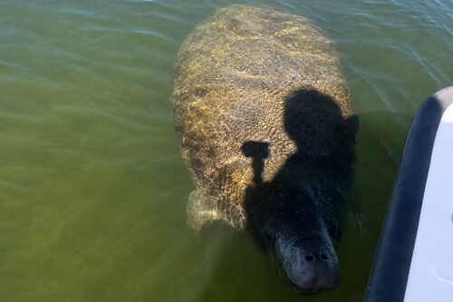
Not long after entering the shallower backwaters, another surprise was waiting.
A gentle swirl appeared ahead of the boat.
Then another.
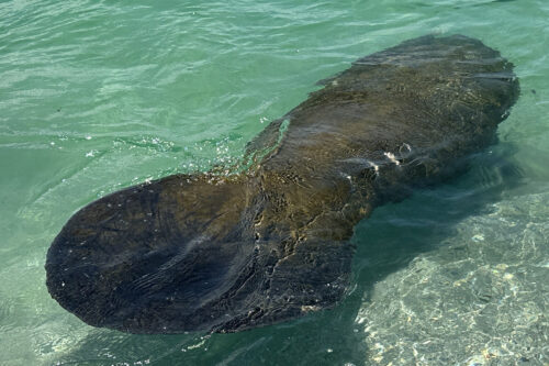
Within seconds several manatees surfaced quietly around us.
I immediately pulled the throttles back to idle and let the boat drift. There was no reason to rush. Encounters like this deserve patience.
One curious manatee surfaced only a few yards away before disappearing beneath the water again. Another rolled slowly near a patch of turtle grass, its broad tail leaving only a faint ripple on the surface.
These peaceful animals never seem to be in a hurry.
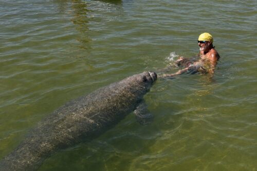
Watching them always reminds me that nature has its own rhythm, and the best way to experience it is simply to slow down.
Eventually the manatees continued feeding, and so did we.
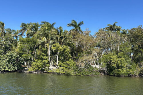
Our route carried us into Jug Creek, one of my favorite waterways around Pine Island. The creek winds gently through mangrove forests that feel almost untouched by time. Around every bend there’s another quiet cove, another hidden shoreline, another reminder of what Florida looked like decades ago.
It is easy to understand why early settlers chose this area. Protected waters, abundant wildlife, and easy access to Pine Island Sound made it an ideal place to call home.
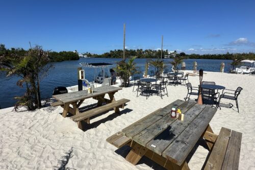
By late morning it was time for lunch.
One of the advantages of traveling by boat is that some of Southwest Florida’s best restaurants are reached from the water rather than by car.
We eased into Jug Creek Marina, tied the Axopar securely to the dock, and walked only a few steps to Jug Creek Marina & Fish House.
The setting couldn’t have been better.
Colorful boats rested quietly in their slips while the breeze carried the scent of salt air across the marina. From the outdoor seating area, boats came and went throughout the afternoon, each one heading toward another adventure somewhere across Pine Island Sound.
The atmosphere was relaxed, welcoming, and unmistakably Old Florida.
There’s something special about arriving at a waterfront restaurant by boat. The journey becomes part of the meal. Instead of parking lots and traffic lights, you’re surrounded by docks, mangroves, seabirds, and fellow boaters sharing stories about where they’ve been or where they’re headed next.
Searching for a Hidden Sandbar
After an excellent lunch and a short walk around the marina, it was time to continue exploring.
I had no idea the best part of the day was still ahead.
Leaving Jug Creek behind, we carefully followed the winding channels toward Shell Pass.
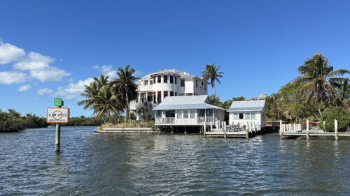
This area demands attention.
The water becomes shallower, the channels narrower, and navigation more dependent on experience than electronics. The reward, however, is entering one of the most peaceful parts of Pine Island Sound.
As we rounded another gentle bend, the water suddenly opened before us.
At first, it didn’t seem unusual.
Then I noticed something beneath the surface.
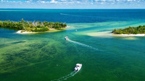
A broad stretch of brilliant white sand extended into crystal-clear water that shimmered with shades of emerald, turquoise, and aquamarine. The tide was just right. The water was calm. There were very few boats.
I slowed the Axopar even further and eased toward the edge of the sand.
The more I looked around, the more I realized what I had found.
This wasn’t just another shallow flat.
It was one of the most beautiful sandbars I had ever discovered in Southwest Florida.
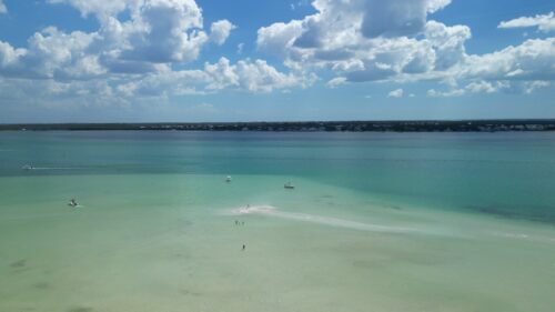
Hidden away near Bokeelia, protected by surrounding islands and rarely crowded, this place offered everything I love about exploring the Gulf Coast. Soft white sand beneath clear water, incredible colors in every direction, complete peace, and the feeling that I had stumbled upon a place many boaters simply pass by without ever noticing.
Some discoveries stay with you forever.
This was one of them.
Discovering Bokeelia Sandbar
I carefully set the anchor and stepped into the shallow water.
The first thing I noticed was how soft the sand felt beneath my feet.
Crystal-clear water revealed every ripple in the white sand below the surface, while gentle waves lapped quietly against the shoreline. A light breeze carried the scent of salt and mangroves across the bay.
I paused for a moment and simply looked around.
There were no crowds.
The usual waterfront noise was absent.
Nothing felt rushed.
Only the peaceful sounds of Southwest Florida.
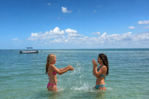
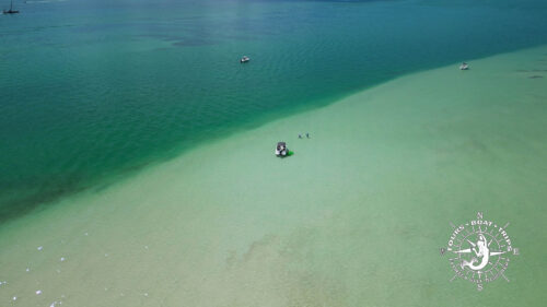
It’s amazing how quickly the pace of life changes once you step away from the busy waterfronts and discover places like this. Time seems to slow down. Every detail becomes more noticeable—the colors of the water, the movement of small fish along the edge of the sandbar, the distant call of an osprey, and the quiet rhythm of the Gulf. I launched my drone to see the area from above. As the aircraft climbed into the sky, the view became even more spectacular.
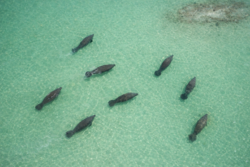
From the boat, I knew this sandbar was beautiful. From the air, I realized just how remarkable it truly was. Brilliant white sand stretched beneath shallow turquoise water, surrounded by deeper shades of emerald and blue. The winding channels, mangrove islands, and protected coves created a landscape that could only be fully appreciated from above. It reminded me once again why I enjoy combining boating with aerial photography. The drone doesn’t simply capture beautiful images.
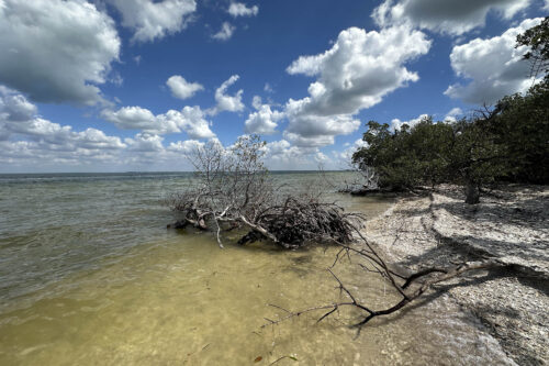
It reveals geography. It shows how islands, channels, sandbars, and shallow flats connect to one another, creating a much deeper understanding of Southwest Florida’s coastline. After spending time enjoying the sandbar, I continued toward Calusa Island. Only a short distance away, another quiet shoreline waited. Shell Beach Spot is exactly the kind of place that many visitors never discover. Accessible primarily by boat, it offers a peaceful beach where shells continue to wash ashore with every changing tide.
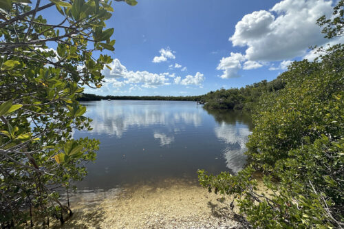
Walking along the shoreline, I couldn’t help but think about the people who lived here centuries before us. Long before modern charts, marinas, and GPS navigation, the Calusa people traveled these same waters by canoe. They understood the tides, the seasons, and the countless channels connecting Pine Island Sound. Their knowledge of these waters allowed them to thrive in one of Florida’s richest coastal environments. Standing there today, it’s easy to imagine why they chose this area. The protected waters provide safety. The surrounding islands offer natural shelter.
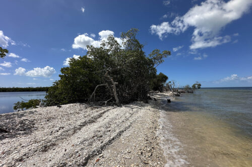
Fish, shellfish, and wildlife remain abundant. Although centuries have passed, the connection between people and these waters has never disappeared. Leaving Calusa Island, I idled through Shell Pass and entered the open waters of Pine Island Sound once again. The contrast was striking. Behind me lay narrow channels and quiet mangrove creeks. Ahead, the broad waters of Pine Island Sound stretched toward the horizon. The afternoon sun reflected across the gentle waves while seabirds glided effortlessly overhead. It was one of those moments that reminds me why every trip is different. Even familiar waters have a way of offering something new when you’re willing to slow down and pay attention.
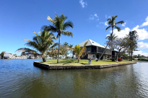
As I pointed the bow toward home, I looked back one last time toward the Bokeelia Sandbar. I realized I hadn’t simply discovered another beautiful place. I had discovered another reason to keep exploring. After years on these waters, Southwest Florida still has the ability to surprise me. Perhaps that’s what I enjoy most about being on the water. Not knowing exactly what waits around the next bend.
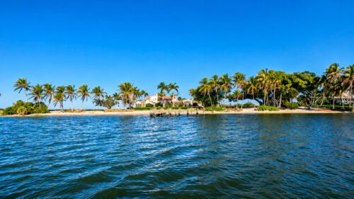
Every journey begins with a plan, but the best memories often come from the unexpected moments along the way. Some days it’s a playful dolphin. Some days it’s a quiet encounter with manatees. Some days it’s a forgotten piece of local history. And sometimes it’s finding a hidden sandbar that quietly becomes one of your favorite places in all of Southwest Florida.
What I Discovered Today
This journey reminded me that exploration isn’t measured by how many miles you travel. It’s measured by your willingness to remain curious.
Some of the most rewarding places aren’t the ones that appear in travel brochures or become crowded weekend destinations. They’re the quiet places that reveal themselves only when you slow down, observe your surroundings, and allow curiosity to guide your course. Every time I leave the dock, I hope to discover something worth sharing. Today, it was one of the most beautiful hidden sandbars I’ve explored in Southwest Florida. Tomorrow… Who knows what’s waiting beyond the next bend? — Captain Pavel
