Journey Contents
Follow this Stump Pass journey from calm morning waters and a rising tide to the sandy tongue, striped mullet, and the changing coastline seen from above.
A Calm Morning at Stump Pass
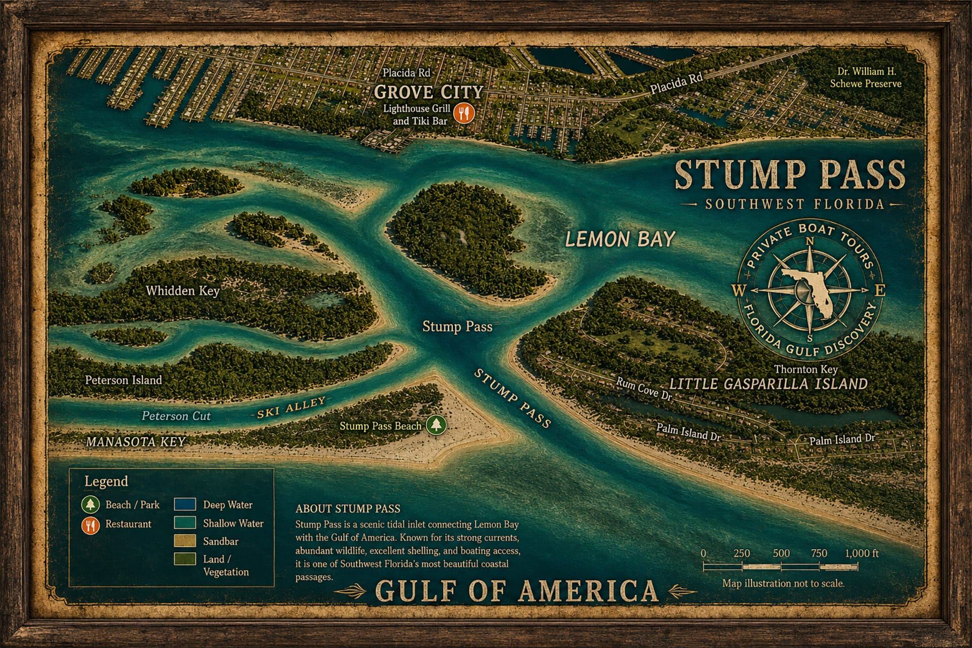
On the morning of August 12, 2026, we entered Ski Alley near the Tom Adams Bridge and started south toward Stump Pass.
For about the first mile, we traveled through a Manatee Zone, where boats must operate at slow speed. With almost no wind and a clear blue sky, Ski Alley was unusually calm that morning.
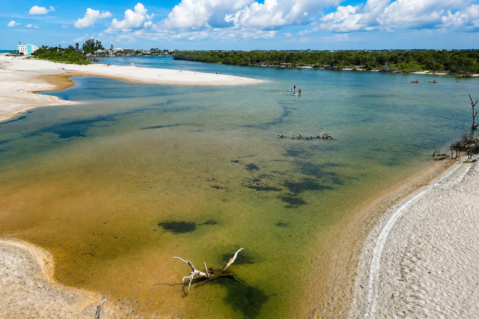
This August 2026 aerial view shows the remarkable transformation of the area once known locally as Milton Pass, near Stump Pass Beach State Park. Hurricane Milton struck Florida's Gulf Coast on October 9, 2024, and powerful storm-driven water cut a new opening across the barrier island in this area. Over the following months, tides and currents continued moving sand through the opening and reshaping its banks. By May 6, 2026, the temporary pass had naturally closed as sand rebuilt the shoreline. From the air in August 2026, its history can still be read in the landscape: broad sandy deposits, shallow water, submerged contours, and the protected waters of Lemon Bay mark an area that looked dramatically different less than two years earlier. It is a powerful example of how quickly hurricanes, tides, and moving sand can redraw Southwest Florida's barrier islands.
Before continuing to Stump Pass, we stopped near the Milton Pass area. I wanted to see what had been happening there since the pass closed. We spent about an hour exploring the area, looking at the changes, and swimming before getting back on the boat and continuing south along Ski Alley.
We arrived at Stump Pass around 9:00 AM.
By then, low tide had already passed. The morning low had occurred at 6:13 AM, at approximately 0.82 feet, and the water was rising toward the 12:47 PM high tide of approximately 2.00 feet.
The conditions were still excellent. There was almost no wind, the water remained calm, and the blue sky stretched above us as the summer heat continued to build.
I have traveled through Stump Pass many times, but I have learned that knowing a place does not mean it will look the same every time you return.
The tide changes. The light changes. The water changes. Even familiar sandbars and shorelines can take on a different appearance.
That morning, with calm water, a rising tide, and a clear blue sky, I wanted to see what Stump Pass looked like from above.
The same coast—but never exactly the same view.
The Incoming Tide

Watch on YouTube: Fly above Stump Pass with Captain Pavel on a calm summer morning in Southwest Florida. This aerial journey reveals shifting sand, clear shallow water, wildlife, tidal channels, and a coastline that is constantly changing. See Stump Pass and the surrounding barrier-island landscape from a perspective that shows how tides and moving sand continually reshape this remarkable part of the Gulf Coast.
By the time we arrived at Stump Pass around 9:00 AM, low tide was already behind us, and the incoming tide was pushing Gulf water back through the pass.
At first, the change was easy to miss. There was almost no wind, the water was calm, and the surface gave little indication of how much was changing underneath. But the rising tide was gradually covering shallow areas and changing the edges of the exposed sand.
This is one of the things I find most interesting about Stump Pass. A sandbar or shallow area that is clearly visible at one time can look completely different only a few hours later. As the water rises, channels become deeper, parts of the sand disappear beneath the surface, and the colors of the water change with the increasing depth.
From the boat, you notice these changes one piece at a time.
From above, you can see how they all connect.
The incoming tide was already beginning to redraw Stump Pass in front of us. The shape of the shallows, the sandy edges, and the different shades of water were all changing as the tide continued to rise.
Soon, I would put the drone in the air and see just how much the incoming tide was changing Stump Pass below.
Stump Pass from Above
Once the drone was in the air, the view changed completely.

Fly above Stump Pass, Ski Alley, Knight Island, and the surrounding beaches on this 4K drone tour of Southwest Florida. Click the image to watch the YouTube video and explore the area's shallow coastal waters, barrier islands, beaches, channels, and changing shoreline from the air with Captain Pavel.
From the boat, Stump Pass looks like a relatively narrow opening between the barrier islands. But as the drone climbed higher, the entire area began to open beneath me. The pass, shallow flats, sandbars, deeper channels, Gulf shoreline, and the waters behind the islands could all be seen together.
The calm conditions made the differences especially easy to see. With almost no wind disturbing the surface, the water below appeared in different shades depending on its depth and the bottom beneath it. Lighter areas revealed shallow sand, while darker water marked deeper sections and channels.
As I continued the flight, I could see Stump Pass Beach State Park stretching along the shoreline and a small part of Knight Island beyond the pass.
But what interested me most was not simply how beautiful everything looked from above.
It was how clearly the drone revealed the shape of the coast.
From above, the boundaries between deep water, shallow flats, exposed sand, and shoreline became remarkably clear. Features that seemed separate from the boat suddenly became connected parts of one larger coastal system.
Flying above Stump Pass reminded me why I enjoy seeing familiar places from the air.
You can fly the same coast, but never the same view.
The Sandy Tongue of Stump Pass
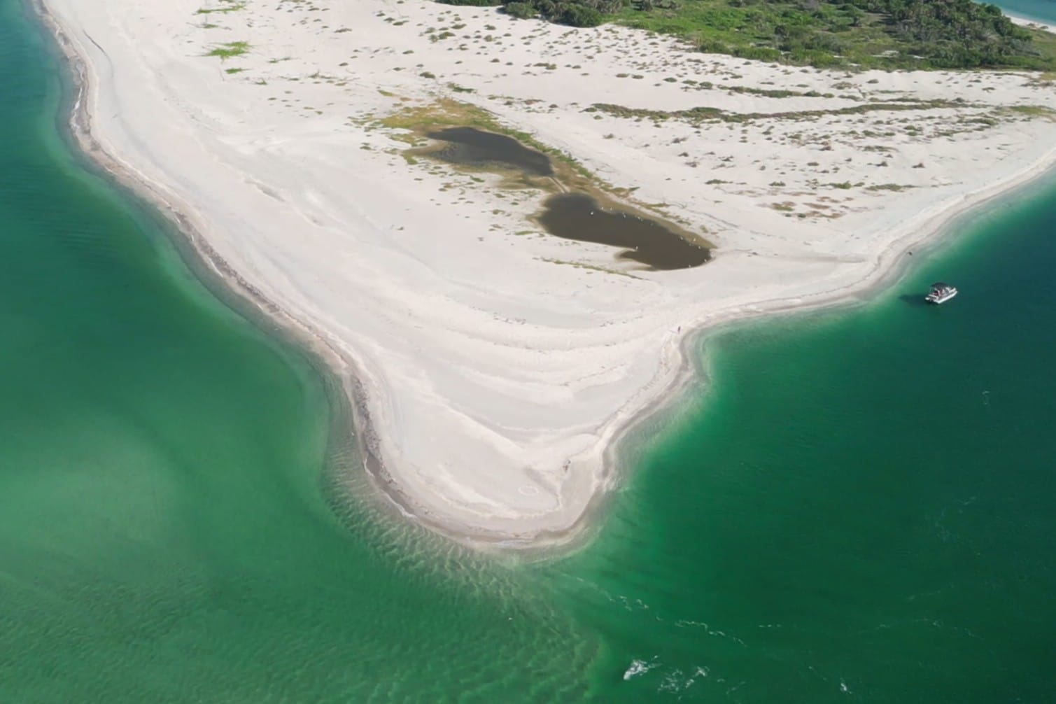
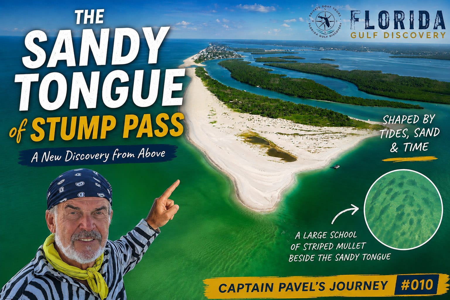
From above, the sandy tongue at Stump Pass reveals how dramatically this coastline is shaped by moving water. Layers of newly deposited sand extend from Stump Pass Beach State Park into the pass, while shallow turquoise water traces the changing contours around its edge. Features like this are not permanent. Tides, waves, currents, storms, and shifting sediment continually reshape the entrance between Lemon Bay and the Gulf. What looks like solid shoreline from a boat becomes much easier to understand from the air—the sand itself records where water has been moving and depositing sediment. This aerial perspective is also a reminder for boaters that the shallow edges and sandy formations around Stump Pass can change over time and should never be assumed to match an earlier visit.
One feature immediately caught my attention from above—the sandy tongue extending into the waters around Stump Pass.
What makes it especially interesting to me is that I first noticed this feature only about a month earlier. Since then, I have been watching it closely whenever I return to Stump Pass.
From the boat, it can simply appear to be another shallow area. From the air, its shape is much easier to understand. The lighter water traces the sand beneath the surface, while darker shades nearby reveal deeper water and help define the edges of the formation.
Stump Pass is constantly changing. Tides, currents, waves, storms, and moving sand continually reshape this narrow connection between the Gulf and the waters behind the barrier islands. The appearance of this sandy tongue is another visible reminder of how quickly those changes can become noticeable.
That morning, the rising tide made it particularly interesting to watch. Some portions remained clearly visible, while others were gradually disappearing beneath the incoming water. From higher altitude, I could follow its shape much farther than I could from the boat.
As I flew along the sandy tongue, something else caught my attention in the shallow water beside it—a large school of what appeared to be striped mullet moving over the light sandy bottom.
From above, their dark shapes were easy to follow as the school turned and regrouped along the edge of the shallows. Judging from the drone footage, many appeared to be roughly 12–15 inches long, with some larger fish possibly approaching 18–20 inches.
Seeing them from the air was completely different from seeing a few fish beside the boat. The drone revealed the size of the school and the way hundreds of fish moved together through the shallow water beside the sandy tongue.
I had launched the drone to study how Stump Pass was changing, but the flight revealed something I wasn't expecting.
For me as a captain, changes like this are more than something interesting to photograph. They are a reminder to observe the water every time I return, even in an area I already know well.
A familiar coastline can change surprisingly quickly—and sometimes those changes reveal much more than sand and water.
The sand was changing—and life was moving around it.
Stump Pass Beach State Park
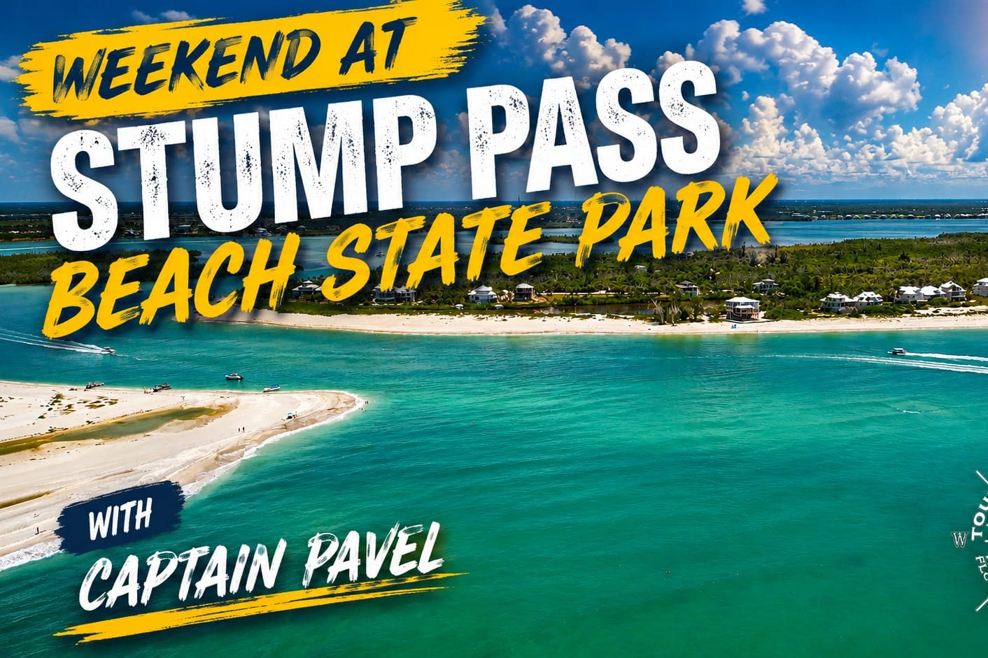
Spend a weekend at Stump Pass Beach State Park and experience one of Englewood's most beautiful coastal destinations with Captain Pavel. Click the image to watch the YouTube video and explore Stump Pass, its beaches, shallow waters, wildlife, boating, and the changing coastline of Southwest Florida.
As the drone continued along the coast, Stump Pass Beach State Park stretched out beside the pass.
From the water, I usually see the park as a long natural shoreline bordering the Gulf. From above, its position becomes much clearer. I could follow the beach and vegetation all the way toward the pass, with the Gulf on one side and the quieter waters behind Manasota Key on the other.
What I like about this part of the coast is how natural it still feels. There are no rows of buildings along this stretch of shoreline. Instead, the view is dominated by sand, coastal vegetation, water, and the changing shape of Stump Pass itself.

Discover Private Boat Tours in Englewood, Florida with Captain Pavel. Explore Lemon Bay, Stump Pass, nearby barrier islands, mangrove waterways, dolphins, coastal wildlife, beaches, and scenic Gulf Coast waters on a private experience customized for your group. Click the image to explore boat tours near Englewood with Florida Gulf Discovery LLC.
That calm August morning made the contrast especially beautiful. The blue sky reflected across the water, the Gulf was nearly flat, and the bright shoreline stood out clearly from the darker vegetation behind it.
From higher altitude, I could also appreciate just how narrow this piece of land really is. Water surrounds it on both sides, and at its southern end the shoreline meets the constantly changing environment of Stump Pass.
Flying beside the park gave me another perspective on a place I have passed many times by boat.
From the water you see the shoreline. From above, you see how the whole landscape fits together.
A Glimpse of Knight Island
As I continued the flight around Stump Pass, a small part of Knight Island came into view.
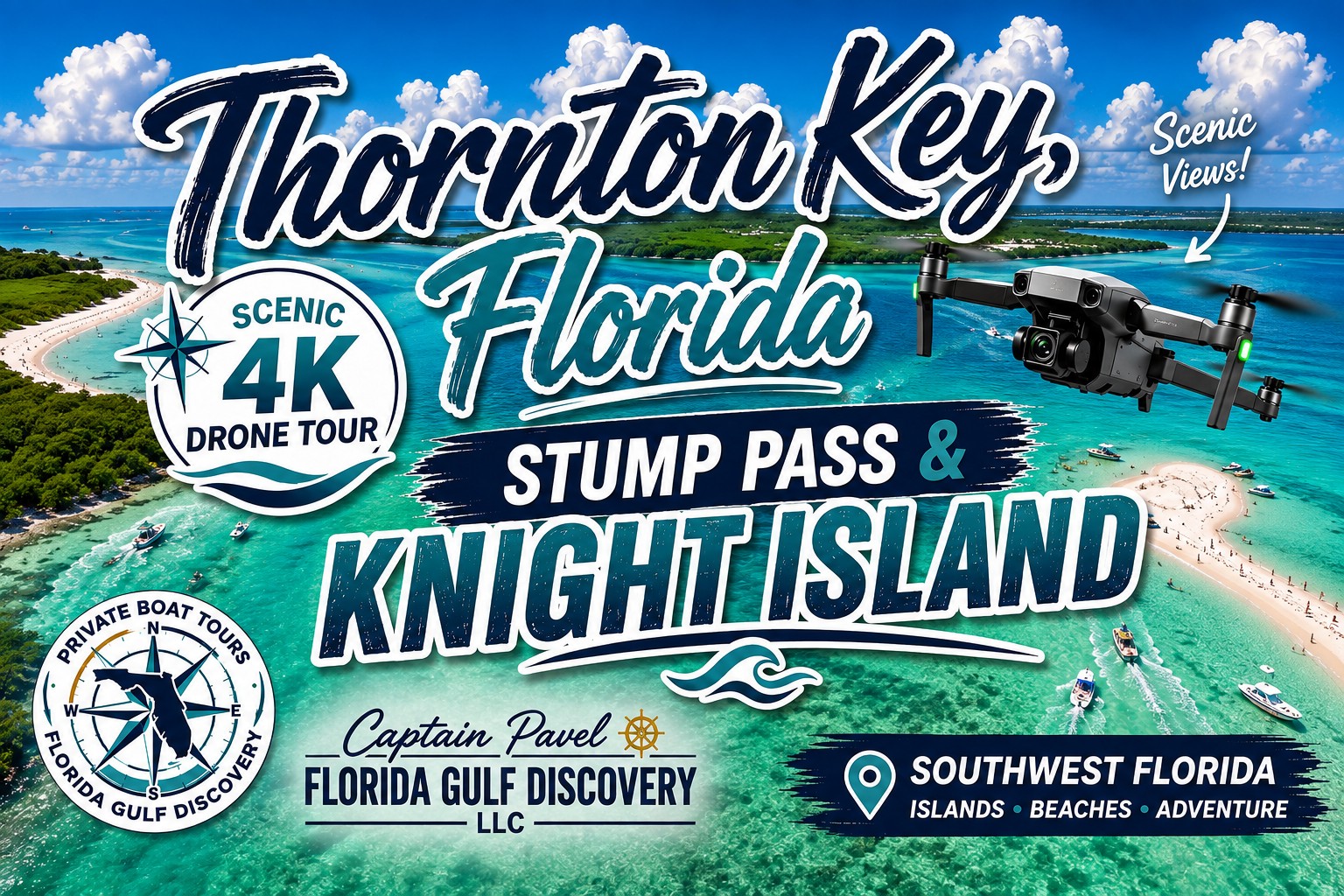
Explore Thornton Key, Stump Pass, and Knight Island from above on a scenic drone flight over Southwest Florida's barrier islands and coastal waterways. Click the image to watch the YouTube video and discover shallow waters, changing shorelines, hidden channels, beaches, and the remarkable landscape surrounding Stump Pass with Captain Pavel.
Knight Island was not the main subject of this flight, but seeing it from above added another piece to the landscape surrounding Stump Pass. Beyond the pass, the island appeared briefly along the coastline as the drone continued its flight.
I did not try to make Knight Island the focus of the video. I simply captured what came into view as I explored Stump Pass from the air.
That is one of the things I enjoy about flying here. Sometimes the camera shows me something beyond what I originally planned to capture, adding another detail to a familiar stretch of Southwest Florida coast.
Knight Island was only a glimpse in this flight—but enough to complete the view around Stump Pass.
Tide, Light & Altitude
During this flight, I was reminded how much tide, light, and altitude can change what we see from above.
The tide was still rising, slowly covering shallow sand and changing the edges of Stump Pass. At the same time, the bright morning sun made differences in the water easier to see. Shallow sandy areas appeared lighter, while deeper water showed darker shades of blue and green.
Then there was altitude.
At lower altitude, I could see individual details—the edges of sandbars, changes in water color, and patterns beneath the surface. As the drone climbed higher, those small details became part of a much larger picture. The shape of Stump Pass, the surrounding shoreline, shallow flats, channels, and barrier islands began to fit together.
Even the direction of the camera and the angle of the sunlight changed what appeared on the screen. A section of water could look completely different only moments later as the drone moved and the viewing angle changed.
That is why I never expect two flights over the same place to look exactly alike. The coastline may have the same name, but the conditions are always changing.
The coastline may be familiar, but from the air, the view is never exactly the same.
Every Flight Tells a New Story
I have flown over familiar parts of Southwest Florida many times, and one thing continues to surprise me: no two flights ever look exactly the same.
You can return to the same place and follow almost the same route, but something will always be different. The tide may be higher or lower. The water may be calm or moving with the wind. Sunlight may reveal the bottom clearly one day and hide it beneath reflections the next. Sandbars shift, shorelines change, and even the altitude of the drone can completely change what I notice below.
Stump Pass was a perfect example.
On this flight, the calm morning, clear blue sky, rising tide, and bright sunlight gave me a view I could only capture under those particular conditions. Even the sandy tongue I had first noticed about a month earlier became part of the story of how this coastline continues to change.
That is what keeps flying these familiar waters interesting for me. I am not simply recording the same place again. I am recording what that place looks like at one particular moment in time.
Tomorrow, next month, or next year, Stump Pass will still be Stump Pass—but the view may tell a completely different story.
I fly the same coast, but never see it twice.
What This Journey Taught Me
By the time I finished flying over Stump Pass, the biggest lesson of the morning was not something completely new. It was something these waters continue to remind me of.
Knowing a place does not mean you know exactly what it will look like today.

Get ready for a Private Family Boat Tour with Captain Pavel and discover Southwest Florida together. Click the image to explore family-friendly private boat trips featuring dolphins, coastal wildlife, barrier islands, sandbars, secluded beaches, swimming, shelling, and plenty of time to relax and enjoy the water with your family.
I have traveled through Stump Pass many times by boat. I know the shoreline, the pass, the shallow areas, and the surrounding waters. But familiarity does not stop the tide, hold the sand in place, or guarantee that the view I remember will be the view I find when I return.
That morning was a good example. The tide was rising, the water was calm, the sky was clear, and a sandy feature I had first noticed only about a month earlier was now part of what I was watching from above.
The drone gave me a perspective that I could never get from the helm of my boat. It allowed me to see how the shallows, channels, shoreline, Stump Pass Beach State Park, and surrounding waters fit together—and how quickly some of those details can change.