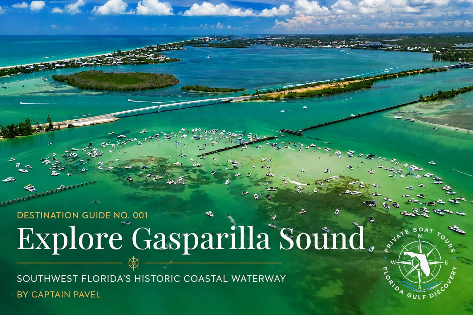
Destination Guide #001
Explore Gasparilla Sound
Southwest Florida’s Historic Coastal Waterway
Discover one of Southwest Florida’s most remarkable estuaries through the eyes of Captain Pavel.
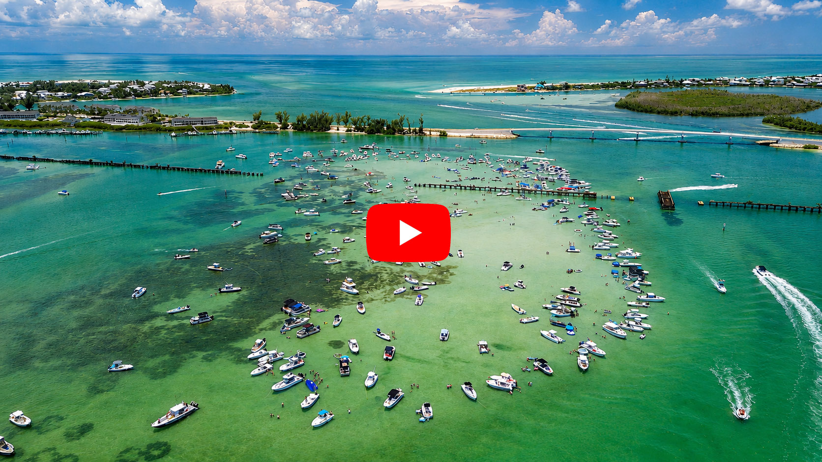
From hidden barrier islands and quiet mangrove shorelines to abundant wildlife, rich history, and spectacular boating destinations, Gasparilla Sound offers an experience unlike anywhere else on the Gulf Coast.
This complete guide combines local knowledge, verified history, scientific information, practical boating advice, and firsthand exploration to help you discover why Gasparilla Sound remains one of Southwest Florida’s most treasured waterways.
Welcome to Gasparilla Sound
“Some places are visited. Others are explored. Gasparilla Sound has inspired explorers for thousands of years.”
— Captain Pavel
Some places leave you with memories after a single visit. Others reveal something new every time you return. Gasparilla Sound is one of those rare places.
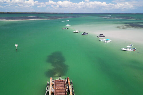
Stretching along Southwest Florida’s Gulf Coast between the mainland and the barrier islands of Gasparilla Island and Little Gasparilla Island, Gasparilla Sound is far more than a body of water. It is a living coastal ecosystem, a historic waterway, and one of the region’s most rewarding places to explore by boat. Protected from the open Gulf of America by these barrier islands, its calm waters connect visitors to some of Southwest Florida’s most beautiful natural landscapes.
For thousands of years, people have depended on these waters. The Calusa navigated the Sound by canoe long before the arrival of European explorers. Later came Spanish expeditions, commercial fishing communities, lighthouse keepers, railroad development, and the rise of Boca Grande as an important port on Florida’s Gulf Coast. Every generation has added another chapter, yet the Sound itself continues to shape the lives of those who navigate its waters.
Today, Gasparilla Sound remains one of Southwest Florida’s most remarkable destinations for boating, wildlife viewing, photography, shelling, and quiet days on the water. Dolphins patrol the tidal currents, manatees graze among the seagrass meadows, ospreys and bald eagles soar overhead, and the changing tides continually reshape beaches, passes, and sandbars.
The surrounding estuary supports an extraordinary diversity of life. Mangrove forests protect the shoreline from erosion, while extensive seagrass meadows provide vital nursery habitat for countless marine species. Tidal creeks connect the Sound to one of Florida’s most productive coastal ecosystems. Together, these natural resources form the foundation of both the area’s environmental importance and its recreational appeal.
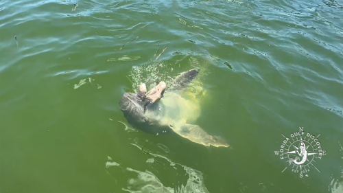
As Captain Pavel, I have explored Gasparilla Sound through every season and in every type of weather the Gulf Coast offers. I’ve watched dolphins feed along quiet mangrove shorelines, photographed unforgettable sunrises and sunsets, navigated changing tides, and discovered hidden places that many visitors cruise past without ever noticing. Every trip teaches me something new about these waters.
This guide combines verified historical research, scientific information from trusted sources, practical boating knowledge, and my own firsthand experience exploring Southwest Florida’s coastal waters. My goal is not simply to describe Gasparilla Sound, but to help you understand why it has become one of the Gulf Coast’s most treasured waterways.
Whether you’re planning your first visit, preparing for a day on the water, researching the area’s history, or simply wanting to learn more about this remarkable corner of Southwest Florida, I hope this guide becomes a trusted resource you’ll return to whenever Gasparilla Sound calls you back.
Why Explore Gasparilla Sound?
Gasparilla Sound offers far more than beautiful scenery. It combines rich history, abundant wildlife, peaceful waterways, and some of Southwest Florida’s most spectacular boating destinations.
Whether you’re interested in history, photography, shelling, dolphin watching, or simply enjoying a relaxing day on the water, there’s always something new to discover.
Along the way, you’ll experience:
- Historic landmarks dating back thousands of years
- Crystal-clear waters and hidden sandbars
- Barrier islands and secluded beaches
- Dolphins, manatees, and abundant birdlife
- Historic lighthouses and Boca Grande’s maritime heritage
- Some of Florida’s finest boating destinations
That’s what makes Gasparilla Sound one of Southwest Florida’s most remarkable coastal waterways.
Gasparilla Sound at a Glance
Whether you’re planning a private boat tour, researching Southwest Florida, or simply exploring the region from home, these quick facts provide an overview of one of Florida’s most remarkable coastal waterways.
| Feature | Information |
|---|---|
| Location | Southwest Florida’s Gulf Coast, between the mainland and the barrier islands of Gasparilla Island and Little Gasparilla Island |
| Water Body | Protected estuary and coastal waterway forming part of the Gulf Intracoastal Waterway |
| Approximate Length | About 10 miles (16 km) from Cape Haze through Placida to Gasparilla Pass |
| Protected By | Gasparilla Island, Little Gasparilla Island, and the mainland shoreline of Cape Haze and Placida |
| Connected Waters | Lemon Bay, Charlotte Harbor, Boca Grande Pass, Gasparilla Pass, Pine Island Sound, and the Gulf of America |
| Known For | Dolphin watching, manatee sightings, shelling, boating, barrier islands, wildlife, spectacular sunsets, and world-class tarpon fishing nearby |
| Wildlife | Bottlenose dolphins, West Indian manatees, ospreys, bald eagles, pelicans, roseate spoonbills, herons, egrets, sea turtles, rays, and abundant coastal fish species |
| Habitats | Mangrove forests, seagrass meadows, tidal creeks, oyster bars, sandy beaches, coastal marshes, and shallow estuaries |
| Best Way to Explore | By private boat, allowing access to hidden beaches, quiet coves, scenic waterways, and shallow coastal habitats |
| Popular Destinations | Boca Grande Sandbar, Gasparilla Island (Boca Grande), Little Gasparilla Island, Placida, Cape Haze, and Gasparilla Pass |
| Primary Departure Areas | Placida and Boca Grande |
| Ideal Activities | Private boat tours, sightseeing, shelling, swimming, photography, wildlife viewing, waterfront dining, and sunset cruises |
| Best Seasons | Beautiful year-round, with each season offering unique wildlife, weather, and boating experiences |
Why Gasparilla Sound Is Special
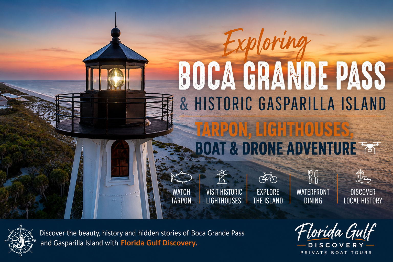
Unlike many coastal destinations where the Gulf of America dominates the scenery, Gasparilla Sound offers a unique combination of protected waters, barrier islands, thriving wildlife habitats, and centuries of maritime history. Its calm estuarine environment makes it one of Southwest Florida’s finest places for boating, nature exploration, photography, and discovering quiet corners of the Gulf Coast that many visitors never experience.
The story of Gasparilla Sound is still being written—and every journey on these waters becomes part of that story.
What Makes Gasparilla Sound Unique?
Unlike many destinations along Florida’s Gulf Coast, Gasparilla Sound brings together natural beauty, maritime history, and exceptional boating within one protected estuary.
As a result, visitors can experience several completely different environments during a single day on the water.
For example, you might begin your morning watching dolphins near Boca Grande Pass, spend the afternoon swimming at Boca Grande Sandbar, explore a quiet mangrove shoreline, and finish the day with dinner at a waterfront restaurant while watching the sunset.
Few places in Southwest Florida offer such variety within such a compact area.
Where Is Gasparilla Sound?
Gasparilla Sound is a protected estuarine waterway on the Gulf Coast of Southwest Florida, extending between the mainland and the barrier islands of Gasparilla Island and Little Gasparilla Island. Sheltered from the open Gulf of America by these barrier islands, the Sound forms one of the region’s most scenic and biologically important waterways.
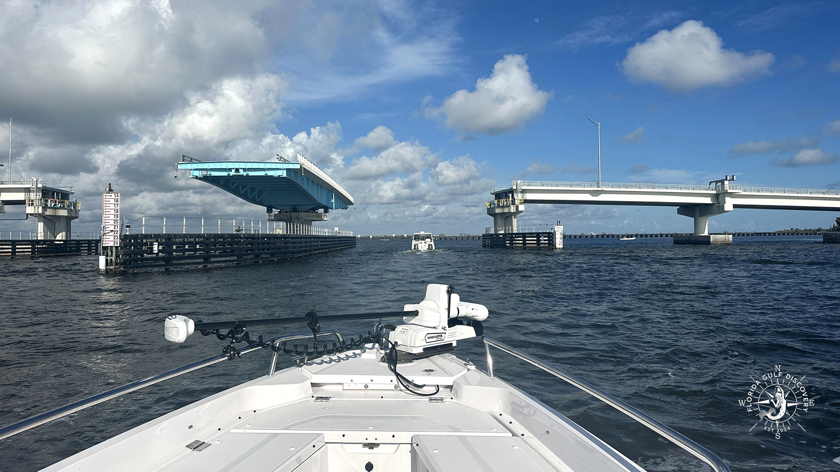
Stretching approximately 10 miles from Cape Haze through Placida to Gasparilla Pass, Gasparilla Sound serves as a natural connection between Lemon Bay, Charlotte Harbor, the Gulf Intracoastal Waterway, and the coastal waters leading toward Pine Island Sound. These protected waters provide safe navigation for recreational boaters while supporting one of Florida’s richest coastal ecosystems.
Unlike the open Gulf of America, Gasparilla Sound is characterized by generally calmer waters, winding mangrove shorelines, extensive seagrass meadows, shallow bays, and numerous small islands. This combination creates ideal conditions for boating, wildlife viewing, kayaking, paddleboarding, photography, shelling, and exploring one of Southwest Florida’s most beautiful coastal environments.
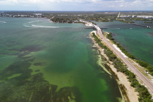
Several well-known destinations border or lie within Gasparilla Sound, including Placida, Cape Haze, Gasparilla Island (Boca Grande), Little Gasparilla Island, Boca Grande Sandbar, and Gasparilla Pass. Together, these locations create a unique network of waterways, barrier islands, beaches, sandbars, and historic coastal communities that attract boaters and nature lovers throughout the year.
For many boaters, Gasparilla Sound is the heart of Southwest Florida’s coastal boating experience. Whether cruising to Boca Grande Sandbar, exploring the shoreline of Little Gasparilla Island, enjoying waterfront dining in Boca Grande, or simply watching dolphins along a quiet mangrove shoreline, every journey reveals another reason why this remarkable estuary is considered one of Florida’s most treasured waterways.
The Geography of Gasparilla Sound
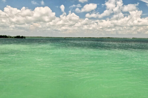
Understanding the geography of Gasparilla Sound is the key to appreciating why it has become one of Southwest Florida’s most treasured boating destinations. Unlike the open waters of the Gulf of America, the Sound is a protected estuary where freshwater flowing from inland rivers mixes with saltwater carried by the tides. This ever-changing balance creates an environment that supports remarkable biodiversity while providing excellent conditions for boating and wildlife viewing.
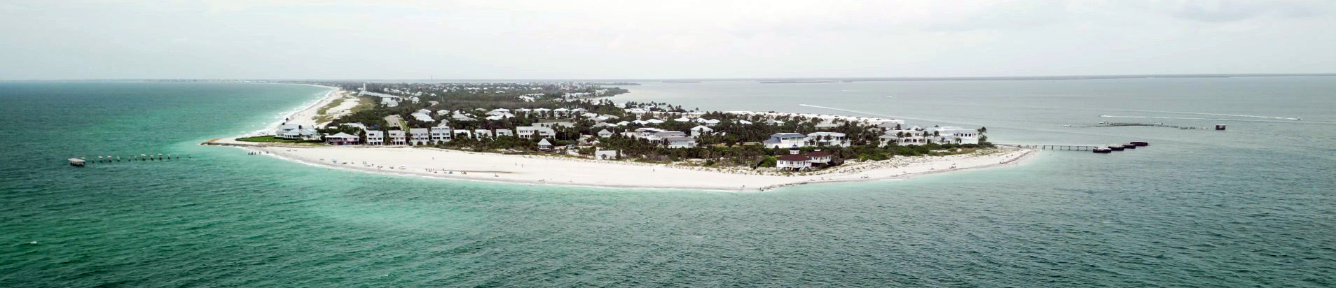
The Sound stretches between Florida’s mainland and the barrier islands of Gasparilla Island and Little Gasparilla Island. Along its shores are landmarks such as Cape Haze, the historic Placida Trestle, and Boca Grande Sandbar, each contributing to the area’s unique character and boating experience. These islands act as a natural shield, reducing the force of Gulf waves and creating calmer waters throughout much of the estuary. While weather and tides can still produce challenging conditions, especially near the passes, the protected nature of Gasparilla Sound makes it one of the most enjoyable areas for recreational boating on Florida’s Gulf Coast.
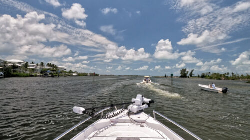
The geography of the Sound is constantly changing. Powerful tides move millions of gallons of water through Boca Grande Pass and Gasparilla Pass each day, transporting nutrients, marine life, and sediment throughout the estuary. Over time, these tidal currents reshape beaches, sandbars, oyster bars, and shallow flats, creating a landscape that is never exactly the same from one season to the next.
Beneath the surface, extensive seagrass meadows cover much of the shallow bottom. These underwater grass beds stabilize sediments, improve water clarity, produce oxygen, and provide nursery habitat for countless fish, crabs, shrimp, scallops, and other marine species. Healthy seagrass is one of the primary reasons dolphins, manatees, sea turtles, and a remarkable variety of birds thrive throughout the region.
Mangrove forests line much of the mainland shoreline and many of the smaller islands. Their intricate root systems reduce erosion, protect the coastline from storm surge, filter runoff, and create shelter for juvenile fish and crustaceans. These mangrove habitats are among the most productive ecosystems in Florida and play a critical role in maintaining the health of Gasparilla Sound.
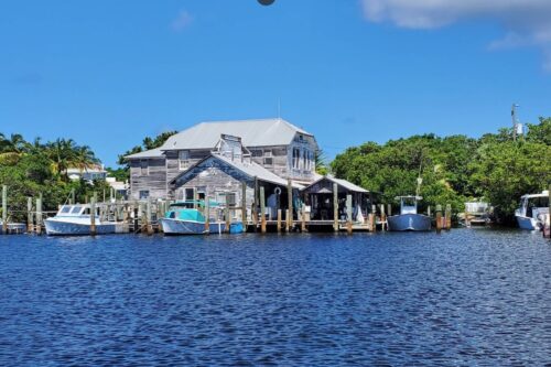
The combination of barrier islands, tidal passes, seagrass meadows, mangrove shorelines, shallow bays, and deeper navigation channels creates an extraordinary variety of habitats within a relatively compact area. This diversity explains why visitors can experience secluded beaches, thriving wildlife, quiet anchorages, historic communities, and spectacular scenery during a single day on the water.
Today, Gasparilla Sound remains an essential part of the larger Charlotte Harbor estuarine system, one of the most significant and productive estuaries in the United States. Its geography continues to shape the region’s wildlife, maritime history, recreation, and way of life, just as it has for thousands of years.
Captain Pavel’s Note
One of the things I appreciate most about Gasparilla Sound is its variety. Within a single day, I can cruise through open water, follow quiet mangrove shorelines, visit remote barrier islands, anchor at a sandbar, watch dolphins feeding in tidal currents, and enjoy lunch at a waterfront restaurant. Few places on Florida’s Gulf Coast offer so many different experiences within such a compact area.
Every season offers something different, which is why no two trips through Gasparilla Sound are ever exactly alike.
Captain Pavel’s Tip
I’ve found that dolphins are often most active around tidal changes near Boca Grande Pass and Gasparilla Pass, especially when schools of baitfish are moving with the current.
View Gasparilla Sound on Captain Pavel’s Southwest Florida Explorer Map
Continue exploring Gasparilla Sound on Captain Pavel’s Southwest Florida Explorer Map. Discover nearby barrier islands, beaches, passes, marinas, wildlife hotspots, historic landmarks, waterfront restaurants, and Captain Pavel’s recommended boating routes.
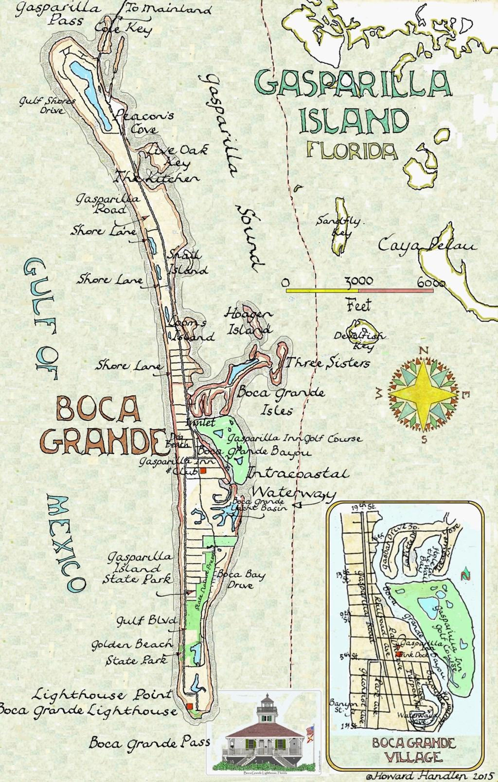
The Explorer Map features more than 100 destinations across Southwest Florida and is continuously updated with new discoveries, historic landmarks, wildlife locations, marinas, beaches, and Captain Pavel’s favorite boating destinations.
A History of Gasparilla Sound: From the Calusa to Today
Gasparilla Sound Timeline
| Period / Year | Historical Milestone |
|---|---|
| 4,000+ years ago | Native American fishing cultures, including the Calusa, thrive throughout Charlotte Harbor and Gasparilla Sound, using the estuary for transportation, fishing, trade, and daily life. |
| 1513 | Spanish explorers, including the expedition of Juan Ponce de León, reach Southwest Florida and encounter the Calusa civilization. |
| 1700s–1800s | Cuban fishing ranchos are established along the Gulf Coast, creating seasonal fishing settlements and trade routes between Florida and Cuba. |
| 1885 | Construction begins on the Placida Trestle, creating the rail connection between the mainland and Gasparilla Island that would transform the region’s future. |
| December 31, 1890 | The Port Boca Grande Lighthouse is first illuminated, guiding commercial ships safely through Boca Grande Pass. |
| 1907 | The Charlotte Harbor & Northern Railway reaches Boca Grande, while Port Boca Grande and its massive phosphate-loading facilities develop into one of the world’s busiest phosphate export operations. |
| 1911–1913 | The Gasparilla Inn opens, establishing Boca Grande as one of Florida’s premier winter resorts. |
| 1927 | The former Delaware Breakwater Rear Range Light is relocated to Gasparilla Island and reassembled south of Boca Grande Village. |
| January 1, 1932 | The relocated tower officially enters service as the Boca Grande Entrance Rear Range Light, now known as the Gasparilla Island Lighthouse. |
| Today | Gasparilla Sound is recognized as one of Southwest Florida’s premier destinations for boating, wildlife, history, conservation, and coastal exploration. |
The First People of Gasparilla Sound
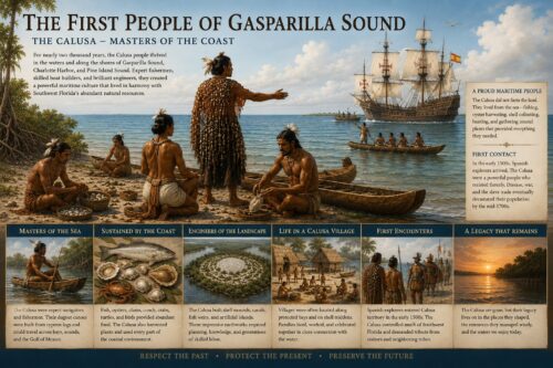
Long before European explorers reached Florida, Gasparilla Sound was home to Native American peoples who depended on its rich estuary for survival. Among them, the Calusa became one of the most powerful civilizations in North America. Skilled fishermen and navigators, they traveled the Sound in dugout canoes, harvesting fish, shellfish, and other marine resources from its productive waters.
The mangrove shorelines, tidal creeks, and shallow bays provided abundant food throughout the year, while the protected waters offered safe travel between Charlotte Harbor, the barrier islands, and neighboring estuaries. Evidence of these early communities can still be found today in shell middens and archaeological sites throughout Southwest Florida, reminding visitors that people have relied on these waters for thousands of years.
Spanish Explorers Reach Southwest Florida
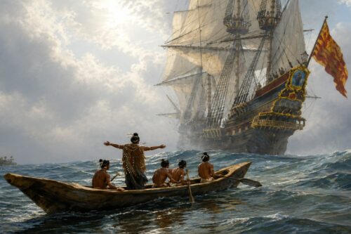
In 1513, Spanish explorer Juan Ponce de León arrived along Florida’s Gulf Coast during one of the earliest recorded European expeditions to the region. The Spanish encountered the Calusa, whose knowledge of the coastal waterways far exceeded that of the newcomers.
Although Spain explored and mapped the surrounding waters, the Calusa remained dominant for generations. The challenging coastal environment, combined with strong Native resistance, prevented Spain from establishing permanent settlements within Gasparilla Sound itself. Nevertheless, these early voyages placed the region on European maps and began a new chapter in its history.
The Cuban Fishing Ranchos
During the eighteenth and nineteenth centuries, Cuban fishermen established seasonal fishing ranchos along Florida’s Gulf Coast. These camps harvested mullet, grouper, snapper, sharks, and other fish, preserving their catch with salt before shipping it to Havana and other Caribbean markets.
Gasparilla Sound provided sheltered anchorages, plentiful fishing grounds, and convenient access to Charlotte Harbor and the Gulf of America. These early commercial fisheries helped shape the maritime culture that would later define Southwest Florida’s coastal communities.
Building the Placida Trestle
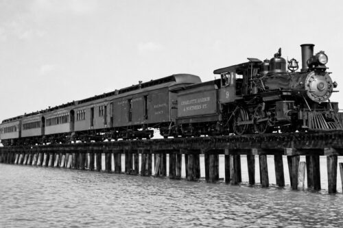
The construction of the Placida Trestle marked one of the most significant engineering achievements in the history of Gasparilla Sound. Built in the late nineteenth century as part of the Charlotte Harbor & Northern Railway, the wooden trestle connected the mainland at Placida with Gasparilla Island, allowing trains to transport phosphate from Boca Grande to waiting cargo ships.
For decades, locomotives crossed the Sound daily, carrying one of Florida’s most valuable natural resources to international markets. Although trains no longer cross the trestle, the remaining structure stands as one of the area’s most recognizable historic landmarks and a lasting reminder of Southwest Florida’s railroad era.
The Historic Lighthouses of Gasparilla Island
Port Boca Grande Lighthouse
First illuminated December 31, 1890
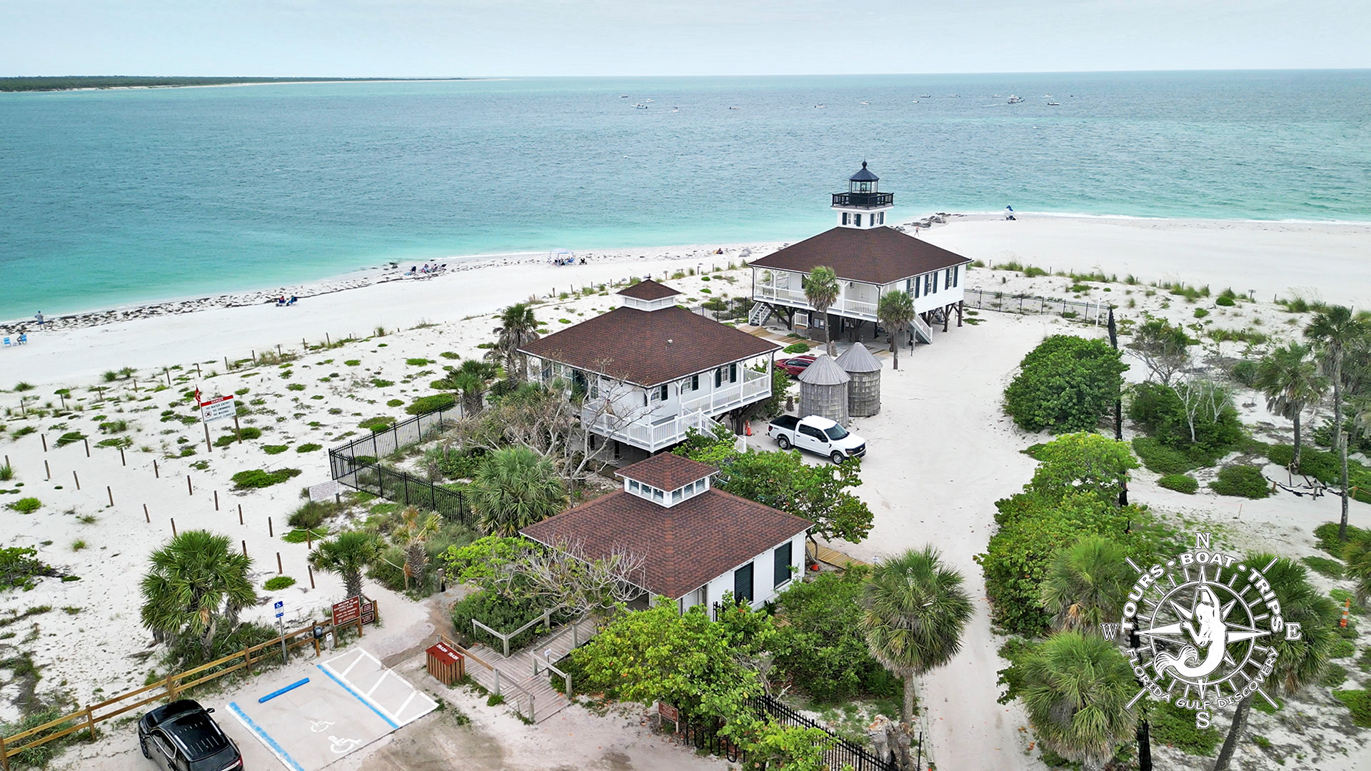
The Port Boca Grande Lighthouse guided commercial ships safely through Boca Grande Pass. Located at the southern tip of Gasparilla Island, it played an essential role during the region’s busiest years of maritime commerce.
Today, the beautifully restored lighthouse operates as the Port Boca Grande Lighthouse Museum, preserving the history of the area’s lighthouse keepers, shipping industry, and coastal heritage.
Gasparilla Island Rear Range Lighthouse
Relocated from Delaware in 1927 • First illuminated January 1, 1932
Today known as the Gasparilla Island Lighthouse, this historic skeletal tower originally served as the Boca Grande Entrance Rear Range Light. It was relocated from Delaware to Gasparilla Island in 1927 and first illuminated on January 1, 1932.
The Story Begins in Delaware
In 1881, the Phoenix Iron Company of Trenton, New Jersey, built a 105-foot iron skeletal lighthouse for the entrance to Delaware Bay. Known as the Delaware Breakwater Rear Range Light, or Green Hill Lighthouse, it guided ships safely into one of the busiest harbors on the East Coast.
By the early twentieth century, changing shorelines made the lighthouse unnecessary. It was removed from service, carefully dismantled, and each iron component was numbered for future reassembly. The structure then remained in storage for several years.
A New Home in Florida
Meanwhile, Southwest Florida was booming.
The discovery of rich phosphate deposits in Central Florida had transformed Port Boca Grande into one of Florida’s busiest shipping ports. Ocean-going freighters loaded phosphate at Boca Grande, creating a need for improved navigation into the harbor.
Rather than building a completely new lighthouse, the U.S. Lighthouse Service chose to relocate the Delaware tower.
In 1927, the entire lighthouse was transported to Gasparilla Island and reassembled along the Gulf Coast south of Boca Grande Village.
The Boca Grande Range Lights
The lighthouse became the rear range light of a two-light navigation system.
About one mile offshore stood the front range light. Mariners entering Boca Grande Pass aligned the two lights vertically. When the lights appeared one above the other, captains knew their vessels were properly aligned with the shipping channel leading into Charlotte Harbor.
The lighthouse was equipped with a fourth-order Fresnel lens and officially entered service on January 1, 1932. Although it was unmanned, it was maintained by lighthouse keepers stationed at the nearby Port Boca Grande Lighthouse.
Decline and Restoration
As phosphate shipping declined during the late twentieth century, the range lights became less important. The front range light was eventually removed, and the rear range light ceased serving as part of the original two-light range system.
In 2016, the Barrier Island Parks Society became steward of the lighthouse and completed a major restoration funded by community donations. The restored lighthouse reopened to the public in 2017 and received a Florida Trust Award for historic preservation in 2018.
A History of Gasparilla Sound: From the Calusa to Today
The Rise of an Industrial Giant
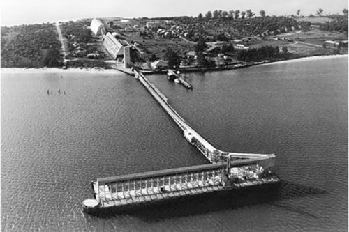
An aerial photograph of Boca Grande around 1940, showing the phosphate loading terminal, railroad infrastructure, and shipping docks that made the island one of the world’s leading phosphate export ports.
The discovery of rich phosphate deposits in Central Florida during the late 1800s transformed the quiet fishing village of Boca Grande into one of the world’s most important phosphate export ports.
Everything changed with the completion of the Charlotte Harbor & Northern Railway in 1907. The railroad connected the phosphate mines near Mulberry with the deep-water harbor at Boca Grande, creating one of the most efficient export routes in the world.
Long trains crossed Charlotte Harbor over the famous Placida Trestle, delivering thousands of tons of phosphate rock to the Port Boca Grande terminal every day. At the waterfront, enormous steel loading structures transferred the cargo directly into ocean-going freighters anchored alongside the docks.
For decades, ships departed Boca Grande carrying Florida phosphate to Europe, South America, Asia, and other international markets, where it was used primarily to manufacture agricultural fertilizers that helped feed a growing world population.
A Landmark of Southwest Florida
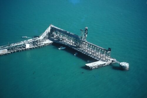
The Boca Grande phosphate loading docks, photographed before their removal in the early 1990s. For nearly a century, these structures played a vital role in Florida’s phosphate industry and helped shape the history of Boca Grande and Gasparilla Sound.
At their peak, the Port Boca Grande facilities ranked among the busiest phosphate export terminals anywhere in the world. The towering loading equipment, railroad tracks, storage areas, and visiting cargo ships dominated the southern end of Gasparilla Island for nearly ninety years.
The port became the economic engine of Boca Grande, supporting railroad workers, dock crews, ship captains, merchants, hotels, restaurants, and countless local businesses. Much of the island’s early prosperity can be traced directly to the phosphate industry.
Visitors arriving by boat would have seen an entirely different Boca Grande than today—a busy industrial waterfront where locomotives, conveyor systems, cranes, and large cargo vessels operated almost continuously.
From Industry to History
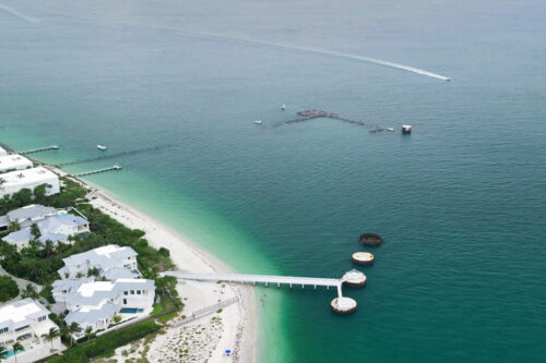
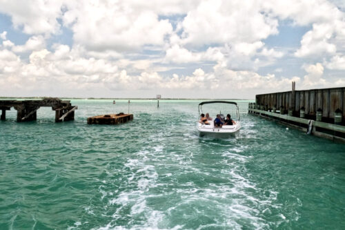
Only a few concrete foundations and timber pilings remain of the once-massive Boca Grande phosphate loading docks. Today, these remnants stand as quiet reminders of one of Southwest Florida’s most important industrial landmarks.
Commercial phosphate shipping ended in 1979 after newer and more efficient deep-water export facilities opened at other Florida ports. The enormous loading docks gradually became obsolete and were dismantled during the early 1990s.
Today, only scattered concrete foundations, weathered timber pilings, and underwater remains survive at the south end of Boca Grande. Most visitors pass these remnants without realizing they once supported one of Florida’s largest industrial shipping operations.
For boaters exploring Gasparilla Sound today, these quiet remains provide a fascinating contrast between Boca Grande’s industrial past and the peaceful coastal paradise visitors enjoy today.
Captain Pavel’s Note
When I cruise past the southern end of Boca Grande, I often point out the remaining pilings and concrete foundations. It’s difficult to imagine that this peaceful shoreline once echoed with steam locomotives, conveyor machinery, cargo ships, and thousands of tons of phosphate moving through the port each day.
Knowing this history gives visitors a completely different appreciation of Boca Grande. Beneath today’s calm waters and beautiful scenery lies the story of one of the most important industrial ports ever built on Florida’s Gulf Coast.
Boca Grande Becomes a Winter Resort
While commerce fueled the area’s economy, tourism was also beginning to flourish. The opening of the Gasparilla Inn in the early twentieth century established Boca Grande as one of Florida’s premier winter destinations.
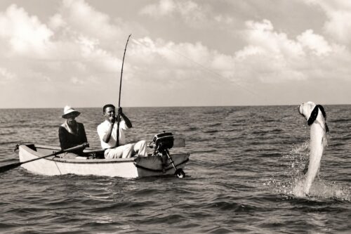
Visitors arrived by train to enjoy world-class tarpon fishing, beautiful beaches, warm weather, and the peaceful atmosphere of Gasparilla Island. Over time, Boca Grande earned an international reputation as an elegant yet unspoiled coastal community—a reputation it continues to enjoy today.
Gasparilla Sound Today
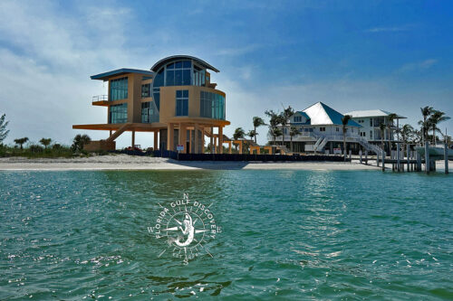
Today, Gasparilla Sound remains one of Southwest Florida’s most treasured coastal waterways. Its protected estuary supports extensive seagrass meadows, mangrove forests, oyster bars, tidal creeks, and diverse marine habitats that provide essential nursery grounds for countless species of fish, birds, and marine mammals.
The Sound is now valued not only for its natural beauty but also for its ecological importance. Dolphins, manatees, sea turtles, ospreys, bald eagles, pelicans, and hundreds of other species depend on this healthy estuary throughout the year.
For boaters, kayakers, photographers, and nature enthusiasts, Gasparilla Sound offers a unique opportunity to experience one of Florida’s most remarkable coastal environments while helping preserve it for future generations.
A Living Waterway
For thousands of years, Gasparilla Sound has connected people to Southwest Florida’s coast. Native Americans paddled these waters long before maps existed. Spanish explorers charted the shoreline. Lighthouse keepers watched over passing ships. Railroad workers crossed the Placida Trestle, while commercial captains loaded phosphate destined for ports around the world.
Today, the Sound continues to write new stories every day. Some visitors come to watch dolphins, others to discover hidden beaches, photograph spectacular sunsets, or simply enjoy the peaceful rhythm of life on the water. Whatever brings them here, they become part of a history that is still unfolding.
Every journey across Gasparilla Sound adds another chapter to one of Florida’s most remarkable coastal waterways.
Nature Shapes Gasparilla Sound
| Year / Period | Natural Event |
|---|---|
| 2004 | Hurricane Charley significantly reshapes beaches, dunes, shorelines, tidal channels, and coastal vegetation throughout the Gasparilla Sound region, demonstrating the powerful influence of tropical storms on Southwest Florida’s barrier islands. |
| 2022 | Hurricane Ian makes landfall on Cayo Costa, dramatically altering nearby beaches, dunes, mangrove forests, coastal habitats, and park facilities while reinforcing the constantly changing nature of the region’s coastal landscape. |
| Every Day | Twice-daily tides flowing through Boca Grande Pass and Gasparilla Pass transport sediment, nourish seagrass meadows, shape beaches and sandbars, flush the estuary with fresh Gulf waters, and sustain the rich marine ecosystem that defines Gasparilla Sound. |
| Today | Winds, tides, storms, and coastal currents continue to reshape beaches, sandbars, tidal passes, and shorelines, making Gasparilla Sound a living estuary that is constantly evolving. Every visit offers a slightly different landscape, reminding us that nature is still writing the next chapter of this remarkable coastal waterway. |
Why Gasparilla Sound Still Matters
For thousands of years, Gasparilla Sound has been a place of discovery.
The Calusa navigated these waters in hand-carved dugout canoes.
Spanish explorers charted an unfamiliar coastline.
Commercial fishing communities developed along the coast, relying on the sea for their livelihoods.
Lighthouse keepers guided ships safely through Boca Grande Pass.
Railroad workers transformed Boca Grande into a world-famous port.
Today, visitors come for different reasons. Some seek dolphins, quiet beaches, unforgettable sunsets, or a relaxing day on the water. Others simply want to experience one of Florida’s last great coastal landscapes.
Although much has changed over the centuries, the essence of Gasparilla Sound remains the same. It is a place best understood not by rushing through it, but by slowing down, observing, and appreciating the remarkable relationship between history, nature, and the sea.
For me, every trip is another opportunity to discover something new. I hope this guide inspires you to explore Gasparilla Sound with the same curiosity and respect that have drawn people to these waters for thousands of years.
— Captain Pavel