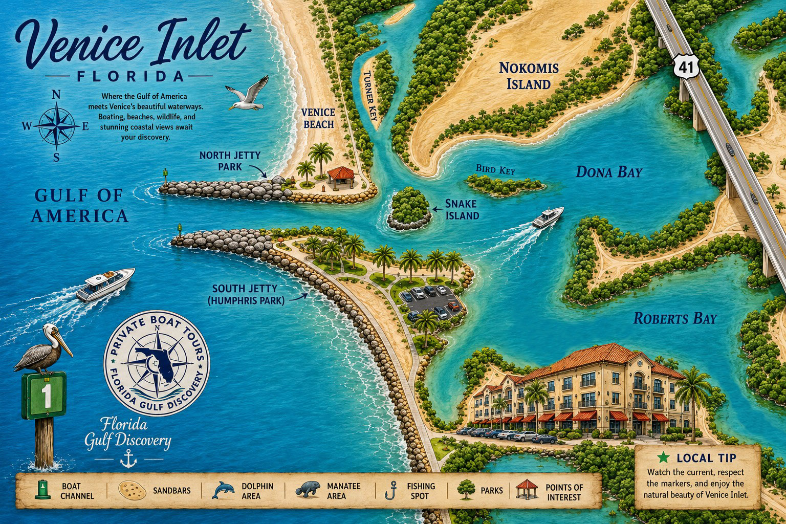
2. Quick Facts
Essential geographic, historical, engineering, and boating information about Venice Inlet, Florida.
| Location | Sarasota County, between Venice Beach and Casey Key on Florida’s Southwest Gulf Coast |
|---|---|
| Historic Name | Casey’s Pass |
| Inlet Type | Federally engineered and permanently stabilized tidal inlet |
| Origin | Developed from the naturally shifting Casey’s Pass and permanently fixed through federal engineering in 1937 |
| Modern Inlet Constructed | 1937 |
| Federal Authorization | Rivers and Harbors Act of 1935 |
| Navigation Channel | Authorized at approximately 8 feet deep and 100 feet wide; actual depths may vary because of shoaling, storms, and maintenance |
| Jetty Spacing | Approximately 300 feet apart |
| Navigation Structures | Parallel North and South jetties originally constructed with sheet-pile components and later repaired and reinforced |
| Waterway Connection | Connects the Gulf of America with Roberts Bay and the Gulf Intracoastal Waterway |
| Nearby Waters | Roberts Bay, Dona Bay, Lyons Bay, and Blackburn Bay |
| Nearby Beaches | Venice Beach, Nokomis Beach, Humphris Park, and North Jetty Park |
| Nearby Island | Snake Island, a mangrove-covered island shaped by marshland, dredging, erosion, and restoration |
| Tidal Conditions | Strong flood and ebb currents; timing and intensity vary with tides, wind, rainfall, and weather systems |
| Popular Activities | Boating, fishing, kayaking, paddleboarding, wildlife observation, beachcombing, shark-tooth hunting, and waterfront dining |
3. Geography
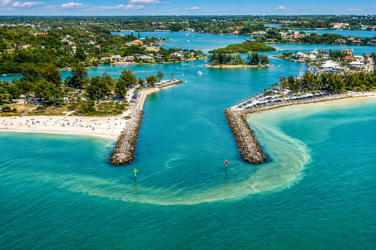
This aerial view showcases Venice Inlet, where twin rock jetties stabilize the navigation channel between the Intracoastal Waterway and the Gulf of America.
Venice Inlet is located on Florida's southwest Gulf Coast in Sarasota County, separating Venice Beach from Casey Key. The inlet forms a permanent connection between the Gulf of America, Roberts Bay, and the Gulf Intracoastal Waterway (GIWW), providing one of the region's most important navigation routes for both recreational and commercial vessels.
The modern inlet is approximately 300 feet wide and is stabilized by two parallel engineered jetties that protect the federal navigation channel from the natural migration that once characterized historic Casey's Pass. Although the inlet itself remains fixed, the surrounding beaches, shoals, and sandbars continue to evolve under the influence of waves, tides, longshore sediment transport, and periodic tropical storms.
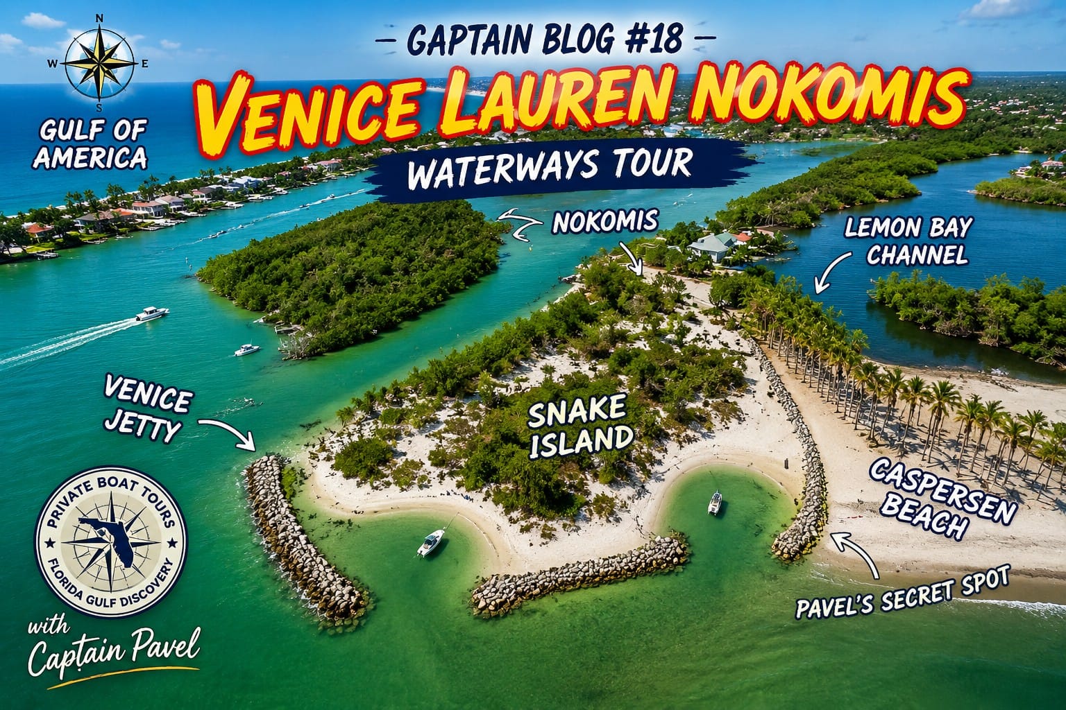
Discover the beautiful waterways of Venice, Nokomis, Snake Island, and Caspersen Beach on a private boat tour with Captain Pavel.
North of the inlet lie Nokomis Beach, North Jetty Park, Casey Key, Blackburn Bay, Dona Bay, and Roberts Bay. To the south are Venice Beach, Humphris Park, the City of Venice, and the broad shoreline extending toward Venice Municipal Beach. Together, these waters create an extensive estuarine system where freshwater from inland waters mixes with saltwater from the Gulf, supporting productive coastal habitats and diverse marine life.
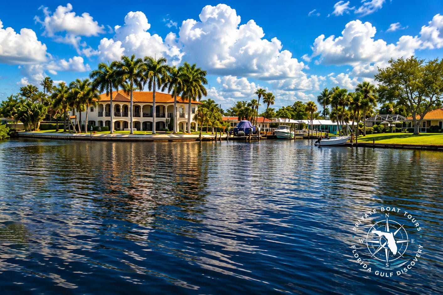
This luxury waterfront estate overlooks Lyons Bay, a protected estuary just inside Venice Inlet that offers direct boating access to the Intracoastal Waterway and the Gulf of America. Many homes along Lyons Bay feature private docks, deep-water access, and panoramic sunset views, making the area one of Venice's most prestigious waterfront neighborhoods.
Within the protected waters east of the inlet lies Snake Island, a mangrove-covered island formed through a combination of historic marshland, dredging, natural erosion, and ecological restoration. Nearby seagrass meadows, tidal flats, mangrove shorelines, and shallow bays provide nursery habitat for fish, feeding areas for manatees, and resting places for numerous coastal birds.
Although Venice Inlet is a product of modern engineering, the surrounding landscape remains part of a naturally dynamic barrier island system. Waves, tides, hurricanes, and longshore currents continue to reshape nearby beaches and coastal habitats, demonstrating that even a stabilized navigation inlet remains closely connected to the powerful natural processes that have shaped Florida's Gulf Coast for thousands of years.
4. History — From Casey's Pass to Venice Inlet
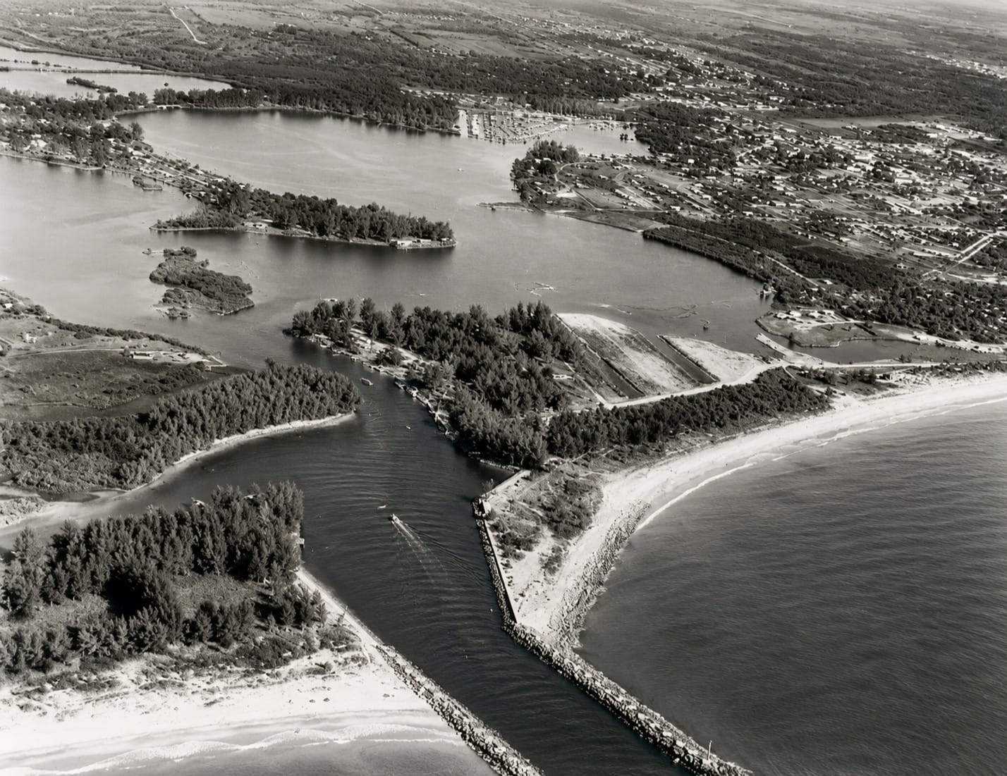
This historic aerial photograph, taken around 1938, captures Venice Inlet shortly after completion of the jetties that permanently stabilized the former Casey's Pass. The image documents one of the most significant coastal engineering projects on Florida's Gulf Coast, transforming a naturally migrating tidal pass into a reliable navigation channel connecting Roberts Bay and the Intracoastal Waterway with the Gulf of America. Historic aerial photographs such as this provide a valuable record of how Venice's shoreline, waterways, and surrounding development have evolved over the past century.
Long before Venice Inlet became a permanently stabilized navigation channel, this section of Florida's Gulf Coast was shaped by a naturally shifting tidal opening known as Casey's Pass. Early coastal maps indicate that the pass moved over time as storms, tides, currents, and longshore sediment transport continuously reshaped the barrier islands separating the Gulf of America from the protected waters of Roberts Bay.
Natural tidal inlets along barrier-island coastlines are rarely fixed in one position. Sand carried along the shoreline can gradually narrow a pass, while storms and strong tidal currents may deepen, widen, relocate, or close it. Casey's Pass followed this pattern, changing in response to coastal conditions and creating an unreliable route for vessels traveling between the Gulf and inland waterways.
As the Venice area developed during the early twentieth century, local residents, commercial operators, and government agencies recognized the need for a dependable navigation entrance. A stable inlet would improve access between the Gulf of America, Roberts Bay, and the inland waterway system while supporting fishing, transportation, waterfront development, and recreational boating.
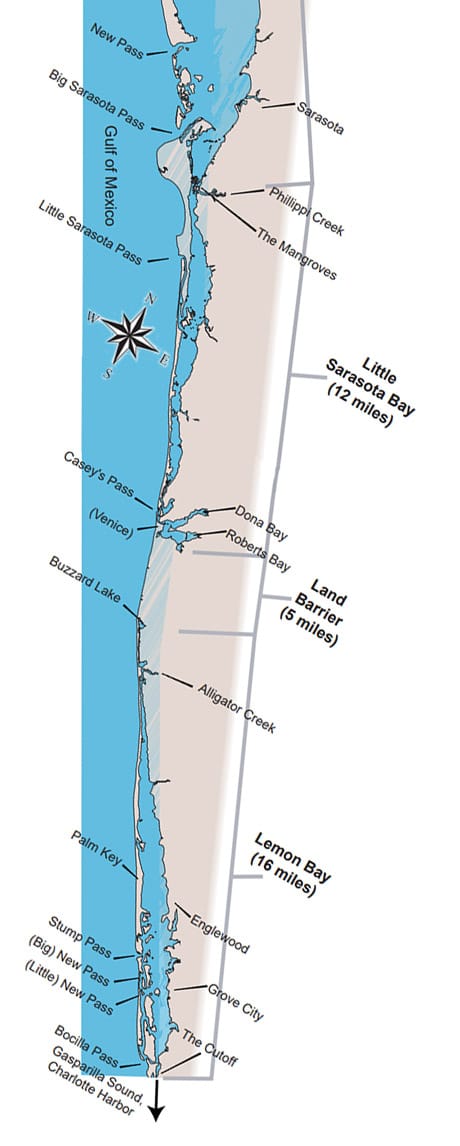
This historic map illustrates the waterways between Casey's Pass, Venice Inlet, and Lemon Bay, revealing how Southwest Florida's barrier islands, passes, and navigation routes have evolved over time. Click the image to examine the full-size map and compare the historic coastal landscape with today's shoreline, highlighting the dramatic natural changes that shaped the region's waterways.
Federal authorization for the navigation project was provided through the Rivers and Harbors Act of 1935. The project called for the creation and stabilization of a permanent Gulf entrance near Venice, replacing the unpredictable natural characteristics of Casey's Pass with an engineered navigation channel.
Construction was completed in 1937. The new inlet was protected by jetties and associated shoreline structures designed to hold the entrance in a fixed position and reduce the movement of sand into the channel. The federally authorized channel was designed to provide an approximately 8-foot-deep and 100-foot-wide navigation route between the Gulf and Roberts Bay.
The stabilized entrance gradually became known as Venice Inlet. Its construction represented a major transformation of the local coastline. What had once been a naturally migrating tidal pass became a permanently maintained navigation inlet shaped by engineering, dredging, shoreline reinforcement, and continuing federal and local management.
The inlet also influenced the surrounding beaches and barrier islands. By interrupting the natural movement of sand along the shoreline, the jetties affected patterns of erosion and deposition north and south of the entrance. These effects later contributed to the need for periodic dredging, shoreline monitoring, and beach-nourishment projects.
Today, Venice Inlet remains both a functioning waterway and a visible record of twentieth-century coastal engineering. Its history reflects the continuing relationship between natural coastal processes and human efforts to create reliable access through Florida's dynamic barrier-island shoreline.
5. Engineering the Modern Venice Inlet
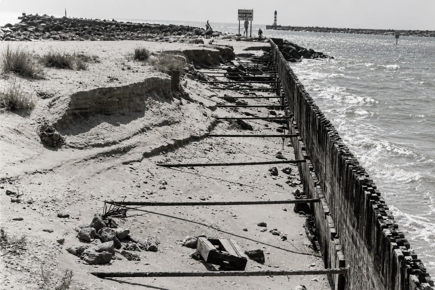
This historic photograph documents erosion along the South Jetty at Venice Inlet, a structure built to stabilize the former Casey's Pass navigation channel. Since the jetties were completed in 1937, powerful Gulf waves, hurricanes, and the interruption of natural longshore sand transport have required repeated repairs and beach nourishment projects to protect the inlet and nearby shoreline. The South Jetty remains one of Southwest Florida's most important coastal engineering structures, providing safe navigation while helping manage erosion and sediment movement along the Gulf Coast.
Venice Inlet may appear to be a natural opening through the barrier-island shoreline, but its present form is largely the result of twentieth-century coastal engineering. The modern inlet was designed to provide a dependable navigation route between the Gulf of America, Roberts Bay, and the inland waterway system.
Before stabilization, Casey's Pass shifted in response to storms, tides, currents, and longshore sediment transport. These natural movements made the entrance unpredictable and sometimes difficult for vessels to use. Engineers therefore sought to create a fixed channel that could remain open and navigable under changing coastal conditions.
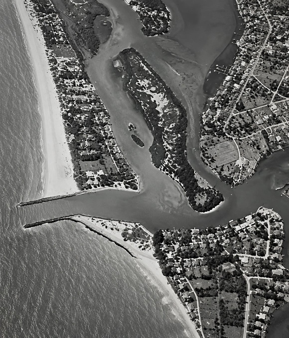
This historic aerial photograph from 1957 shows Venice Inlet nearly two decades after construction of the north and south jetties permanently stabilized the former Casey's Pass. By the 1950s, the inlet had become a vital navigation gateway linking Roberts Bay and the Intracoastal Waterway with the Gulf of America, while the surrounding shoreline and waterfront community continued to expand. Historic aerial images such as this illustrate how the jetties transformed coastal navigation, influenced sediment movement, and shaped the modern development of Venice's waterfront.
The federal navigation project was authorized through the Rivers and Harbors Act of 1935, and construction of the stabilized inlet was completed in 1937. The project created an authorized navigation channel approximately 8 feet deep and 100 feet wide, connecting the Gulf with Roberts Bay.
Early stabilization structures included sheet-pile cylinders, timber bulkheads, and related structural components designed to hold the inlet in a fixed position. Over time, these structures were reinforced and modified as engineers responded to corrosion, wave action, shoreline change, and the continuing movement of sand along the coast.
The north and south jetties serve several important purposes. They help guide tidal flow through the inlet, reduce the direct movement of sand into the navigation channel, and limit the tendency of the entrance to migrate along the shoreline. The jetties also protect the channel margins from wave-driven erosion.
Stabilizing an inlet does not stop natural coastal processes. Sand continues to move along the shoreline through longshore sediment transport, while tides carry suspended sediment into and out of the entrance. Some of this material can accumulate within the channel, around the jetty tips, and along nearby beaches.
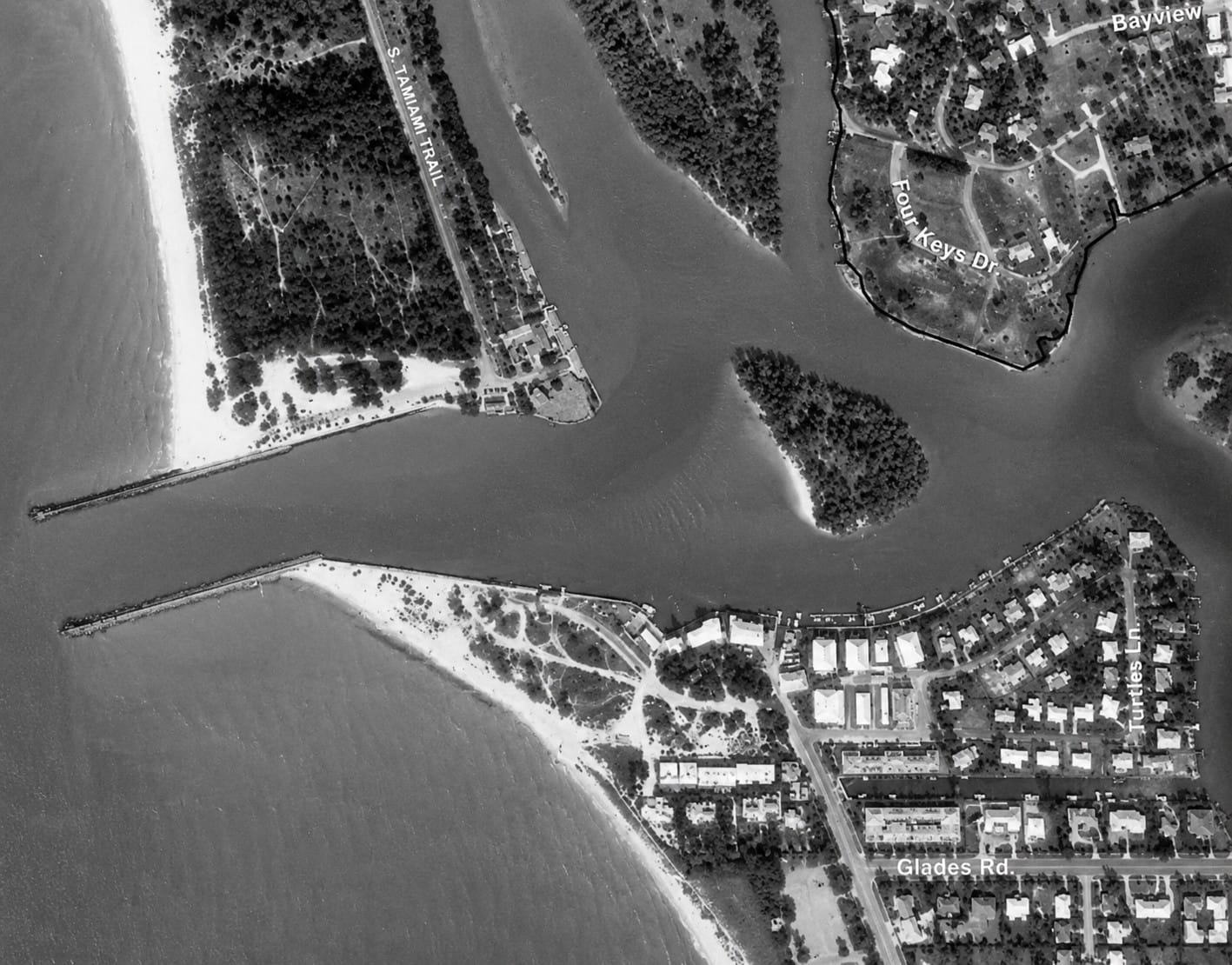
This historic aerial photograph from 1978 shows Venice Inlet, Snake Island, and the surrounding waterways more than forty years after the inlet was permanently stabilized. By this time, Snake Island had become a distinct feature at the mouth of the inlet, shaped by dredging, tidal currents, and ongoing sediment movement associated with the Intracoastal Waterway. Historic aerial imagery documents the continuing evolution of Venice Inlet and illustrates how coastal engineering and natural processes have transformed one of Southwest Florida's most important boating destinations.
Because of this continuing sediment movement, Venice Inlet requires periodic maintenance. Dredging may be used to remove accumulated material and restore the authorized channel dimensions. Hydrographic surveys are also conducted to measure water depth, identify shoaling, and evaluate changes in the channel and surrounding seabed.
Material removed during maintenance dredging may sometimes be placed on nearby beaches as part of beach-nourishment or shoreline-management projects. This practice can help return sand to sections of the coast affected by erosion or by the interruption of natural sediment movement around the inlet.
The engineering of Venice Inlet therefore extends beyond the visible jetties. It includes channel design, structural maintenance, hydrographic surveying, dredging, beach nourishment, and long-term monitoring of the surrounding shoreline.
Today, the inlet represents a continuing balance between navigation needs and natural coastal processes. Its fixed entrance provides dependable access for boaters, but maintaining that access requires ongoing observation, maintenance, and adaptation to the changing Gulf Coast environment.
6. Historic Maps & Coastal Changes
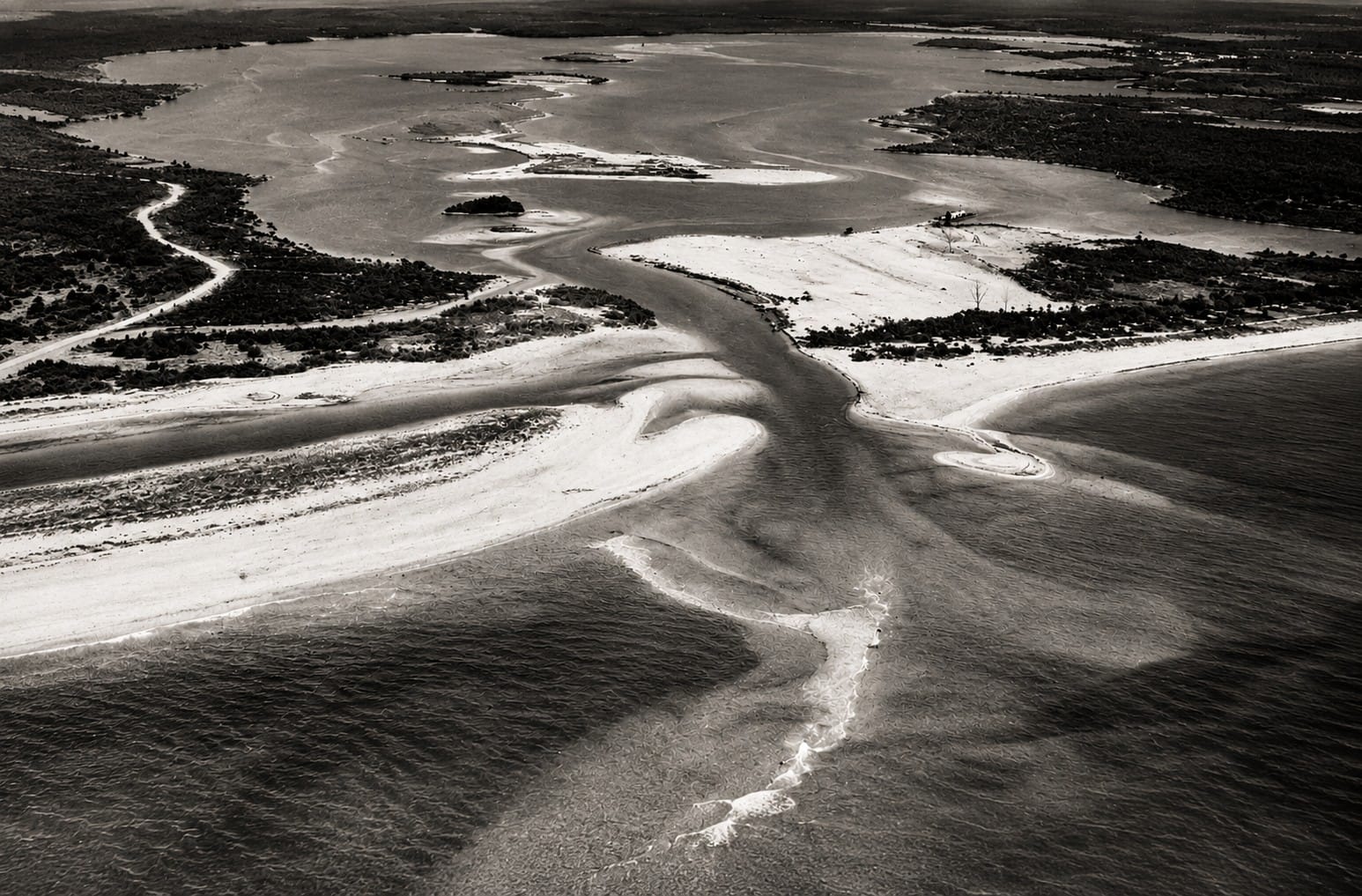
This historic aerial photograph captures Casey's Pass before it was transformed into today's Venice Inlet. Click the image to read The History of the Venice Jetties from Sarasota History Alive, which explains the natural migration of Casey's Pass, the construction of the jetties in 1937, and the evolution of this important Gulf Coast navigation route into part of Florida's Intracoastal Waterway.
Historic maps provide one of the clearest records of how the coastline around Venice Inlet has changed over time. Early coastal surveys show a shoreline shaped by shifting sand, migrating tidal openings, storms, and the continuous movement of sediment along Florida's Gulf Coast.
Before the modern inlet was constructed, the entrance between the Gulf of America and Roberts Bay was known as Casey's Pass. Unlike the stabilized inlet seen today, Casey's Pass was a natural opening that could narrow, widen, migrate, or become partially obstructed as coastal conditions changed.
Nineteenth- and early-twentieth-century maps indicate that the location and shape of the pass were not permanently fixed. Tides moved water through the opening, while waves and longshore sediment transport carried sand along the shoreline. Storms could rapidly alter the channel and reshape the adjacent barrier islands.
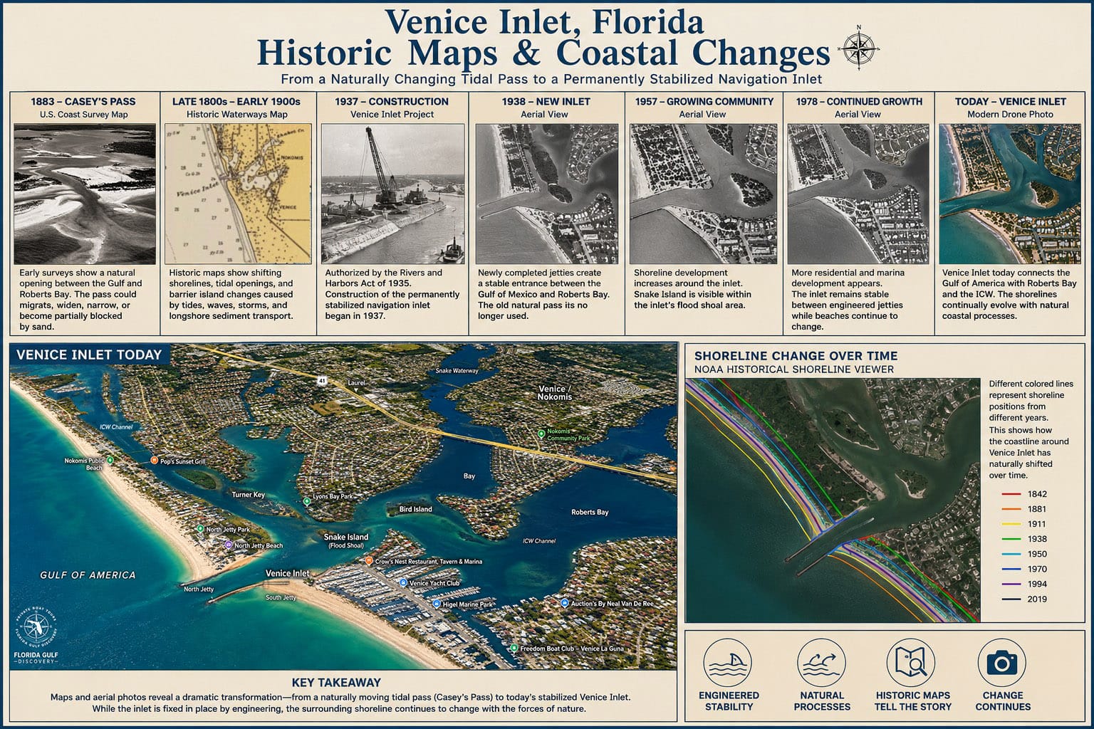
These maps also help explain why navigation through the natural pass was often unreliable. Water depth, channel alignment, and shoaling could change over time, making the entrance difficult to use without local knowledge and favorable conditions.
As Venice developed during the early twentieth century, the need for a stable Gulf entrance became increasingly important. Federal authorization was provided through the Rivers and Harbors Act of 1935, and the permanently stabilized navigation inlet was constructed in 1937.
Later maps show a dramatically different coastal pattern. The inlet remained fixed between engineered jetties, while the navigation channel connected the Gulf with Roberts Bay and the inland waterway system. The stabilized entrance gradually became known as Venice Inlet.
Fixing the inlet in one location changed the way sand moved along the nearby shoreline. The jetties interrupted some of the natural longshore sediment transport, contributing to sand accumulation in certain areas and erosion in others. These changes became increasingly visible when historic maps, aerial photographs, and modern shoreline surveys were compared.
Maps created after major storms also reveal how quickly the surrounding coast can change. Beaches may become narrower or wider, offshore sandbars may shift, and shoaling may develop near the inlet entrance. Even though the inlet itself is stabilized, the adjacent shoreline remains dynamic.
Modern mapping methods provide far more detail than early coastal charts. Aerial photography, satellite imagery, hydrographic surveys, and geographic information systems allow researchers and engineers to compare shoreline positions, water depths, channel conditions, and patterns of erosion and deposition.
Together, historic and modern maps show the transformation from a naturally migrating tidal pass to a permanently stabilized navigation inlet. They also demonstrate that engineering can hold an inlet in place, but it cannot stop the larger coastal system from continuing to change around it.
7. Hurricanes That Changed the Inlet
Hurricanes have played a major role in shaping the coastline around Venice Inlet for centuries. Long before engineers stabilized the entrance in 1937, powerful storms periodically altered beaches, barrier islands, and natural tidal passes throughout Southwest Florida.
Natural inlets such as Casey's Pass responded quickly to major storms. Strong waves, storm surge, and tidal currents could deepen existing channels, deposit large volumes of sand, or shift the location of an inlet. Historic maps indicate that Casey's Pass changed position over time as coastal processes continually reshaped the shoreline.
The devastating hurricane of 1921, which struck the Tampa Bay region, caused widespread coastal damage throughout Southwest Florida. Although Casey's Pass already experienced natural migration before the storm, events such as this demonstrated how vulnerable natural tidal inlets could be to extreme weather.
These recurring changes strengthened support for constructing a permanently stabilized navigation entrance. Federal authorization followed through the Rivers and Harbors Act of 1935, and the engineered Venice Inlet was completed in 1937.
Even after stabilization, hurricanes continue to influence the surrounding coastline. Powerful storms can reshape beaches, move offshore sandbars, increase shoaling near the inlet, and accelerate erosion or deposition along adjacent shorelines. While the jetties help maintain the position of the inlet, they cannot prevent natural coastal change.
Recent hurricanes, including Hurricane Ian (2022), Hurricane Helene (2024), and Hurricane Milton (2024), produced elevated water levels, strong wave action, and significant beach erosion across portions of Florida's Gulf Coast. Following major storms, navigation conditions may change until new hydrographic surveys and maintenance activities are completed.
Because storm impacts vary from year to year, boaters should always check the latest navigation information before entering or leaving Venice Inlet after a hurricane. Temporary shoals, displaced navigation aids, and changing water depths can create hazards even when the inlet itself remains open.
The history of Venice Inlet illustrates the continuing relationship between coastal engineering and the forces of nature. Engineering provides a dependable navigation entrance, while hurricanes continually remind us that Florida's barrier-island coastline remains one of the most dynamic environments in North America.
8. How the Tide Works
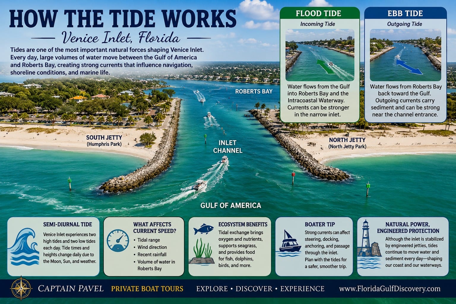
This infographic illustrates how the tides move water through Venice Inlet, connecting Roberts Bay and the Intracoastal Waterway with the Gulf of America. Like much of Florida's Gulf Coast, Venice Inlet experiences a semi-diurnal tide, with two high tides and two low tides each day that generate strong flood and ebb currents through the narrow channel. These daily tidal exchanges shape the inlet, transport sand, support marine life, influence navigation, and make Venice Inlet one of Southwest Florida's most dynamic coastal waterways.
Tides are one of the most important natural forces shaping Venice Inlet. During every tidal cycle, large volumes of water move between the Gulf of America and Roberts Bay, creating strong currents that influence navigation, shoreline conditions, and marine life.
Like most of Florida's Gulf Coast, Venice Inlet experiences a semi-diurnal tide, meaning there are typically two high tides and two low tides each day. The exact timing and height of the tides change daily due to the gravitational pull of the Moon and Sun, along with local weather conditions.
During an incoming, or flood tide, water flows from the Gulf into Roberts Bay and the Intracoastal Waterway. As the tide rises, currents can become noticeably stronger within the narrow inlet, especially near the jetties where the flow is concentrated.
During an outgoing, or ebb tide, water reverses direction and flows from Roberts Bay back toward the Gulf. This outgoing flow can carry suspended sand and sediment through the inlet while also creating stronger currents that may affect boat handling near the channel entrance.
The speed of the current depends on several factors, including the tidal range, wind direction, recent rainfall, and the volume of water moving through Roberts Bay. Following periods of heavy rain or strong onshore winds, currents may be stronger than normal.
Tidal movement also plays a vital role in the local ecosystem. The constant exchange of Gulf water and estuarine water helps circulate oxygen, transport nutrients, support seagrass habitats, and provide feeding opportunities for fish, dolphins, birds, and many other coastal species.
For boaters, understanding the tides is essential. Strong currents can affect steering, docking, anchoring, and passage through the inlet, particularly for smaller vessels or during peak tidal flow. Planning departures and arrivals around favorable tidal conditions often makes navigation easier and safer.
Although Venice Inlet is permanently stabilized by engineered jetties, the tides continue to drive the natural movement of water and sediment every day. Learning how these tidal currents work helps visitors better appreciate both the engineering of the inlet and the powerful coastal processes that continue to shape Southwest Florida.
9. Marine Life
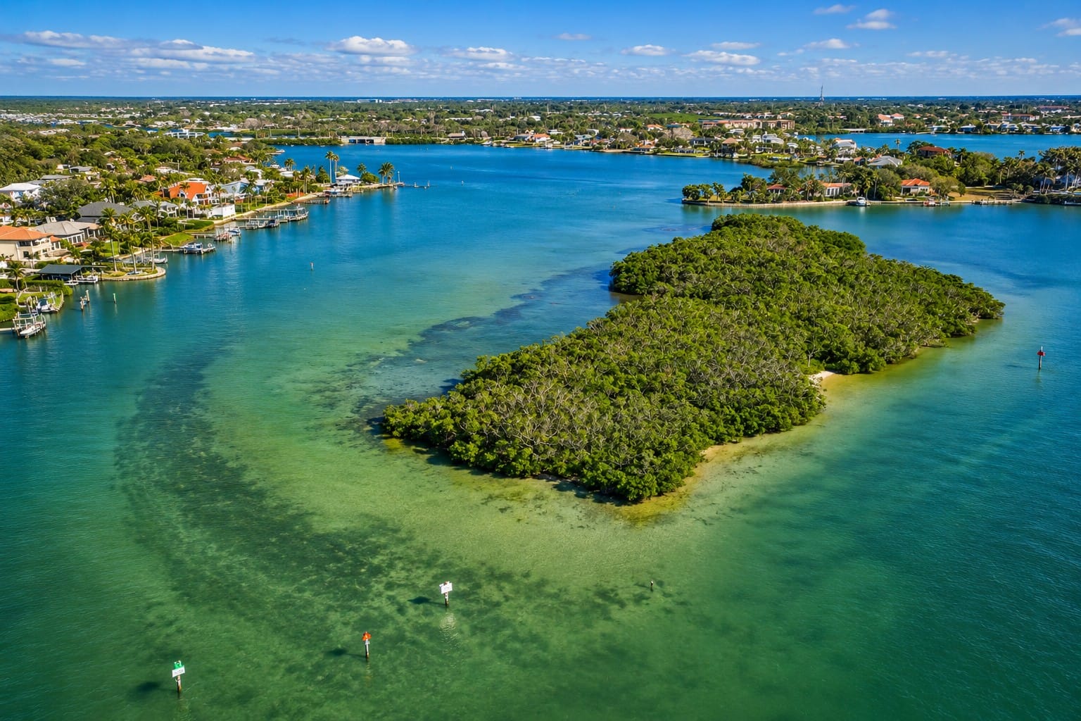
This aerial view showcases Dona Bay and Bird Key, a shallow estuarine area just north of Venice Inlet in Nokomis.
Venice Inlet connects the open waters of the Gulf of America with Roberts Bay, creating an important transition zone between marine and estuarine habitats. Tidal currents continuously move water, nutrients, plankton, and small marine organisms through the inlet, supporting a wide variety of coastal wildlife.
Bottlenose dolphins are among the most visible animals in the area. They may travel through the inlet while following schools of fish, feeding near tidal currents, or moving between the Gulf and the protected waters of Roberts Bay. Dolphins are often most active where currents concentrate baitfish near the channel and jetty tips.
The Florida manatee may also be seen in the surrounding waterways, particularly during warmer periods. Manatees generally prefer calmer, protected water and may move through Roberts Bay, nearby canals, and sections of the Gulf Intracoastal Waterway. Boaters should remain alert and follow posted slow-speed and manatee-protection zones.
Numerous fish species use the inlet as a travel corridor and feeding area. Snook, red drum, sheepshead, mangrove snapper, tarpon, mullet, ladyfish, and several species of jack may be found around the channel, seawalls, bridge structures, and engineered jetties.
The jetties create hard-bottom habitat in an otherwise sandy coastal environment. Algae, barnacles, oysters, crabs, small fish, and other organisms attach to or shelter among the rocks and structural surfaces. These organisms attract larger fish and diving birds, forming a concentrated food web around the inlet.
Shorebirds and seabirds are common throughout the area. Brown pelicans, cormorants, anhingas, herons, egrets, ospreys, gulls, and terns may be observed resting, fishing, or flying along the shoreline. Pelicans and terns frequently dive near schools of baitfish moving through the tidal current.
Sea turtles also use the beaches north and south of Venice Inlet for nesting. Loggerhead sea turtles are the most commonly recorded species along this part of Florida's Gulf Coast. During nesting season, visitors should avoid disturbing marked nests, keep beaches free of litter, and reduce artificial light near the shoreline at night.
Beneath the surface, seagrass beds and shallow estuarine habitats in Roberts Bay provide shelter and nursery areas for juvenile fish, shrimp, crabs, and other marine organisms. These habitats depend on suitable water quality, sunlight, and regular tidal exchange.
Wildlife activity changes with the tide, season, water temperature, weather, and availability of food. An incoming tide may bring clearer Gulf water and baitfish into the inlet, while an outgoing tide can concentrate fish and birds near the channel entrance.
Venice Inlet is therefore more than a navigation channel. It is an active ecological corridor where Gulf and estuarine environments meet, supporting marine mammals, fish, birds, sea turtles, and many smaller organisms that depend on the daily movement of the tide.
10. Beaches, Islands & Snake Island
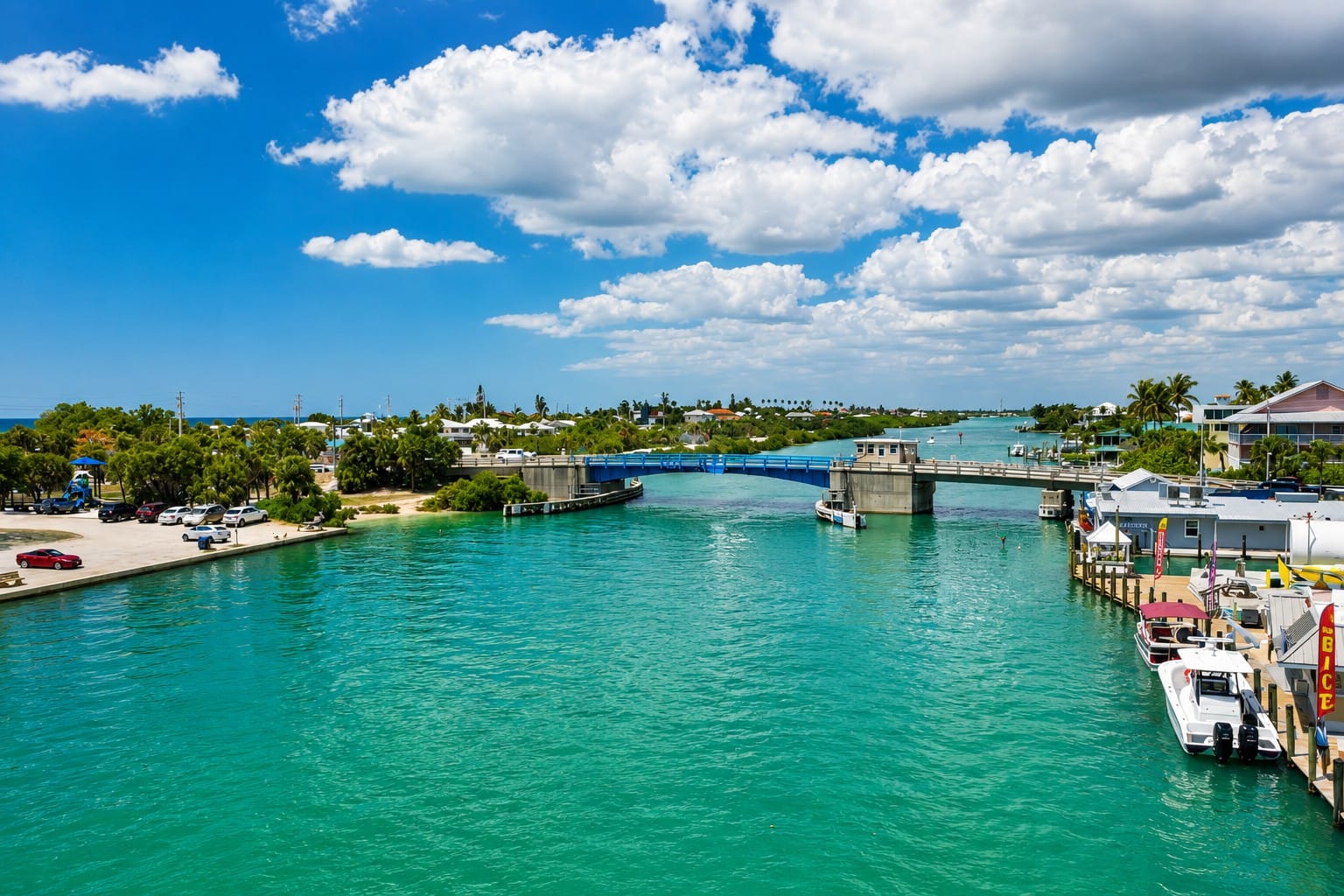
Venice-Nokomis drawbridge spanning the Intracoastal Waterway, an important link between the mainland, Nokomis, and Casey Key.
Venice Inlet is surrounded by some of Sarasota County's most scenic coastal destinations. Wide Gulf beaches, protected bays, waterfront parks, fishing jetties, and small coastal islands create a landscape where natural beauty and outdoor recreation come together. Whether arriving by boat, kayak, paddleboard, bicycle, or car, visitors can enjoy swimming, fishing, wildlife viewing, beachcombing, shark tooth hunting, or simply relaxing along one of Florida's most picturesque stretches of coastline.
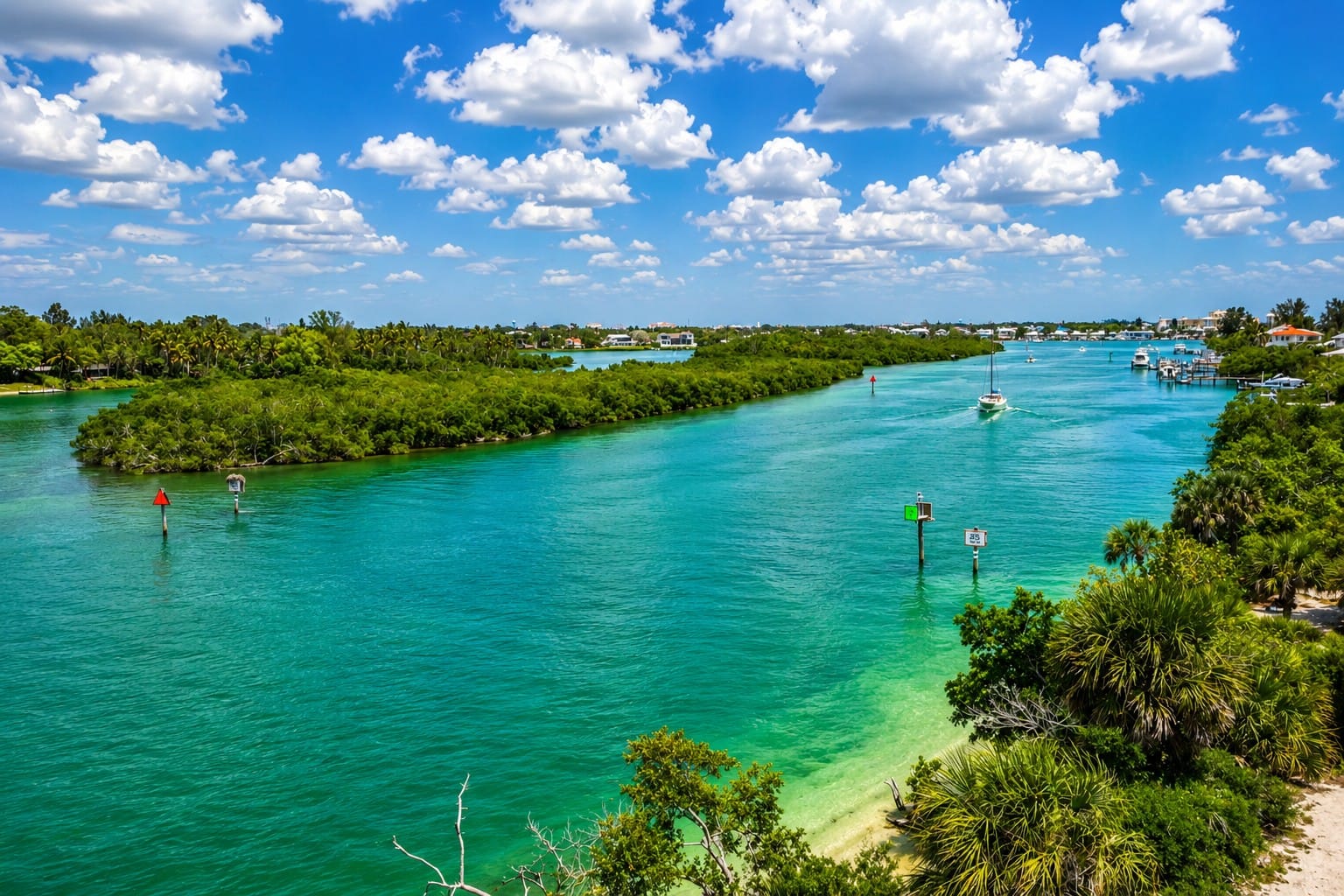
Intracoastal Waterway (ICW) from the Albee Road Bridge South to Venice Inlet.
The southern side of the inlet is home to Venice Beach and Humphris Park, while Nokomis Beach, North Jetty Park, and Casey Key border the northern shoreline. Together, these destinations provide easy access to sandy beaches, scenic walking paths, picnic facilities, public boat launches, and excellent opportunities for watching boats, dolphins, seabirds, and Gulf sunsets.
Beyond the beaches, several small islands and protected waters add to the area's distinctive character. The best known is Snake Island, a favorite destination for boaters and paddlers, while nearby Bird Island and the surrounding estuarine waters provide valuable habitat for fish, shorebirds, and other coastal wildlife.
The following locations highlight the beaches, parks, and islands that make Venice Inlet one of Sarasota County's most popular waterfront destinations.
Snake Island
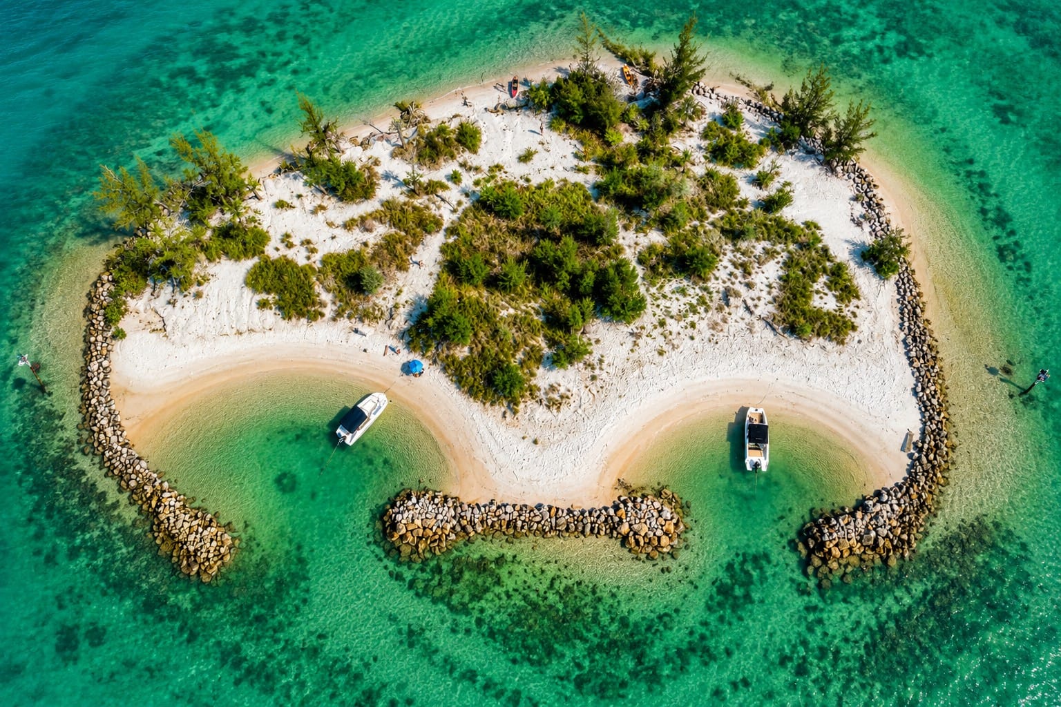
This drone view highlights Snake Island, a small dredge-material island located at the mouth of Venice Inlet between the Intracoastal Waterway and the Gulf of America.
Few visitors realize that Snake Island is not a naturally formed island in its present shape. Although it now appears to be a mature mangrove island surrounded by calm coastal waters, the modern island is largely the result of more than a century of navigation engineering, dredging, natural erosion, and habitat restoration.
Before the twentieth century, this area was not an isolated island at all. It consisted of a low coastal marsh connected to the mainland near what was historically known as Turner Key, bordering the shallow waters of Roberts Bay. During construction of the original Gulf Intracoastal Waterway in 1907, engineers excavated a navigation channel through the marsh, separating the land from the mainland. Material dredged from the new channel was deposited on the remaining marsh, creating the foundation of today's Snake Island.
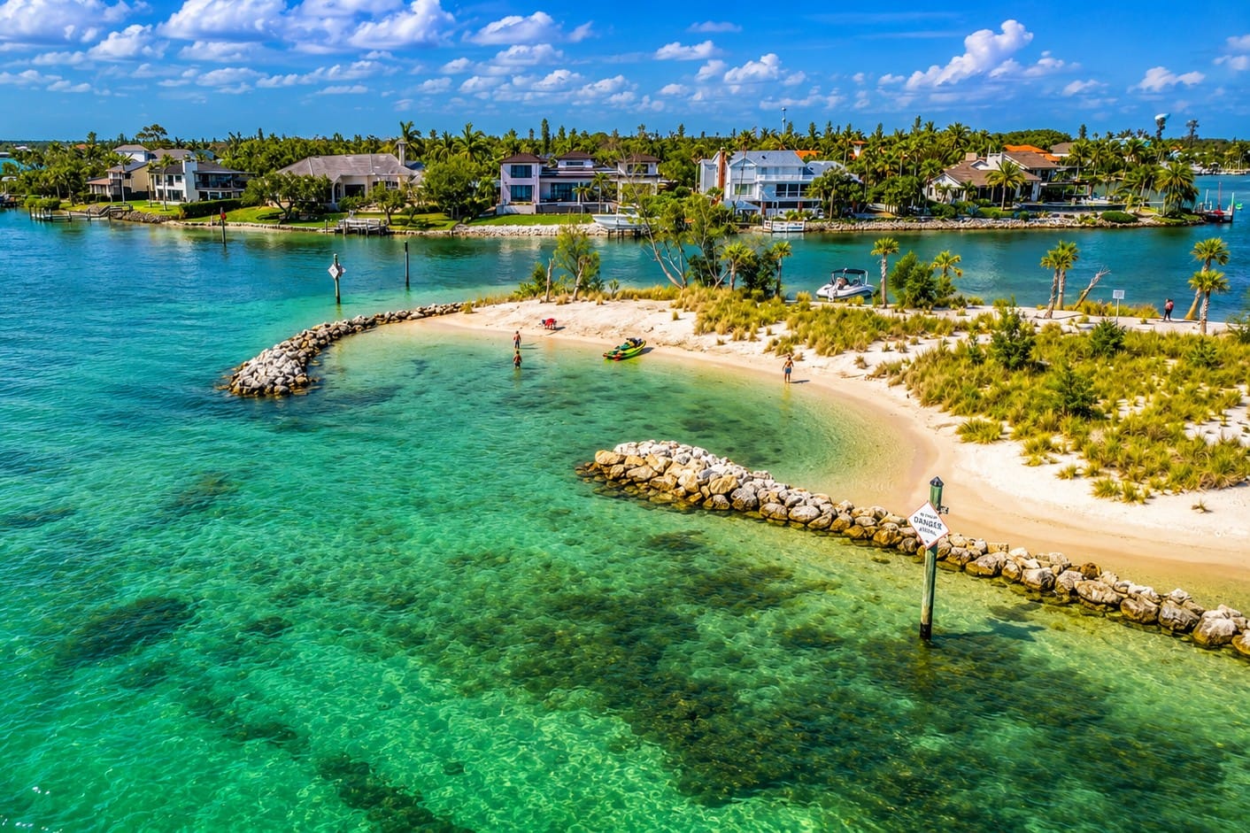
Looking North from above Snake Island, aerial view reveals the intricate network of shallow flats, tidal channels, and protected waters surrounding Venice Inlet.
Rather than being built entirely from open water, Snake Island evolved from an existing coastal marsh that was reshaped and elevated through dredging. As navigation projects continued throughout the twentieth century, additional dredging, channel improvements, and shoreline modifications further changed the island's size, elevation, and relationship to the surrounding waterways. In many ways, Snake Island represents the intersection of natural coastal processes and human engineering.
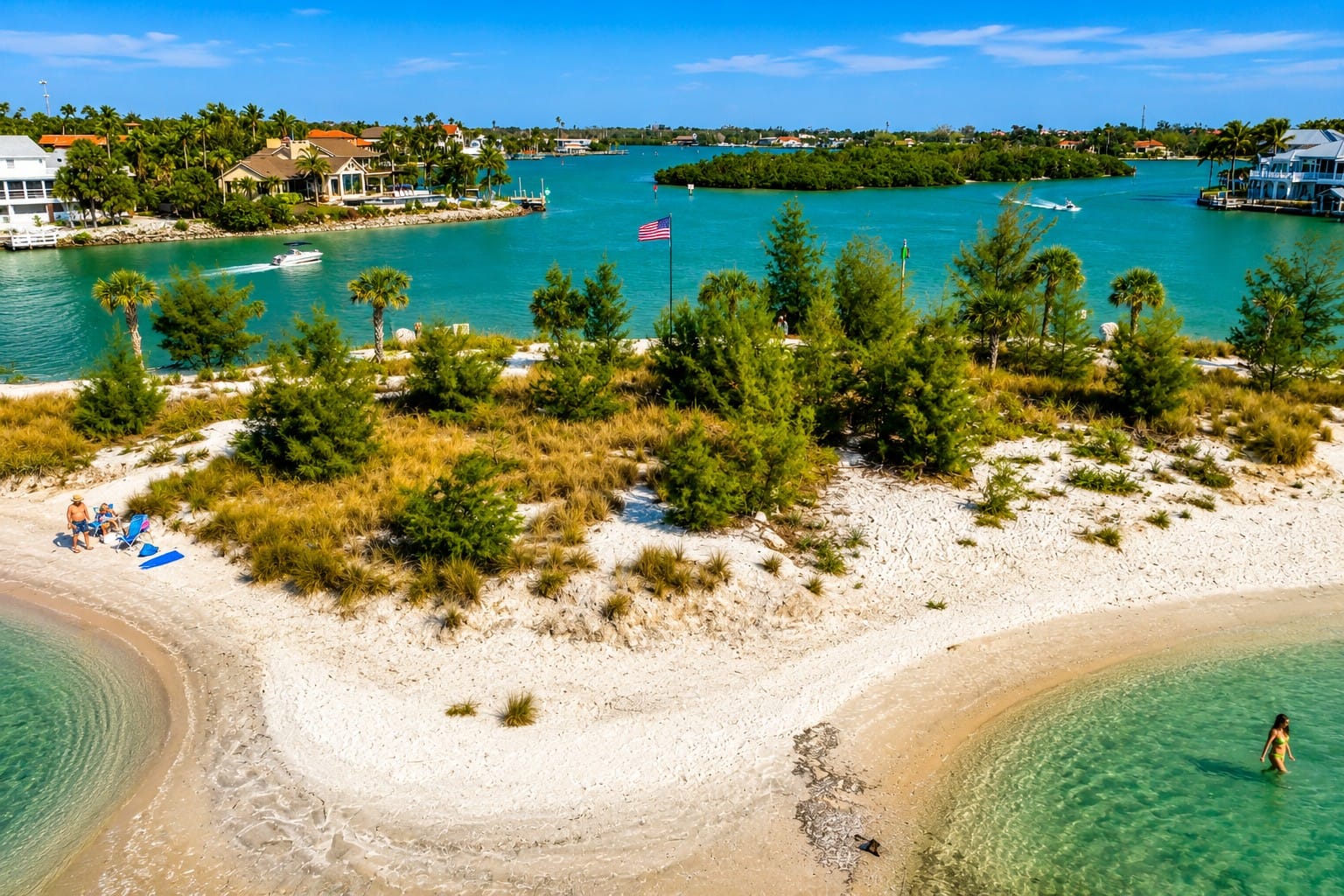
Snake Island and nearby Bird Key at the entrance to Venice Inlet.
Long before these engineering projects, however, the site was already an important place for people living along Florida's Gulf Coast. Archaeological excavations have revealed a large Native American shell midden beneath the dredged material, containing pottery, shell tools, animal remains, and thousands of shells deposited over centuries. The site dates from approximately A.D. 600 to 1500, demonstrating that Indigenous communities were using this shoreline nearly a thousand years before Venice Inlet or the Gulf Intracoastal Waterway existed.
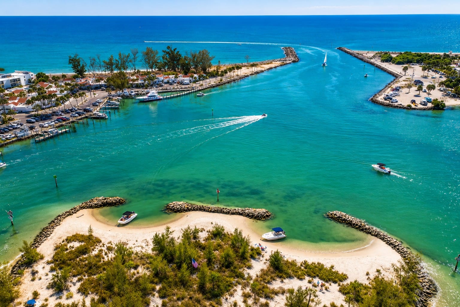
This enhanced aerial view provides a clear perspective of Venice Inlet, Snake Island, and the surrounding waterways where the Intracoastal Waterway meets the Gulf of America. Originally created from dredged material during construction and maintenance of the navigation channel.
As decades passed, nature gradually reclaimed the engineered landscape. Mangroves spread across the dredged soils, creating a thriving coastal forest that today supports juvenile fish, shrimp, blue crabs, oysters, and countless other marine organisms. The surrounding seagrass meadows provide feeding grounds for manatees, while dolphins regularly patrol the nearby tidal channels. Ospreys, brown pelicans, herons, egrets, cormorants, ibis, and numerous migratory shorebirds use the island for nesting, feeding, or resting throughout the year.
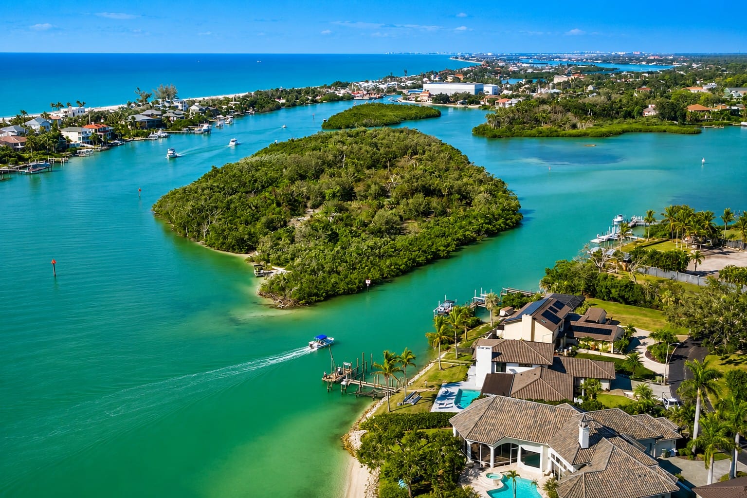
This aerial view highlights Turner Key, a spoil island located just inside Venice Inlet along the Intracoastal Waterway. The island was created during dredging associated with development of the Intracoastal Waterway and stabilization of the former Casey's Pass in the late 1930s. Today, Turner Key serves as an important stop for paddlers and boaters while providing valuable habitat for coastal birds and marine wildlife.
Like Florida's barrier islands, Snake Island has never remained unchanged. Waves, tidal currents, boat wakes, tropical storms, and hurricanes have continually reshaped its shoreline. Coastal studies estimate that between 1977 and 2013, the island lost nearly 80 percent of its land area, highlighting the powerful natural forces that continue to reshape even engineered landscapes.
To slow this loss, Sarasota County and its partners have completed several restoration projects, adding dredged material, stabilizing shorelines, removing invasive vegetation, and planting native mangroves and other coastal vegetation. Sediment from maintenance dredging of nearby navigation channels has also been beneficially reused to help preserve the island.
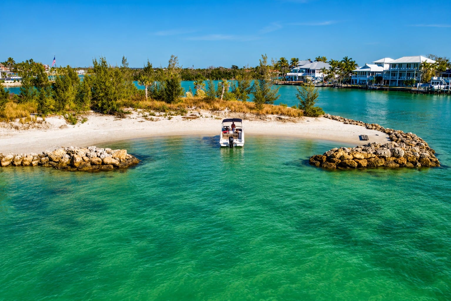
Looking south from above Snake Island, this aerial view showcases the intricate waterways surrounding Venice Inlet, where the Intracoastal Waterway connects with the Gulf of America.
Today, Snake Island is one of Sarasota County's most popular boating destinations. On weekends and holidays, dozens of boats gather in the protected waters surrounding the island as visitors swim, paddleboard, kayak, and relax away from the open Gulf.
Although the surrounding waters are generally calm, boaters should remain outside the marked navigation channel, respect idle-speed and manatee-protection zones, avoid disturbing mangrove habitat, and always practice Leave No Trace principles. Water depth can vary with the tide, and operators should approach slowly while watching for swimmers, shallow flats, submerged sand, and passing boat wakes.
Snake Island is far more than a convenient anchorage. It is a place where Native American history, early navigation projects, coastal engineering, ecological restoration, and modern recreation all come together, making it one of the most fascinating landscapes within the Venice Inlet estuary.
Venice Beach
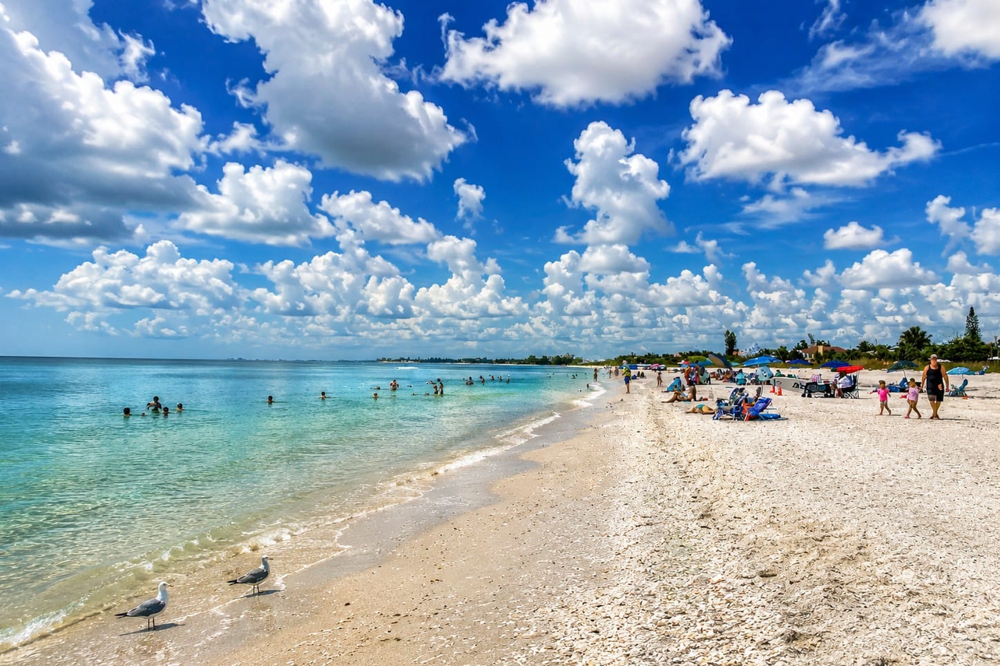
A beautiful summer day at Venice Beach showcases the wide sandy shoreline, turquoise waters of the Gulf of America, and the relaxed atmosphere that has made Venice one of Southwest Florida's favorite beach destinations. Located just minutes south of Venice Inlet.
Located south of Venice Inlet, Venice Beach stretches along the Gulf of America and is internationally recognized as the "Shark Tooth Capital of the World." For millions of years, ancient shark teeth have eroded from offshore fossil deposits and washed onto the shoreline, making beachcombing one of the area's signature activities.
Visitors also enjoy swimming, shelling, sunbathing, fishing, picnic areas, restrooms, and spectacular Gulf sunsets. During sea turtle nesting season, portions of the beach are carefully managed to protect nesting loggerhead turtles and emerging hatchlings.
Nokomis Beach
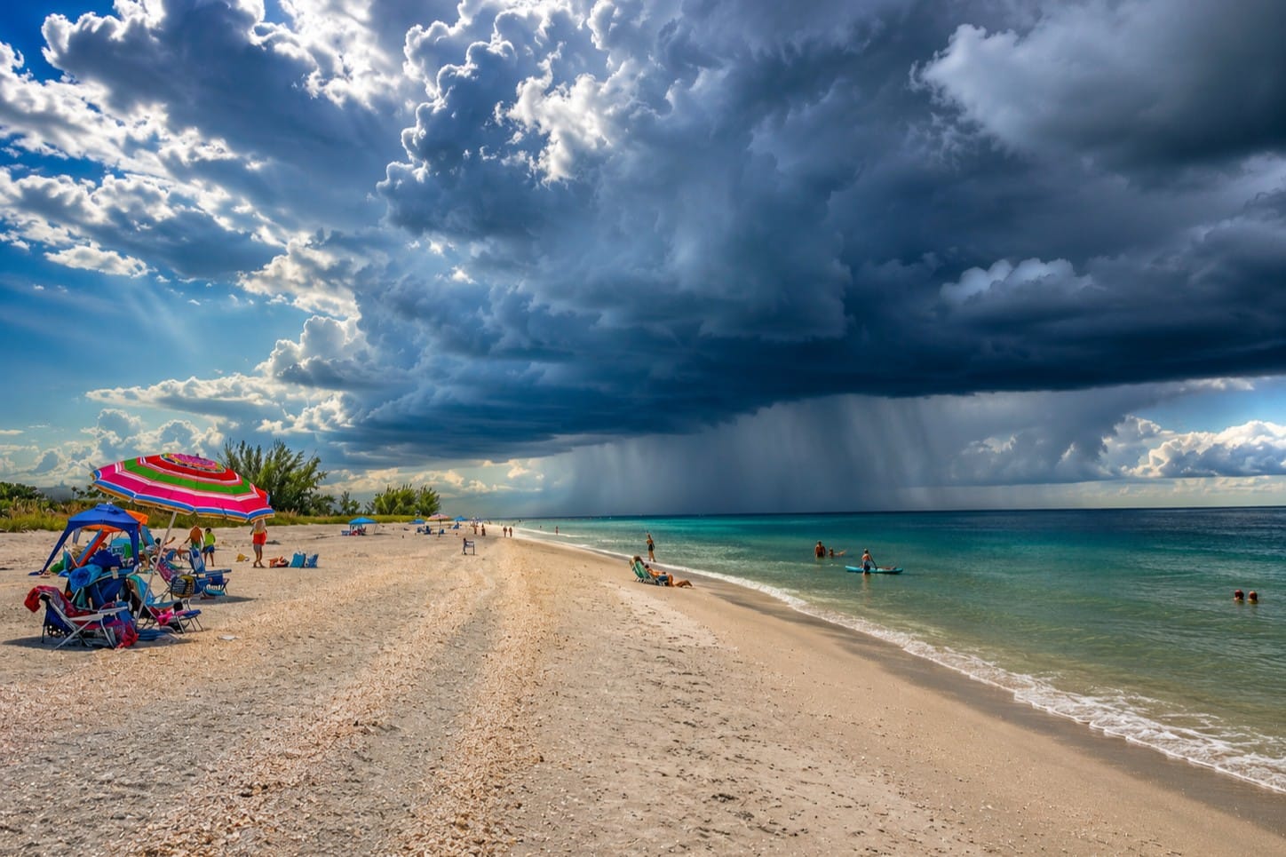
Dramatic storm clouds gather above Nokomis Beach on Casey Key, just north of Venice Inlet. As Sarasota County's oldest public beach, Nokomis Beach is known for its wide sandy shoreline, shelling, spectacular Gulf sunsets, and easy access to both the Gulf of America and the Intracoastal Waterway.
North of the inlet, Nokomis Beach is Sarasota County's oldest public beach and one of the region's most beloved coastal destinations. Its wide sandy shoreline, gentle Gulf waters, and relaxed atmosphere make it especially popular with families, swimmers, and sunset visitors.
From the beach and nearby North Jetty Park, visitors can watch recreational boats, sportfishing vessels, and sailboats entering and leaving Venice Inlet throughout the day.
North Jetty & South Jetty
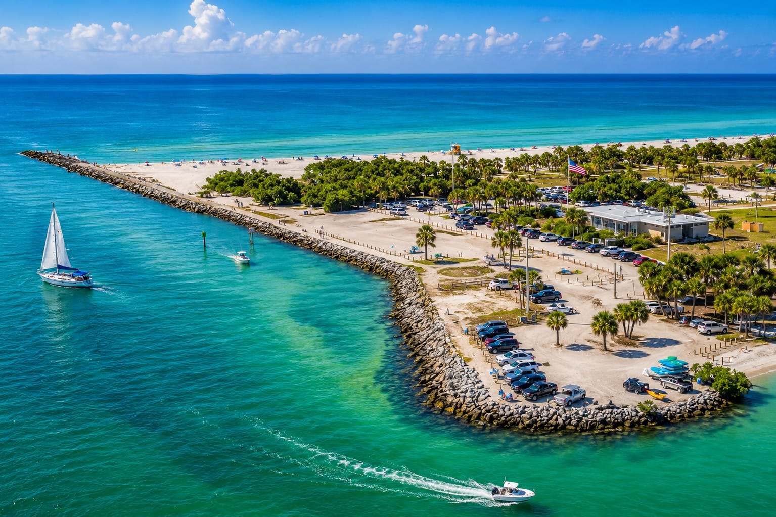
This aerial view showcases North Jetty Park on the south tip of Casey Key, overlooking the north side of Venice Inlet.
The North Jetty and South Jetty are among Venice Inlet's most recognizable landmarks. Originally constructed to stabilize the navigation channel, they have become popular destinations for fishing, sightseeing, photography, and wildlife viewing.
The armored structures provide habitat for numerous marine species, while the swift tidal currents attract schools of baitfish followed by snook, tarpon, jack crevalle, dolphins, pelicans, and other predators. At sunrise and sunset, the jetties offer panoramic views of the Gulf of America and the inlet.
Boating & Kayaking
Venice Inlet provides excellent access for recreational boating, kayaking, paddleboarding, and wildlife exploration. Protected waters inside the inlet are generally suitable for paddling during favorable weather, while larger vessels can continue into Roberts Bay, Dona Bay, the Gulf Intracoastal Waterway, or the Gulf of America.
Because tidal currents between the jetties can become strong and vessel traffic is often heavy, boaters and paddlers should remain aware of changing conditions, stay outside the marked navigation channel whenever practical, and always check current weather and tide forecasts before departing.
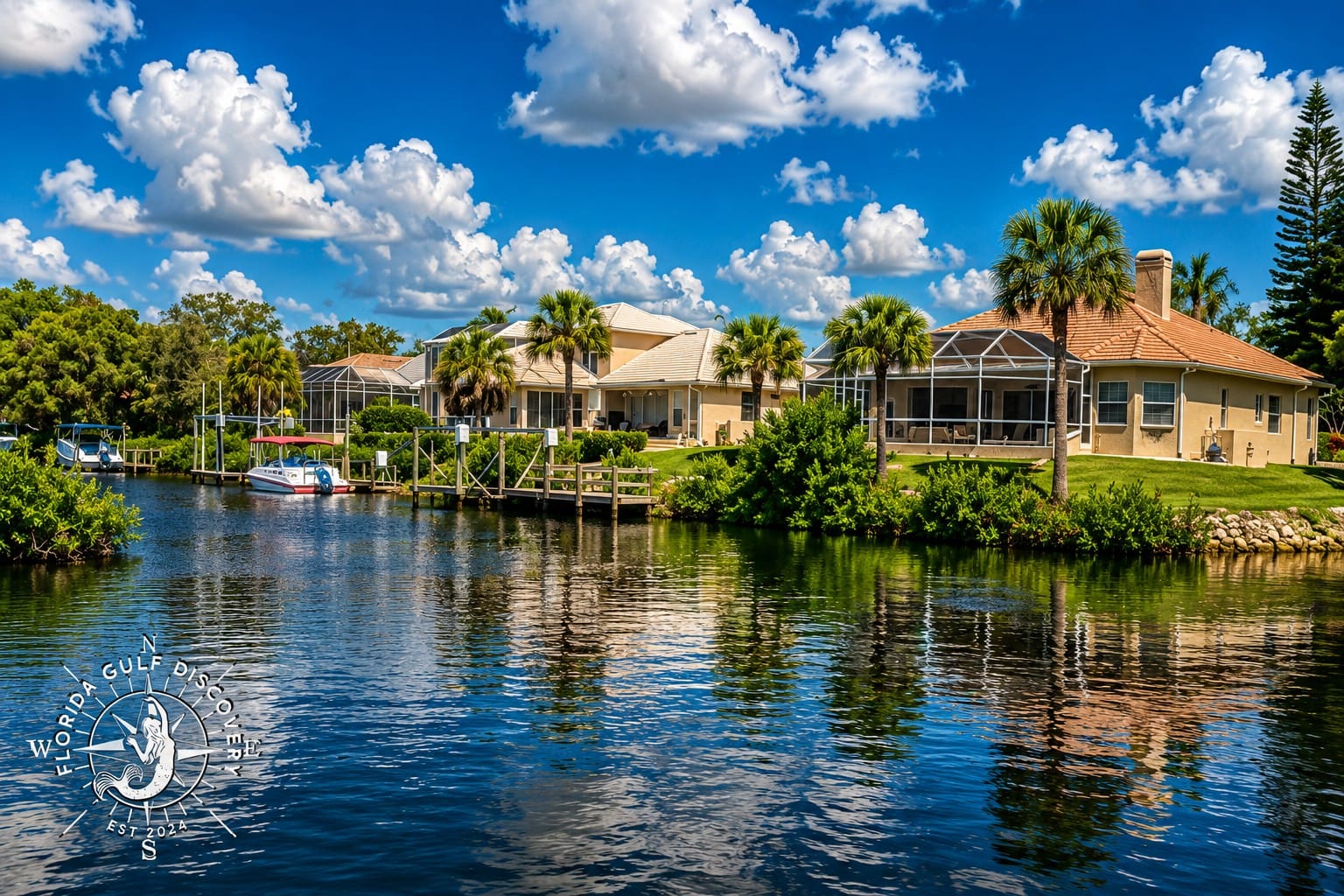
Elegant waterfront homes line the shores of Lyons Bay, a sheltered estuary connected to Venice Inlet and the Gulf Intracoastal Waterway. Many properties feature private docks with direct boating access to the Gulf of America. Protected waters, sunset views, abundant wildlife, and convenient access to Nokomis Beach and waterfront restaurants make Lyons Bay a distinctive coastal neighborhood in the Venice area.
Together, Venice Beach, Nokomis Beach, Casey Key, Venice Island, Snake Island, and the surrounding bays reveal the variety of environments surrounding Venice Inlet. They also demonstrate how beaches, islands, navigation channels, tides, storms, and human activity interact within one constantly changing coastal landscape.
11. Waterfront Restaurants
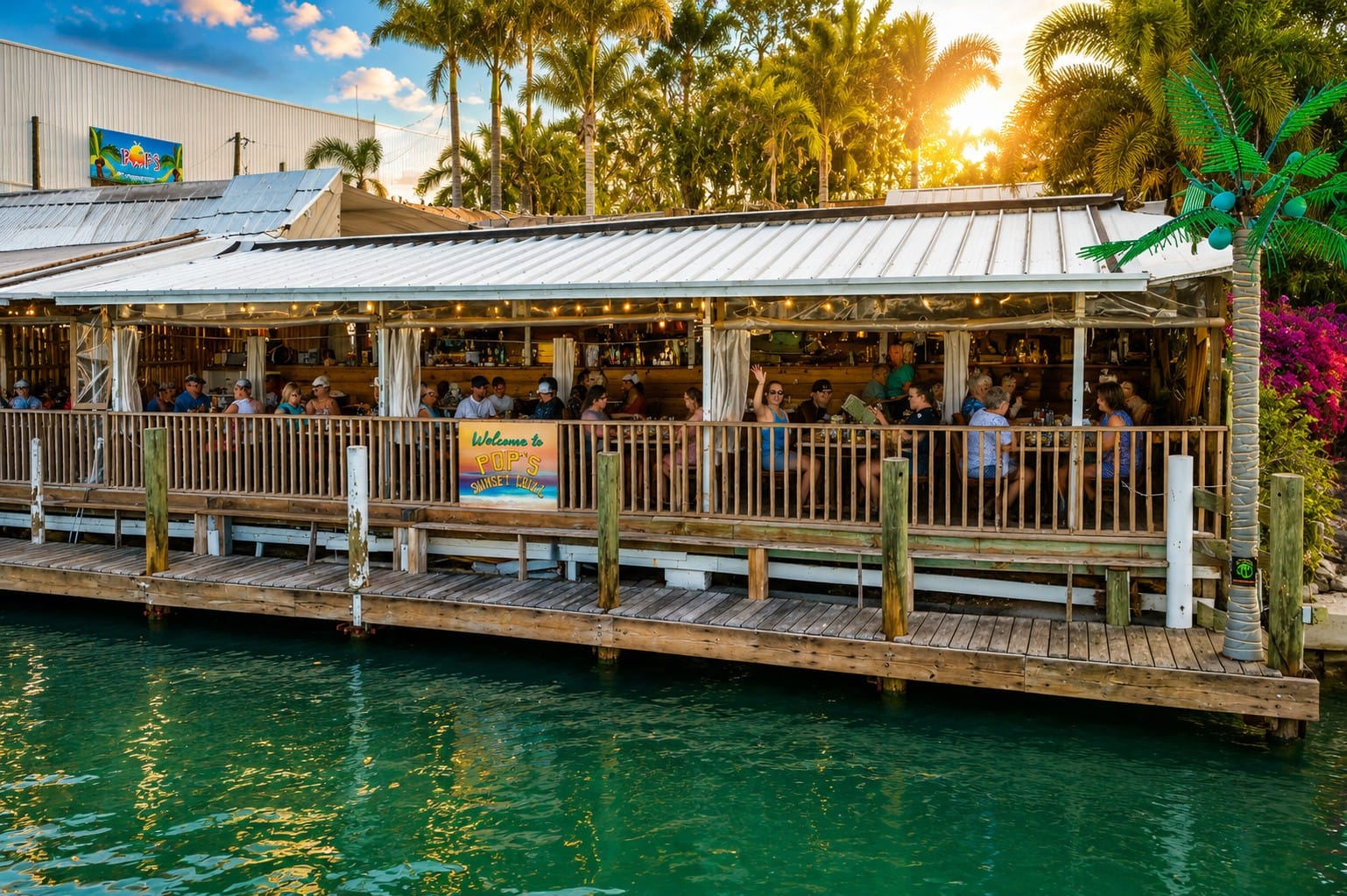
Pop's Sunset Grill is one of the most popular waterfront restaurants near Venice Inlet, offering dockside dining along the Intracoastal Waterway in Nokomis. Located just south of the Albee Road Bridge and across from Nokomis Beach, the restaurant welcomes both boaters and visitors arriving by car, with dockage available near ICW Marker 10. Fresh Gulf seafood, live music, tropical outdoor seating, and panoramic water views make Pop's a favorite stop for boaters exploring Venice Inlet and Southwest Florida's Gulf Coast.
Venice Inlet is surrounded by several waterfront restaurants that combine coastal scenery with easy access by both land and water. Whether arriving by boat through the inlet or by car from nearby beaches, visitors can enjoy fresh seafood, casual waterfront dining, and panoramic views of Roberts Bay, the Gulf Intracoastal Waterway, and the passing boat traffic.
Many restaurants are located along the protected waters east of the inlet, where docks allow boaters to tie up and walk directly to their table. These locations are popular stops for cruising boaters exploring Sarasota County and Florida's Gulf Coast.
One of the area's best-known landmarks is Crow's Nest Restaurant, Tavern & Marina, located immediately east of Venice Inlet. For decades, it has served as both a waterfront restaurant and a marina, welcoming recreational boaters arriving from the Gulf and the Gulf Intracoastal Waterway.
Additional waterfront restaurants can be found throughout Venice, Nokomis, and nearby sections of Roberts Bay. Together they offer a variety of dining experiences ranging from fresh local seafood and Florida favorites to casual cafés and open-air waterfront patios.
For boaters, weather, tides, and available dock space should always be considered before planning a stop. During weekends, holidays, and the winter boating season, guest docks may fill quickly, especially near Venice Inlet.
Visitors arriving by water should also pay attention to idle-speed zones, posted navigation markers, bridge clearances, and local boating regulations. Approaching restaurant docks slowly helps protect nearby vessels, reduces wake, and improves safety for everyone using the waterfront.
Beyond the food itself, these restaurants provide an opportunity to experience the character of Venice's waterfront community. Watching dolphins pass through the inlet, observing pelicans diving for fish, or enjoying a sunset over the Gulf of America often becomes just as memorable as the meal.
Whether stopping for lunch during a day on the water or ending an afternoon of boating with dinner overlooking the inlet, Venice's waterfront restaurants offer visitors another way to experience the unique connection between the city's maritime heritage, scenic waterways, and relaxed Gulf Coast lifestyle.
12. Explore Venice Inlet with Captain Pavel
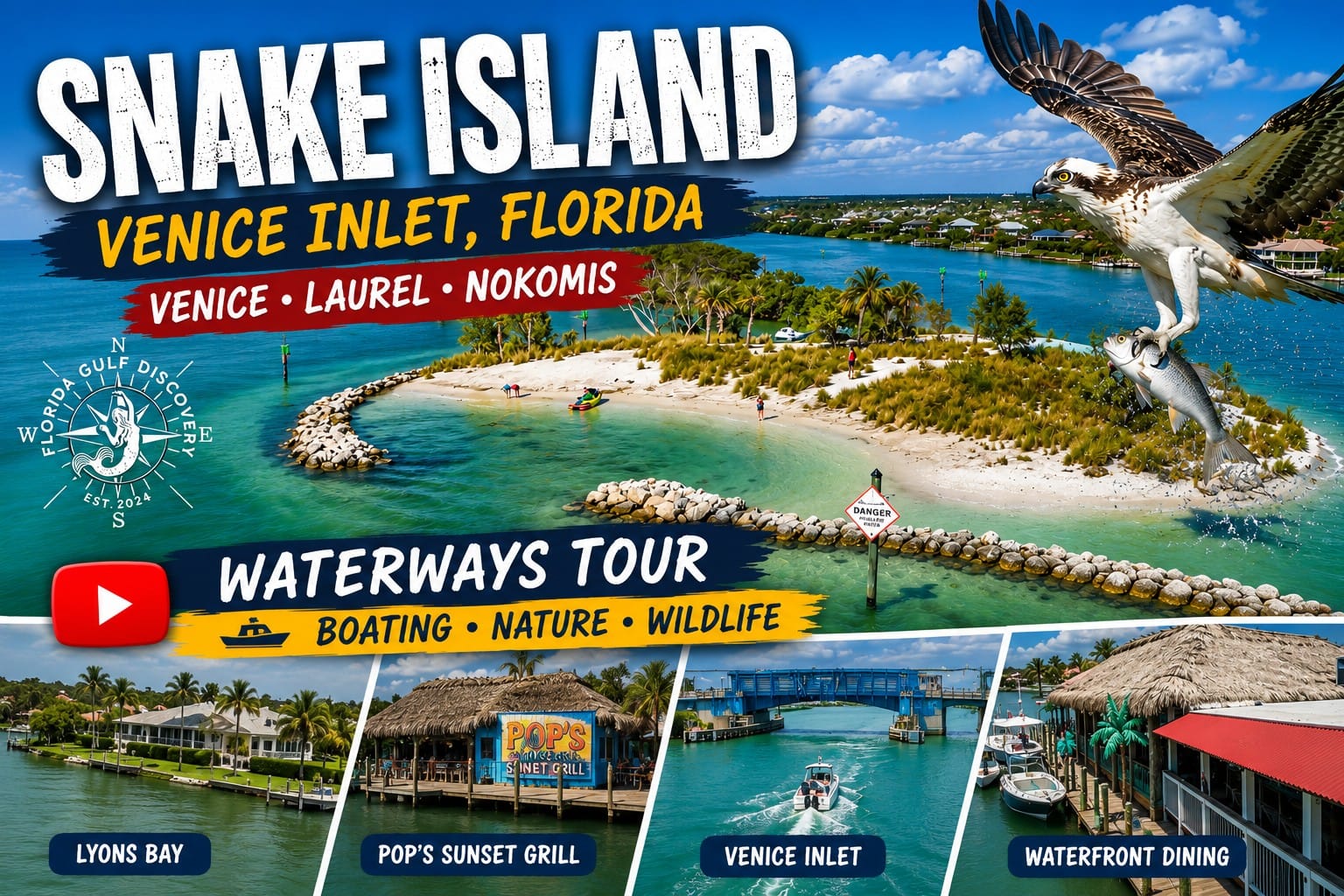
Watch on YouTube: Explore Snake Island at Venice Inlet with Captain Pavel as this video showcases one of Southwest Florida's most popular boating destinations. Discover crystal-clear water, sandy shallows, abundant wildlife, and spectacular aerial views of Venice Inlet, the North and South Jetties, and the surrounding waterways. Snake Island is a favorite stop for boaters, swimmers, and families enjoying a day on the water. The island sits on the inlet's ebb shoal and is surrounded by strong tidal currents that continually reshape the area.
Venice Inlet is more than a passage between Roberts Bay and the Gulf of America. It is a meeting point of natural coastal processes, maritime history, wildlife, waterfront communities, and modern navigation.
A private boat trip through the area provides a closer view of the inlet's engineered jetties, tidal currents, surrounding beaches, Snake Island, Roberts Bay, and the Gulf Intracoastal Waterway. Every trip is different because the landscape changes with the tide, weather, season, water conditions, and wildlife activity.
From the water, visitors can observe how Venice Beach, Nokomis Beach, Casey Key, Venice Island, and Snake Island fit together within one interconnected coastal environment. Dolphins, manatees, pelicans, ospreys, shorebirds, and schools of fish may appear along the route, although wildlife sightings can never be guaranteed.
Conditions near Venice Inlet can change quickly. Tidal currents may become strong near the jetties, boat traffic may increase during weekends and holidays, and shallow areas around Snake Island require careful navigation. Captain Pavel plans each trip according to current weather, tides, water depth, and the interests of the guests.
Depending on conditions, an outing may include sightseeing around Roberts Bay, cruising through the Gulf Intracoastal Waterway, observing the inlet from the Gulf, visiting nearby islands and beaches, looking for wildlife, or stopping at a waterfront restaurant.
Florida Gulf Discovery offers private and personalized boat experiences for groups of up to six passengers. The route is not based on rushing between fixed stops. Instead, each trip is designed around the conditions of the day and the places that offer the most interesting experience.
“I'm not here to rush from stop to stop. I'm here to help you discover Southwest Florida the way nature intended—one island, one dolphin, one sunset, and one unforgettable moment at a time.”