Guide Contents
Use this guide to explore Boca Grande Pass, one of Southwest Florida's deepest, most historic, and most important natural waterways—from its formation and maritime history to its underwater landscape, wildlife, tarpon migration, lighthouse, historic maps, and changing coastline.
2. Quick Facts
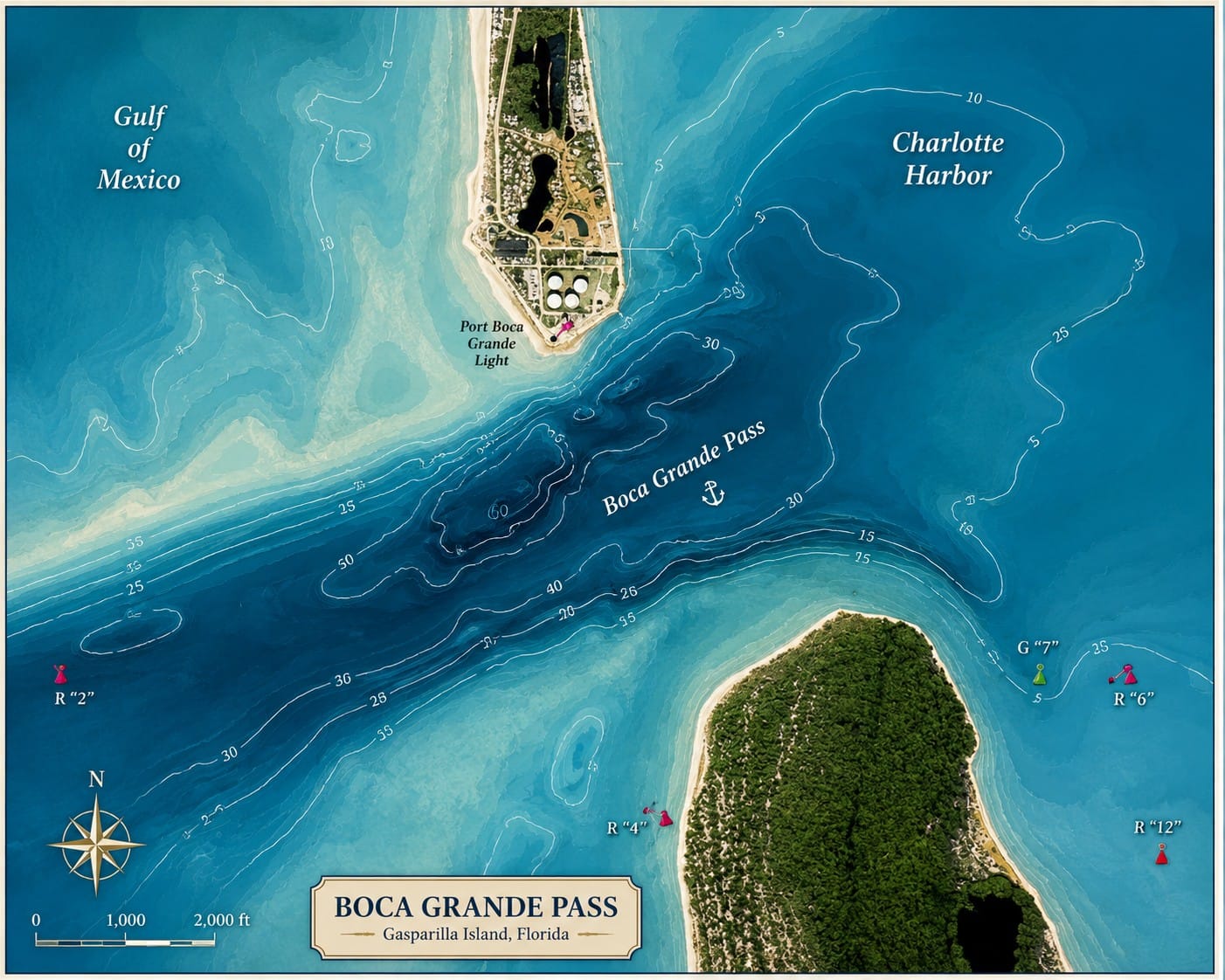
Boca Grande Pass is the largest and deepest natural inlet connecting Charlotte Harbor with the Gulf of America. Internationally recognized for its powerful tidal currents, remarkable underwater landscape, and annual tarpon migration, the pass has served for centuries as a gateway for Native Americans, European explorers, commercial shipping, recreational boating, and an extraordinary diversity of marine life.
Today, Boca Grande Pass remains one of the most important waterways on Florida's Gulf Coast, linking one of Florida's largest estuaries with the open Gulf while supporting navigation, wildlife, recreation, and scientific research.
| Quick Fact | Details |
|---|---|
| Location | Southwest Florida, between Gasparilla Island and Cayo Costa State Park |
| Coordinates | Approximately 26.74° N, 82.27° W |
| Connects | Charlotte Harbor with the Gulf of America |
| Nearby Communities | Boca Grande, Placida, Cape Haze, and Pine Island |
| Nearby Islands | Gasparilla Island, Cayo Costa, North Captiva Island, and Useppa Island |
| Length | Approximately 2.5 miles (4 km) from Charlotte Harbor to the Gulf |
| Width | Approximately 0.7–1.2 miles (1.1–2 km), depending on location |
| Maximum Natural Depth | Approximately 80 feet (24 m) in the deepest scour holes |
| Typical Channel Depth | Approximately 35–55 feet (11–17 m) through much of the main navigation channel |
| Bottom Composition | Sand, shell, limestone, underwater shoals, and deep scour holes |
| Tides | Semi-diurnal, with two high tides and two low tides each day |
| Currents | Strong tidal currents that vary with tidal range, wind, and weather conditions |
| Federal Navigation Channel | Maintained by the U.S. Army Corps of Engineers |
| Historic Importance | Calusa canoe route, Spanish exploration, phosphate shipping, and international maritime gateway |
| Wildlife Highlights | Tarpon, bottlenose dolphins, manatees, sea turtles, sharks, rays, pelicans, ospreys, and numerous coastal birds |
| Best Known For | World-famous tarpon migration, exceptional natural depth, Port Boca Grande Lighthouse, maritime history, and outstanding boating scenery |
| Protected Areas Nearby | Cayo Costa State Park, Charlotte Harbor Aquatic Preserves, and Charlotte Harbor Preserve State Park |
| Managed By | U.S. Army Corps of Engineers, U.S. Coast Guard, Florida Fish and Wildlife Conservation Commission, and Florida State Parks |
Why Boca Grande Pass Is Unique
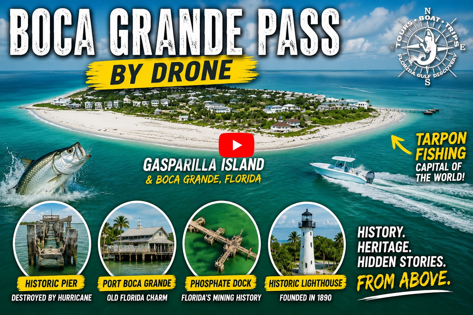
Watch on YouTube: Explore Boca Grande Pass from the air with Captain Pavel. See the deep tidal channel between Gasparilla Island and Cayo Costa, shifting sandbars, powerful currents, turquoise Gulf water, and the entrance connecting Charlotte Harbor with the Gulf of America.
Unlike many Florida inlets that require regular dredging or extensive engineering to remain navigable, Boca Grande Pass has retained its exceptional natural depth through the continuous movement of tidal waters between Charlotte Harbor and the Gulf of America. Every tidal cycle moves enormous volumes of water through the pass, helping shape its deep channel, underwater shoals, sand waves, and distinctive scour holes.
The pass is far more than a famous tarpon destination. It serves as the primary maritime gateway to Charlotte Harbor, supports one of Southwest Florida's richest marine ecosystems, provides essential habitat for resident and migratory wildlife, and has played a central role in the exploration, commerce, navigation, and history of the region for centuries.
3. Why Boca Grande Pass Is World Famous
Boca Grande Pass has earned an international reputation unlike any other waterway on Florida's Gulf Coast. Known worldwide for its annual tarpon migration, exceptional natural depth, powerful tidal currents, and rich maritime history, it attracts scientists, boaters, photographers, wildlife enthusiasts, and visitors from around the world.
Boca Grande Pass is far more than the waterway separating Gasparilla Island from Cayo Costa. It is one of North America's most remarkable tidal inlets—a place where geology, history, wildlife, and maritime heritage have shaped Southwest Florida for thousands of years.
Located between the southern tip of Gasparilla Island and Cayo Costa, the pass forms the primary connection between Charlotte Harbor—one of Florida's largest estuaries—and the Gulf of America. Its size, exceptional depth, powerful tidal exchange, and strategic location have made it one of the defining coastal landmarks of Southwest Florida.
To many people, Boca Grande Pass is synonymous with giant tarpon and world-class sport fishing. Although the annual tarpon migration has earned the pass international recognition, its importance extends far beyond fishing. It is one of Florida's deepest tidal inlets, a major maritime gateway, and one of the state's most fascinating geological features.
Twice each day, enormous volumes of water surge through Boca Grande Pass, carving deep underwater channels and continually reshaping the sandy seafloor. These powerful tidal currents create an ever-changing landscape of shoals, sand waves, steep bottom contours, and deep scour holes found in few other places along Florida's Gulf Coast.
This dynamic environment supports an extraordinary variety of marine life while providing a dependable natural entrance into Charlotte Harbor for commercial vessels, recreational boats, and sailing craft.
Long before modern navigation charts existed, the Calusa people traveled these waters in large dugout canoes. Spanish explorers later recognized the pass as an important landmark along Florida's Gulf Coast, and by the late nineteenth century it had become an international shipping gateway exporting phosphate from Port Boca Grande to markets around the world.
The construction of the Port Boca Grande Lighthouse and continued improvements to the navigation channel further strengthened the pass's role as one of Florida's most important maritime entrances.
Today, Boca Grande Pass remains one of Southwest Florida's most recognizable waterways. Recreational boaters, sailors, photographers, wildlife enthusiasts, and visitors from around the world come to experience its scenic beauty, rich history, and abundant wildlife.
Dolphins frequently ride the tidal currents, sea turtles surface in the surrounding waters, pelicans and ospreys patrol overhead, and the seasonal tarpon migration continues to create one of North America's most impressive marine wildlife spectacles.
Why the Pass Earned Its Worldwide Reputation
- One of the deepest natural tidal inlets on Florida's Gulf Coast.
- The primary maritime gateway between Charlotte Harbor and the Gulf of America.
- Internationally famous for the annual tarpon migration.
- Remarkable underwater geology shaped by powerful tidal currents.
- More than 500 years of documented maritime history.
- A major former phosphate-shipping entrance serving international markets.
- The historic Port Boca Grande Lighthouse overlooking the pass.
- Protected islands, state parks, wildlife habitats, and exceptional coastal scenery.
Whether viewed from the deck of a passing boat, the historic Port Boca Grande Lighthouse, or the beaches of Gasparilla Island and Cayo Costa, Boca Grande Pass offers a rare opportunity to witness the forces that continue to shape Florida's Gulf Coast.
Few places combine such remarkable geology, maritime history, abundant wildlife, and scenic beauty in a single location. Together, these qualities have earned Boca Grande Pass its reputation as one of the most extraordinary natural waterways in the United States—and the legendary gateway to Charlotte Harbor.
4. Where Is Boca Grande Pass?
Boca Grande Pass is located on Florida's Southwest Gulf Coast, where the waters of Charlotte Harbor meet the Gulf of America between Gasparilla Island and Cayo Costa. As the region's largest natural tidal entrance, it serves as the primary gateway between one of Florida's largest estuaries and the open Gulf.
The pass lies along the boundary of Charlotte and Lee counties. Its northern side is bordered by Gasparilla Island and the historic village of Boca Grande, while its southern side is framed by the undeveloped beaches, forests, and coastal habitats of Cayo Costa State Park.
Together, these barrier islands create a dramatic natural gateway where tidal waters move continuously between Charlotte Harbor and the Gulf of America.
Distance from Major Southwest Florida Communities
- About 10 miles (16 km) southwest of Placida
- About 28 miles (45 km) west of Punta Gorda
- About 35 miles (56 km) northwest of Fort Myers
- About 55 miles (89 km) south of Sarasota
- About 100 miles (160 km) south of Tampa
Its strategic location makes Boca Grande Pass the maritime crossroads of Southwest Florida. Most vessels traveling between Charlotte Harbor and the Gulf of America pass through this natural opening, making it one of the region's most important marine gateways.
From the pass, boaters can enter a vast network of waterways leading to Gasparilla Sound, Pine Island Sound, Boca Grande Harbor, the Peace and Myakka Rivers, and hundreds of miles of protected bays, islands, mangrove shorelines, and tidal estuaries.
A Gateway to Southwest Florida
Few locations provide access to so many well-known destinations within such a short distance. Within minutes of leaving Boca Grande Pass, boaters can reach:
- Gasparilla Island and the historic village of Boca Grande
- Cayo Costa State Park
- North Captiva Island
- Useppa Island
- Pine Island Sound
- Gasparilla Sound
- Charlotte Harbor
- Boca Grande Sandbar
- Port Boca Grande Lighthouse
This strategic position has made the pass an essential maritime corridor for centuries. Native Calusa people paddled through these waters long before European explorers arrived. Spanish navigators later used the pass as a landmark while charting Florida's Gulf Coast, and by the late nineteenth century it had become an internationally important shipping route serving the phosphate industry at Port Boca Grande.
Why This Location Is So Important
Boca Grande Pass occupies one of the most strategic locations on Florida's Gulf Coast. It stands where the open Gulf meets Charlotte Harbor, a vast shallow estuary connected to the Peace and Myakka Rivers, numerous smaller creeks, and an extensive network of tidal bays and wetlands.
During every tidal cycle, enormous volumes of water move through the pass. This powerful exchange has shaped its deep channel, steep bottom contours, underwater shoals, sand waves, and distinctive scour holes.
Unlike many smaller Gulf Coast inlets, Boca Grande Pass has remained naturally open and exceptionally deep for thousands of years. Its size and depth allow commercial vessels, recreational boats, sailing craft, and marine wildlife to move between Charlotte Harbor and the Gulf, while its strong tidal exchange helps support water circulation and the region's rich coastal ecosystems.
Today, Boca Grande Pass remains the front door to Charlotte Harbor—a gateway where history, navigation, wildlife, geology, and recreation come together. Few places on Florida's Gulf Coast connect so many remarkable destinations while continuing to play such an important role in the region's natural and maritime heritage.
5. How Boca Grande Pass Was Formed
Boca Grande Pass is one of Florida's oldest natural tidal inlets. It was not created by dredging, engineering, or a single hurricane, but by thousands of years of rising seas, migrating barrier islands, powerful tides, and the continuous movement of sand. These natural forces have worked together to create one of the deepest and most stable inlets on Florida's Gulf Coast.
Understanding how Boca Grande Pass formed helps explain why it remains one of the most important waterways in the state today.
Born from the Last Ice Age
To understand Boca Grande Pass, we must travel back more than 20,000 years to the end of the last Ice Age.
During the last Ice Age, enormous glaciers covered much of North America, locking vast quantities of water in ice. Global sea levels were approximately 350–400 feet (107–122 meters) lower than they are today. The Gulf shoreline lay many miles west of its present location, and what is now Charlotte Harbor was a broad river valley crossed by ancient rivers flowing toward the Gulf.
As Earth's climate gradually warmed, the glaciers melted and sea levels rose over thousands of years. The advancing Gulf slowly flooded these low-lying valleys, creating bays, estuaries, tidal flats, and eventually the waters of modern Charlotte Harbor.
The Barrier Islands Take Shape
Between approximately 8,000 and 6,000 years ago, rising sea levels, waves, and longshore currents transported enormous quantities of sand along Florida's Gulf Coast. Over time, this sediment accumulated into long, narrow barrier islands that gradually separated the open Gulf from the protected waters behind them.
Gasparilla Island, Little Gasparilla Island, Cayo Costa, North Captiva, Captiva, Sanibel, and the other barrier islands of Southwest Florida were formed during this period.
Unlike solid rock islands, barrier islands are constantly changing. Wind, waves, storms, and tides continually reshape their beaches and dunes while moving sand north and south along the coastline.
A Gateway Carved by the Tides
While many sections of the growing barrier islands eventually became continuous beaches, one location resisted being filled with sand.
The reason lies in the enormous volume of water moving through Charlotte Harbor.
Covering more than 270 square miles (700 square kilometers), Charlotte Harbor is one of Florida's largest estuaries. Twice each day, enormous volumes of water flow into and out of the harbor as the tides rise and fall. These powerful tidal currents continually swept sand away from the developing opening, preventing it from closing.
Over thousands of years, this continuous tidal exchange carved and maintained what is now Boca Grande Pass.
Why Boca Grande Pass Is So Deep
One of the most remarkable characteristics of Boca Grande Pass is its exceptional natural depth. While many Florida Gulf Coast inlets are only 10–30 feet (3–9 meters) deep, Boca Grande Pass contains natural channels exceeding 80 feet (24 meters).
This depth is created through a process known as tidal scouring.
During every tidal cycle, tremendous volumes of water accelerate through the narrow opening between Gasparilla Island and Cayo Costa. As the current speeds up, it erodes sand and sediment from the channel floor, carrying much of it into the Gulf or depositing it on surrounding shoals.
Over thousands of years, this natural erosion has carved deep scour holes, underwater valleys, and steep bottom contours that continue to evolve today.
Modern multibeam sonar surveys reveal an underwater landscape resembling rolling hills and valleys rather than a flat sandy bottom, making Boca Grande Pass one of the most complex underwater environments along Florida's Gulf Coast.
A Seafloor in Constant Motion
Although Boca Grande Pass has remained open for thousands of years, its underwater landscape is constantly changing.
Strong tidal currents continually transport sediment across the channel floor, creating:
- Underwater sand waves
- Migrating sandbars
- Tidal shoals
- Deep scour holes
- Changing bottom contours
These features may shift from season to season, especially after tropical storms and hurricanes. Although the seafloor changes continuously, the main tidal channel remains remarkably stable because of the immense volume of water flowing through the pass.
Why the Pass Has Never Closed
Many Florida inlets open during hurricanes and gradually fill with sand over time. Others require regular dredging to remain navigable.
Boca Grande Pass is different.
Its connection to the vast waters of Charlotte Harbor generates one of the strongest tidal exchanges on Florida's Gulf Coast. Every day, enormous volumes of water move between Charlotte Harbor and the Gulf of America, producing currents powerful enough to remove newly deposited sand before it can permanently block the channel.
This continuous natural maintenance has allowed Boca Grande Pass to remain open for thousands of years with relatively little human intervention compared to many neighboring inlets.
A Landscape Still Being Shaped
The formation of Boca Grande Pass is not simply a story of the distant past—it is an ongoing geological process. Every tide, winter cold front, tropical storm, and hurricane contributes to the gradual reshaping of its beaches, shoals, and underwater channels.
Despite these constant changes, Boca Grande Pass has endured as one of Florida's most stable natural inlets, serving as the gateway to Charlotte Harbor for countless generations of wildlife, Indigenous peoples, explorers, commercial vessels, and recreational boaters.
Today, Boca Grande Pass remains one of North America's finest examples of a naturally maintained tidal inlet—a landscape where geology, tides, and time continue to shape the coastline with every passing day.
6. How Boca Grande Pass Got Its Name
The name Boca Grande has guided sailors for centuries. Derived from Spanish, boca means “mouth” or “entrance,” while grande means “large.” Together, the name translates as “Large Entrance” or “Great Mouth”—an appropriate description for one of the widest and deepest natural tidal inlets on Florida’s Gulf Coast.
For early Spanish mariners navigating the Gulf of Mexico, the broad opening between Gasparilla Island and Cayo Costa was impossible to overlook. Unlike many smaller inlets hidden behind shifting shoals, Boca Grande Pass provided a prominent and dependable entrance into the sheltered waters of Charlotte Harbor.
The name reflected both the size of the opening and its importance as a natural maritime gateway.
Spanish Explorers Arrive
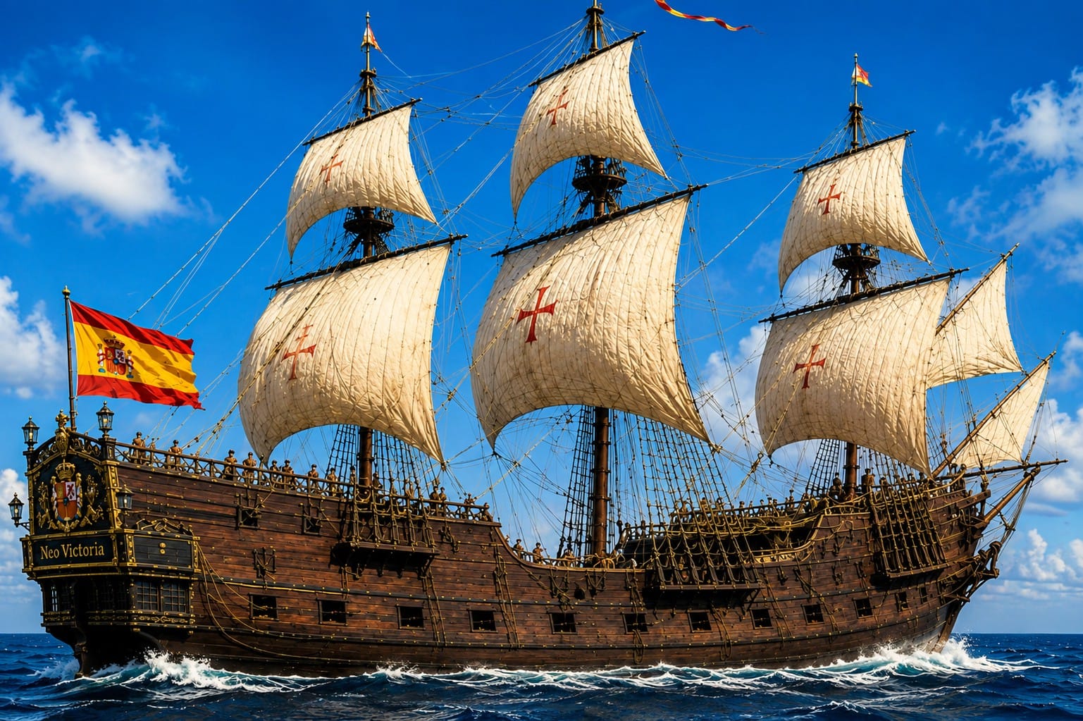
This illustration depicts a Spanish galleon navigating the waters near Boca Grande Pass during the Age of Exploration. Although no permanent Spanish settlement was established here, Spanish explorers and mariners sailed Florida's Gulf Coast throughout the sixteenth and seventeenth centuries while mapping coastlines, searching for safe anchorages, and exploring routes into Charlotte Harbor. The deep natural channel of Boca Grande Pass would later become one of Florida's most important maritime gateways, valued first by explorers and sailors, then by commercial shipping, fishermen, and modern recreational boaters.
Spanish explorers began charting Florida’s Gulf Coast during the early sixteenth century, only a few decades after Juan Ponce de León reached Florida in 1513.
Although no surviving record identifies exactly who first used the name “Boca Grande,” Spanish navigators commonly described coastal features with practical geographic names based on what they observed.
Deep harbors, river mouths, bays, passes, and other prominent landmarks were essential reference points for navigation. Boca Grande Pass became one of those important landmarks because it offered a broad and accessible entrance into the protected waters of Charlotte Harbor.
Long before printed nautical charts became common, these descriptive names were passed from one generation of sailors to the next before gradually appearing on official maps.
George Gauld Maps the Coast
Some of the earliest detailed hydrographic surveys of Florida’s Gulf Coast were completed by Scottish cartographer George Gauld, who worked for the British Admiralty after Florida came under British control in 1763.
Between 1765 and 1775, Gauld carefully surveyed Charlotte Harbor, Gasparilla Island, and the surrounding coastline. His work documented coastal features, water depths, shoals, channels, and navigable entrances with remarkable accuracy for the period.
His charts clearly identified the large natural entrance now known as Boca Grande Pass and became an important foundation for navigation in the region for decades.
Gauld’s work also helped standardize geographic names and provided one of the earliest reliable representations of Southwest Florida’s complex network of bays, islands, channels, and tidal passes.
Bernard Romans Documents the Region
Another important milestone came in 1774, when Dutch-born surveyor, engineer, and naturalist Bernard Romans published one of the most influential maps of Florida from the colonial period.
Romans carefully documented the coastline, barrier islands, navigable waterways, and major entrances of Southwest Florida. His work helped spread geographic knowledge of the region throughout Europe and the American colonies.
His map remains one of the most important historical references for understanding eighteenth-century Southwest Florida.
Together, the charts of George Gauld and Bernard Romans demonstrate that Boca Grande Pass had already been recognized as a major navigational landmark more than 250 years ago.
The Pass Named the Village
Many visitors assume the pass was named after the village of Boca Grande. In fact, the opposite is true.
The natural inlet was already known as Boca Grande because of its size, depth, and importance to navigation. When a permanent community developed near the southern end of Gasparilla Island during the late nineteenth century, it adopted the well-established name of the nearby pass.
The arrival of the railroad, the growth of the phosphate industry, and the construction of Port Boca Grande transformed the area into an important commercial center.
The completion of the Port Boca Grande Lighthouse in 1890 further strengthened the connection between the pass, the port, and the growing village.
Over time, the names Boca Grande Pass, Port Boca Grande, and the village of Boca Grande became closely connected, each reflecting a different part of the area’s maritime history.
A Name That Stood the Test of Time
More than four centuries after Spanish mariners first explored these waters, the name Boca Grande remains one of the most recognizable place names on Florida’s Gulf Coast.
It appears on nautical charts, historical maps, scientific studies, navigation systems, travel guides, and maritime records throughout the world.
Simple yet descriptive, the name still captures what early mariners saw—a broad, deep, and dependable entrance leading from the Gulf of America into one of Florida’s greatest natural harbors.
Today, Boca Grande is far more than a name on a map. It represents centuries of exploration, navigation, commerce, and coastal history while continuing to identify one of Southwest Florida’s most remarkable natural waterways. The name remains as enduring as the pass itself.
7. The First People to Navigate Boca Grande Pass
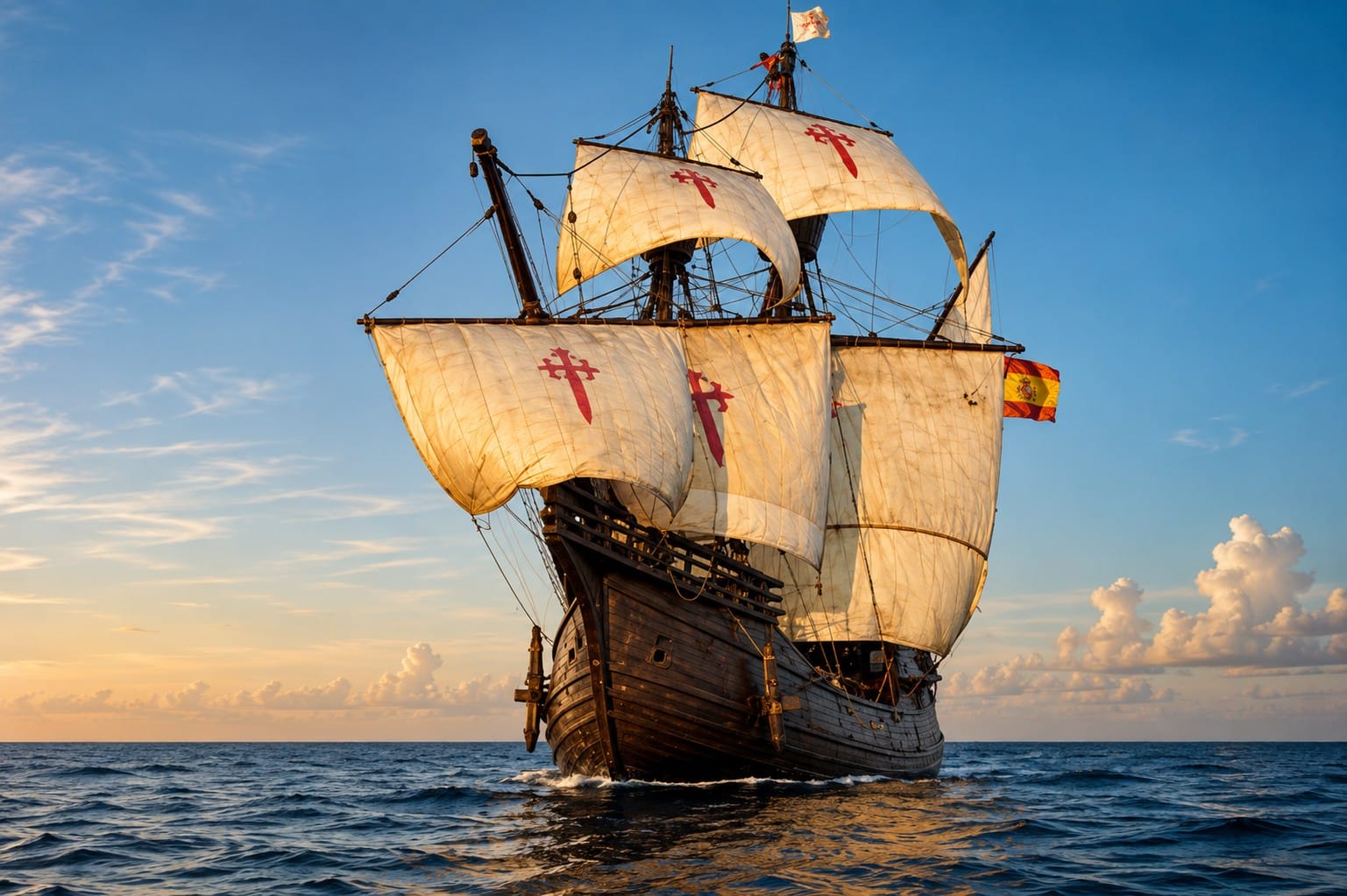
Watch on YouTube: Learn about the remarkable expedition of Spanish conquistador Pánfilo de Narváez, whose 1527–1528 voyage became one of the most dramatic survival stories in North American history. After landing on Florida's Gulf Coast, the expedition encountered storms, disease, starvation, and conflict. Of nearly 600 men who set out from Spain, only four ultimately reached Mexico eight years later, including Álvar Núñez Cabeza de Vaca. The expedition helped shape the early European exploration of Florida and the Gulf Coast. :contentReference[oaicite:0]{index=0}
Long before European explorers reached Florida, Boca Grande Pass was already one of Southwest Florida's most important waterways. For thousands of years, Native peoples traveled through the pass, using it as the natural gateway between the rich fishing grounds of the Gulf of America and the protected waters of Charlotte Harbor.
Archaeological evidence from throughout Southwest Florida shows that people have lived in this coastal region for thousands of years. Boca Grande Pass's strategic location, abundant marine resources, and dependable access to both sheltered and open waters made it an essential route for transportation, trade, fishing, and daily life.
The Calusa: Masters of the Water
By the time Spanish explorers reached Southwest Florida in the early sixteenth century, the region was dominated by the Calusa, one of the most powerful Indigenous societies in the southeastern United States.
Unlike many Indigenous societies of North America, the Calusa developed one of the continent's most sophisticated maritime civilizations. Rather than relying primarily on agriculture, they depended on the extraordinary abundance of Southwest Florida's estuaries, harvesting fish, shellfish, crabs, sea turtles, and other coastal resources.
Their skill on the water was central to Calusa life. Using large dugout canoes carved from cypress, pine, and other substantial trees, Calusa families traveled throughout Charlotte Harbor, Pine Island Sound, Gasparilla Sound, Estero Bay, and the Gulf of America.
Some of these impressive canoes were large enough to carry many passengers, making them suitable for fishing, transportation, trade, diplomacy, and warfare.
Boca Grande Pass was one of the principal gateways connecting these coastal waterways. Anyone traveling between Charlotte Harbor and the open Gulf had to understand its strong tidal currents, shifting shoals, and changing weather conditions.
A Maritime Trading Network
The Calusa maintained an extensive water-based transportation network that connected settlements across Southwest Florida.
Shell tools, pottery, dried fish, shells, wood, and other valuable resources moved through Boca Grande Pass as part of a regional trade system. These canoe routes linked major Calusa centers on Mound Key, Useppa Island, Pine Island, Gasparilla Island, and numerous smaller shell-mound communities.
Boca Grande Pass was therefore more than a route between two bodies of water. It was an important intersection within a thriving maritime civilization.
Spanish Explorers Reach Boca Grande Pass
During the early sixteenth century, Spanish explorers became the first Europeans to navigate the waters around Boca Grande Pass.
Searching for safe anchorages, fresh water, new trade routes, and opportunities for settlement, Spanish vessels explored much of Florida's Gulf Coast. Charlotte Harbor attracted particular attention because of its size, protected waters, and access to the surrounding coastal region.
Navigating Boca Grande Pass required caution. Although naturally deep, its powerful tidal currents and shifting sand shoals demanded skilled seamanship. Even so, it offered one of the deepest and most dependable entrances into Charlotte Harbor, making it an important landmark for early European navigation.
During the sixteenth and seventeenth centuries, Spanish vessels continued visiting the region for exploration, charting, trade, missionary activity, and military operations.
The Era of the Cuban Fishing Ranchos
Beginning during the late eighteenth century and continuing into the nineteenth century, Cuban fishermen established seasonal coastal camps known as ranchos throughout Southwest Florida.
These camps harvested large quantities of mullet, sharks, and other fish, which were salted and exported to Havana and other Caribbean markets.
Although many of the largest fishing ranchos operated around Pine Island Sound and Charlotte Harbor, Boca Grande Pass served as an important navigation route for vessels traveling between the Gulf and these productive fishing grounds.
The rancho trade helped establish regular maritime traffic through the pass long before the arrival of railroads, paved roads, or modern port facilities.
The Age of Sail and Coastal Commerce
During the nineteenth century, schooners and other coastal trading vessels came to rely heavily on Boca Grande Pass while carrying goods throughout Florida, the Gulf of Mexico, and the Caribbean.
These vessels transported lumber, cattle, citrus, agricultural products, supplies, mail, and passengers between Southwest Florida and ports such as Key West, Tampa, Havana, and New Orleans.
Boca Grande Pass's exceptional natural depth allowed larger vessels to enter Charlotte Harbor more safely than through many neighboring inlets, contributing to its growing commercial importance.
The Harbor Pilots
As maritime traffic increased during the late nineteenth century, experienced local captains became essential to safe navigation.
Known as harbor pilots, these skilled mariners boarded incoming ships near Boca Grande Pass and guided them through the deep channel into Charlotte Harbor and, later, toward the phosphate-loading facilities at Port Boca Grande.
Their detailed knowledge of tides, currents, shoals, channels, wind, and changing weather conditions helped protect ships, passengers, crews, and cargo.
Long before GPS, radar, and electronic navigation systems, safe passage depended largely on the harbor pilot's local knowledge and experience.
A Waterway Through Time
Over thousands of years, Boca Grande Pass has served many people for many different purposes.
Native peoples and the Calusa traveled through it in dugout canoes. Spanish explorers charted it while mapping Florida's Gulf Coast. Cuban fishermen used it to reach seasonal ranchos. Schooners and coastal traders carried cargo through its deep waters, while harbor pilots later guided commercial ships safely into Charlotte Harbor.
While the vessels have changed—from Calusa dugout canoes to sailing ships, steamships, commercial freighters, and modern yachts—the role of Boca Grande Pass has remained remarkably consistent.
For thousands of years, it has connected people, commerce, cultures, and wildlife while serving as the natural gateway between Charlotte Harbor and the Gulf of America.
8. From Natural Inlet to an International Shipping Gateway
For thousands of years, Boca Grande Pass served as the natural entrance to Charlotte Harbor, used by Native peoples, explorers, fishermen, and coastal traders. During the late nineteenth and early twentieth centuries, however, the growth of Florida's phosphate industry transformed this once-remote waterway into an international shipping gateway.
The transformation did not happen all at once. It unfolded through the development of inland phosphate mines, rail transportation, harbor improvements, navigation facilities, and a major loading terminal at the southern end of Gasparilla Island. Together, these changes connected Southwest Florida with agricultural markets around the world.
The Discovery of Phosphate
During the 1880s, extensive phosphate deposits were identified in Central Florida, particularly within the Peace River region and the mineral-rich district later known as Bone Valley. Phosphate rock became one of Florida's most valuable commodities because it was an essential ingredient in agricultural fertilizer.
As mining expanded, companies needed an efficient way to move large quantities of phosphate from inland mines to ocean-going ships. Charlotte Harbor offered sheltered water and access to the Gulf, while Boca Grande Pass provided the principal entrance from the open sea.
Before a railroad reached Gasparilla Island, phosphate was transported to waterfront facilities at Punta Gorda and then carried by barge to vessels anchored near Boca Grande. This system demonstrated the value of the pass but also revealed the need for a more direct transportation and loading network.
The Railroad Reaches Gasparilla Island
Construction of the Charlotte Harbor and Northern Railway began in 1905. By 1907, the railroad had reached Port Boca Grande, linking Central Florida's phosphate-producing region with the southern end of Gasparilla Island.
Constructing the route required substantial engineering, including tracks, bridges, trestles, docks, storage areas, and supporting infrastructure. The railroad changed Boca Grande from an isolated coastal settlement into an industrial port connected directly to Florida's interior.
Rather than transferring phosphate repeatedly between trains, barges, and anchored vessels, companies could eventually move it by rail to waterfront loading facilities designed for ocean-going ships.
The Rise of Port Boca Grande
A major phosphate-loading facility entered operation at Port Boca Grande in 1912. Ships from the United States and other countries arrived at Gasparilla Island to load phosphate for fertilizer production and agricultural markets.
By that time, Port Boca Grande had developed into one of the country's most modern phosphate-loading terminals. Storage facilities, rail sidings, loading machinery, wharves, warehouses, and support buildings transformed the southern end of the island.
Freight trains delivered phosphate directly to the terminal, where it was transferred aboard commercial vessels for shipment to domestic and international destinations.
During its industrial era, the Boca Grande waterfront looked very different from the quiet historic community visitors see today. Locomotives, dockworkers, cargo equipment, warehouses, and large ships dominated a landscape now better known for beaches, parks, historic buildings, and recreational boating.
Ocean-Going Ships and Harbor Pilots
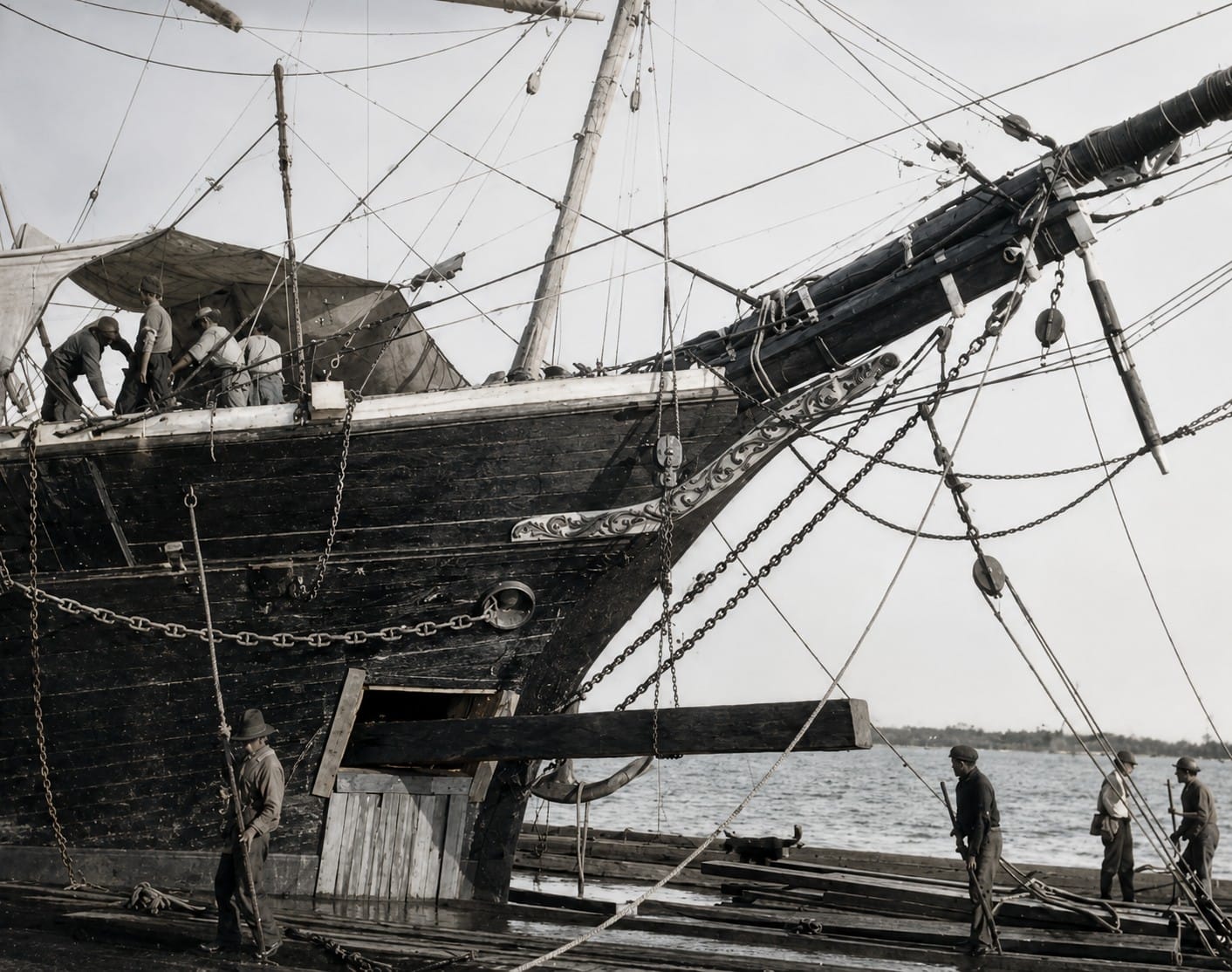
This historic illustration portrays a sailing ship entering Charlotte Harbor, one of Florida's largest and best protected natural harbors. For centuries, these waters served as an important maritime gateway for Spanish explorers, fishermen, traders, and later commercial sailing vessels navigating Florida's Gulf Coast. The deep entrance through Boca Grande Pass provided safe access to the harbor, while the sheltered waters beyond supported shipping, exploration, fishing, and trade long before modern navigation aids existed. Charlotte Harbor remains one of Southwest Florida's most historically significant waterways and a destination for boaters, wildlife enthusiasts, and maritime historians alike.
Boca Grande Pass offered an advantageous entrance to Charlotte Harbor, but commercial navigation still required careful surveying, channel improvements, and experienced local knowledge.
Harbor pilots boarded arriving vessels and guided them through the pass, along the maintained navigation channel, and toward the loading facilities. Their understanding of currents, shoals, water depths, weather, and vessel handling was indispensable long before modern radar, satellite positioning, and electronic charts.
Once loaded, ships departed through Boca Grande Pass carrying Florida phosphate to domestic and international markets. The port became an important part of the worldwide fertilizer supply chain and linked a small Southwest Florida island with ports across the Atlantic and beyond.
The Port Boca Grande Lighthouse
The Port Boca Grande Lighthouse predates the major phosphate terminal. Completed and first lit in 1890, it was constructed to mark Boca Grande Pass and assist vessels entering Charlotte Harbor.
Standing at the southern end of Gasparilla Island, the lighthouse provided mariners with a visible navigational reference when approaching the entrance from the Gulf. As commercial shipping increased, its role became even more important.
Today, the restored lighthouse operates as a museum within Gasparilla Island State Park. It preserves the stories of lighthouse keepers, mariners, commercial shipping, and the communities that developed around the pass.
Federal Navigation Improvements
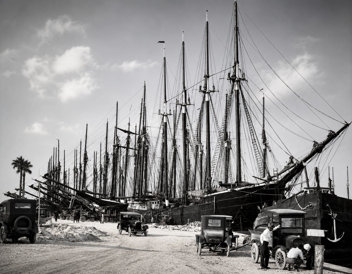
This historic photograph captures ocean-going sailing ships at Port Boca Grande during the 1920s, when the port was one of the world's leading phosphate export terminals. Phosphate mined in Central Florida's Bone Valley arrived by the Charlotte Harbor & Northern Railway and was loaded directly onto deep-draft vessels for shipment to international markets. The deep natural channel of Boca Grande Pass, combined with modern loading facilities, transformed this quiet barrier island into a major maritime gateway and helped shape the economic history of Southwest Florida for more than half a century.
Although Boca Grande Pass is naturally deep in places, its development as a commercial ship channel required federal surveying, dredging, and maintenance.
Before federal dredging began, the natural entrance bar provided a controlling depth of approximately 19 feet (5.8 meters). Initial federal channel dredging began in 1912, helping create access for deeper-draft commercial vessels.
Later hydrographic surveys, dredging projects, navigation aids, and channel maintenance continued to address shoaling and changing channel conditions.
The pass's natural depth and strong tidal exchange remained important advantages, but commercial navigation depended on a combination of natural geography and human engineering. This partnership between the waterway and the federal navigation project allowed Port Boca Grande to operate as a major shipping terminal for much of the twentieth century.
From Industry to Heritage
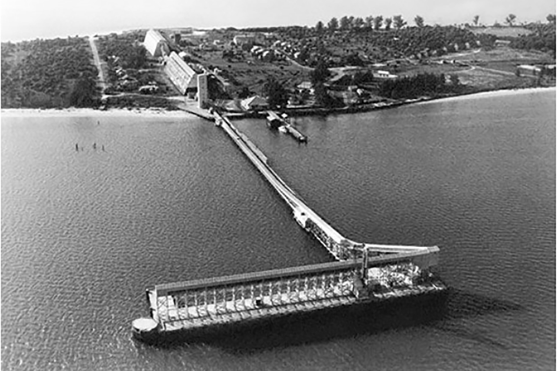
This historic aerial photograph, taken around 1940, captures the massive Port Boca Grande phosphate terminal at the southern end of Gasparilla Island. During this period, the terminal ranked among the world's busiest phosphate export facilities, with trains delivering phosphate from Florida's Bone Valley mines to deep-water ships waiting at Boca Grande Pass. The deep natural harbor and specialized loading docks transformed Port Boca Grande into a major international shipping center, exporting millions of tons of phosphate fertilizer to markets around the world and playing a pivotal role in the economic development of Southwest Florida.
Phosphate shipping through Port Boca Grande continued until 1979, when larger and more efficient ports at Tampa and Manatee increasingly took over the trade. The closure marked the end of more than seventy years of large-scale phosphate transportation and export through Boca Grande.
Railroad operations associated with the port also ended, bringing to a close the industrial transportation system that had shaped Gasparilla Island for much of the twentieth century.
Most of the old terminal infrastructure has since disappeared or been repurposed. Rail corridors became recreational routes, industrial areas changed use, and Boca Grande evolved into a historic residential and visitor destination.
Yet the industrial era remains an essential part of the island's identity. The Port Boca Grande Lighthouse, surviving structures, historic photographs, old rail alignments, and remnants of waterfront facilities preserve the story of a time when phosphate trains and international cargo ships defined the southern end of Gasparilla Island.
Today, Boca Grande Pass remains the principal entrance to Charlotte Harbor. Its traffic has changed from phosphate freighters and industrial vessels to cruising boats, sailing yachts, tour vessels, and recreational craft, but its role as a gateway remains intact.
The pass connects more than Charlotte Harbor and the Gulf of America. It connects the region's remarkable natural geography with more than a century of railroads, commerce, navigation, engineering, industry, and maritime history.
9. How Boca Grande Pass Earned a Worldwide Reputation
Boca Grande Pass did not become internationally known for a single reason. Its reputation developed over more than a century through a rare combination of maritime commerce, tarpon migration, resort tourism, scientific research, historic architecture, and exceptional coastal scenery.
By the early twentieth century, the pass was already familiar to ship captains, harbor pilots, railroad companies, phosphate exporters, sportsmen, and travelers. As newspapers, sporting publications, resort promotions, photographs, and later television and digital media introduced Boca Grande to wider audiences, the name became closely associated with both maritime history and the natural character of Southwest Florida.
A Deep Entrance with International Importance
Boca Grande Pass's naturally deep waters gave it an important advantage as the principal entrance to Charlotte Harbor. Its deepest areas reach approximately 80 feet, making it one of Florida's deepest natural passes.
Natural depth alone, however, did not create a modern commercial port. Federal dredging, hydrographic surveys, navigation markers, and continuing channel maintenance helped make the entrance suitable for deeper-draft vessels serving Port Boca Grande.
During the phosphate era, ships arriving from domestic and international ports passed through Boca Grande Pass to load cargo at Gasparilla Island. This commercial traffic placed a relatively small Southwest Florida community on international shipping routes and introduced the name Boca Grande to mariners and businesses around the world.
The Tarpon Aggregations
The natural event most closely associated with Boca Grande Pass is the seasonal gathering of Atlantic tarpon.
During spring and early summer, large pre-spawning aggregations form in and around the pass before many tarpon move into deeper offshore waters to spawn. Research and conservation organizations recognize Boca Grande Pass as an important pre- and post-spawning location, and documented aggregations may include thousands of fish.
The pass's depth, strong currents, prey concentrations, and direct connection between Charlotte Harbor and the Gulf create favorable conditions for these seasonal gatherings.
Generations of anglers, guides, photographers, writers, and researchers helped spread Boca Grande's tarpon reputation throughout the United States and abroad. Over time, the pass became one of the best-known locations associated with Atlantic tarpon.
The Rise of Winter Tourism
Boca Grande's reputation also grew as Southwest Florida became more accessible to winter visitors.
The arrival of the railroad made Gasparilla Island easier to reach, bringing business leaders, families, sportsmen, and travelers from northern states. Visitors came for warm weather, boating, coastal scenery, tarpon, and the quiet character of the island.
A major turning point came in 1911, when the original Hotel Boca Grande opened as a small two-story hotel. It later expanded into The Gasparilla Inn, becoming one of Florida's best-known historic winter resorts.
The Inn helped transform Boca Grande from a remote port community into a nationally recognized resort destination. Guests could combine refined accommodations with boating, golf, beaches, wildlife, and access to Boca Grande Pass.
Useppa Island and the Sporting Era
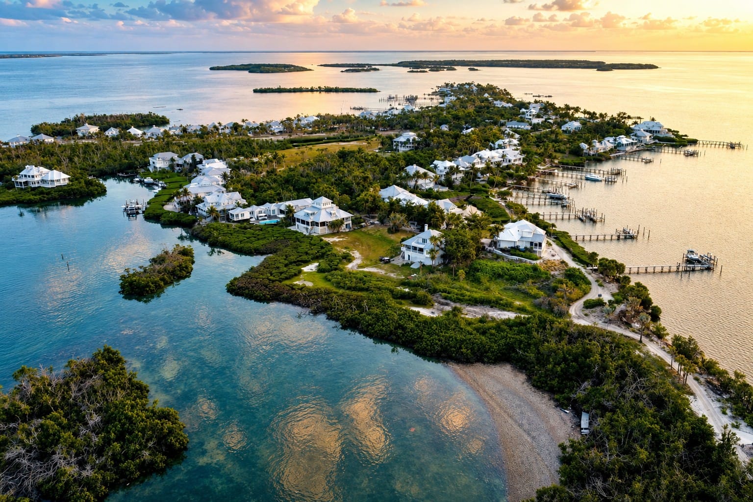
This aerial view showcases the exclusive Useppa Island, a private bridgeless island nestled within Pine Island Sound. Rich in history spanning more than 10,000 years, the island was once home to the Calusa, later became a Cuban fishing rancho, a world-famous tarpon fishing resort under Barron G. Collier, and even served as a CIA training site during the early 1960s. Today, Useppa is an elegant private island community surrounded by crystal-clear waters, mangrove shorelines, and abundant wildlife, making it one of the most historic and picturesque destinations in Southwest Florida.
Useppa Island also contributed to the region's growing reputation.
Chicago businessman John M. Roach acquired Useppa in 1894 and developed it as a winter retreat. Barron Collier later acquired the island, and the establishment of the Izaak Walton Club in 1908 strengthened Useppa's association with tarpon and elite sporting tourism.
Useppa and Boca Grande became linked destinations for visitors exploring Charlotte Harbor and the surrounding islands. Their hotels, clubs, guides, boats, and access to the pass helped establish the region as a nationally recognized center for coastal recreation.
The Lighthouse as an International Landmark
The Port Boca Grande Lighthouse added a powerful visual symbol to the pass.
Built in 1890 to help guide vessels entering Charlotte Harbor, the lighthouse became familiar to commercial crews, local mariners, and generations of visitors. It remains one of Gasparilla Island's most recognizable historic structures and now operates as a museum within Gasparilla Island State Park.
Its location beside the pass links several chapters of Boca Grande's story: navigation, commercial shipping, tourism, coastal preservation, and public history.
Publications, Photography, and Modern Media
As Boca Grande's reputation expanded, stories and images of the pass appeared in newspapers, sporting magazines, travel publications, books, photographs, films, and television programs.
The combination of large tarpon, commercial ships, historic resorts, prominent visitors, a distinctive lighthouse, and dramatic coastal scenery provided compelling material for writers and photographers.
Modern websites, documentaries, social media, and aerial imagery continue introducing Boca Grande Pass to new audiences. These platforms have expanded its reputation beyond traditional boating and angling communities to include historians, wildlife enthusiasts, photographers, and coastal travelers.
A Place for Scientific Research
Boca Grande Pass also attracts scientific attention.
Researchers have studied tarpon behavior, migration, catch-and-release mortality, tidal circulation, sediment movement, channel conditions, and the wider Charlotte Harbor ecosystem.
Florida wildlife officials have conducted research comparing tarpon fishing methods in Boca Grande Pass, while conservation organizations continue studying tarpon migration, spawning behavior, and habitat requirements.
Hydrographic surveys also document water depths and changing channel conditions, supporting navigation and improving knowledge of the pass's complex underwater terrain.
Conservation and Stewardship
International recognition has brought both opportunity and responsibility.
The waters and islands surrounding Boca Grande Pass support tarpon, dolphins, sea turtles, sharks, rays, manatees, coastal birds, seagrass habitats, mangrove shorelines, and estuarine nursery areas.
Protecting these resources depends on responsible boating, habitat conservation, fisheries management, water-quality improvements, and careful wildlife observation.
Florida regulations treat tarpon primarily as a catch-and-release species, and special rules apply to fishing methods used within Boca Grande Pass. These protections reflect the ecological and cultural importance of the seasonal tarpon aggregations.
A Reputation Built Over Generations
Boca Grande Pass earned its worldwide reputation gradually.
Commercial shipping introduced it to international mariners. Tarpon brought sportsmen, guides, writers, scientists, and conservationists. The railroad, Useppa Island, and The Gasparilla Inn brought winter visitors. The lighthouse provided an enduring symbol, while books, magazines, photographs, and modern media carried its story far beyond Southwest Florida.
Today, Boca Grande Pass is recognized not simply as a fishing location or navigation channel, but as a place where maritime history, wildlife, science, tourism, and coastal geography converge.
That layered history—not any single attraction—is what made Boca Grande Pass famous worldwide.
11. Wildlife of Boca Grande Pass
Boca Grande Pass lies within one of Southwest Florida's richest coastal ecosystems. Here, the open Gulf meets Charlotte Harbor, connecting deep tidal water with nearby beaches, seagrass meadows, mangrove shorelines, shallow flats, and protected estuarine habitats.
Every tidal cycle moves water, sediment, prey, and marine organisms through the pass. This constant exchange helps create a dynamic wildlife corridor used by dolphins, tarpon, sharks, rays, sea turtles, manatees, coastal fish, and numerous bird species.
Although Boca Grande Pass is best known for its seasonal tarpon aggregations, its wildlife extends far beyond a single species. What visitors see varies with the tide, season, weather, water clarity, and location within the larger Charlotte Harbor ecosystem.
Bottlenose Dolphins
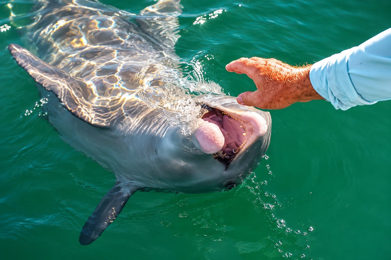
A friendly bottlenose dolphin surfaces alongside the boat in the waters of Boca Grande Pass, where the deep natural channel connecting Charlotte Harbor with the Gulf of America creates one of Florida's richest feeding grounds. Strong tidal currents concentrate baitfish throughout the pass, attracting dolphins year-round and making wildlife encounters a highlight for visitors exploring Southwest Florida by boat. Watching these intelligent marine mammals hunt, socialize, and occasionally ride a boat's wake is one of the unforgettable experiences that makes Boca Grande Pass so special.
The common bottlenose dolphin (Tursiops truncatus) is one of the marine mammals most frequently observed around Charlotte Harbor and Boca Grande Pass.
Long-term research has documented hundreds of individually recognizable dolphins within the Charlotte Harbor region, demonstrating the importance of this estuary to the species.
Dolphins may be seen traveling through the pass, feeding near schools of fish, surfacing beside boats, or riding wakes. They are intelligent, social animals, but their movements are unpredictable, and sightings should always be enjoyed without chasing, crowding, or attempting to feed them.
Atlantic Tarpon
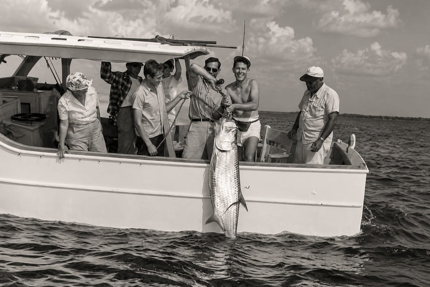
This historic photograph captures the golden era of Boca Grande when visiting anglers traveled from across the world to pursue the legendary Silver King. By the early twentieth century, experienced local guides operated specialized tarpon charter boats from Boca Grande, leading anglers into the deep waters of Boca Grande Pass, where seasonal tarpon migrations created one of the world's greatest sport-fishing destinations. The tradition established more than a century ago continues today, making Boca Grande internationally recognized as the "Tarpon Fishing Capital of the World."
The Atlantic tarpon (Megalops atlanticus) is the animal most closely associated with Boca Grande Pass.
During spring and early summer, large pre-spawning aggregations form in and around the pass before many tarpon move into deeper offshore waters. The pass's depth, strong currents, and concentrations of prey help create favorable seasonal conditions.
Tarpon may grow to extraordinary size, with large adults exceeding six feet in length. Their seasonal presence has shaped the cultural history, scientific research, conservation efforts, and worldwide reputation of Boca Grande Pass.
Because the next section examines tarpon migration in detail, this chapter focuses on the broader community of animals sharing the pass.
Sharks
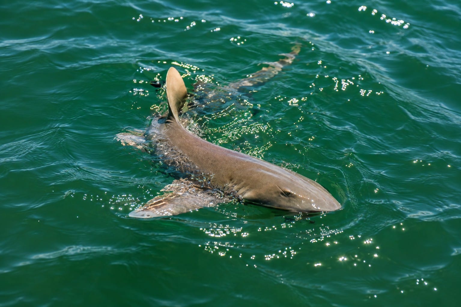
A nurse shark rests on the sandy bottom of Boca Grande Pass, one of Southwest Florida's richest marine habitats. Unlike fast-swimming pelagic sharks, nurse sharks are slow-moving bottom dwellers that spend much of the day resting before becoming more active at night. They commonly inhabit warm coastal waters, seagrass beds, rocky ledges, and channels such as Boca Grande Pass, where they feed on crabs, lobsters, octopus, mollusks, and small fish. Although their appearance can be intimidating, nurse sharks are generally docile and are rarely dangerous unless disturbed or handled.
Several shark species use Charlotte Harbor, Boca Grande Pass, and the adjoining Gulf waters.
Possible regional species include:
- Bull sharks
- Blacktip sharks
- Bonnethead sharks
- Spinner sharks
- Nurse sharks
- Other coastal and migratory sharks
Not every species is present at all times, and sightings vary according to season, prey availability, water conditions, and location.
Sharks are essential predators within healthy marine ecosystems. They help regulate food webs and often concentrate in areas where fish and other prey are abundant. The presence of dolphins does not mean sharks are absent; both may use the same productive waters and pursue similar prey.
Sea Turtles
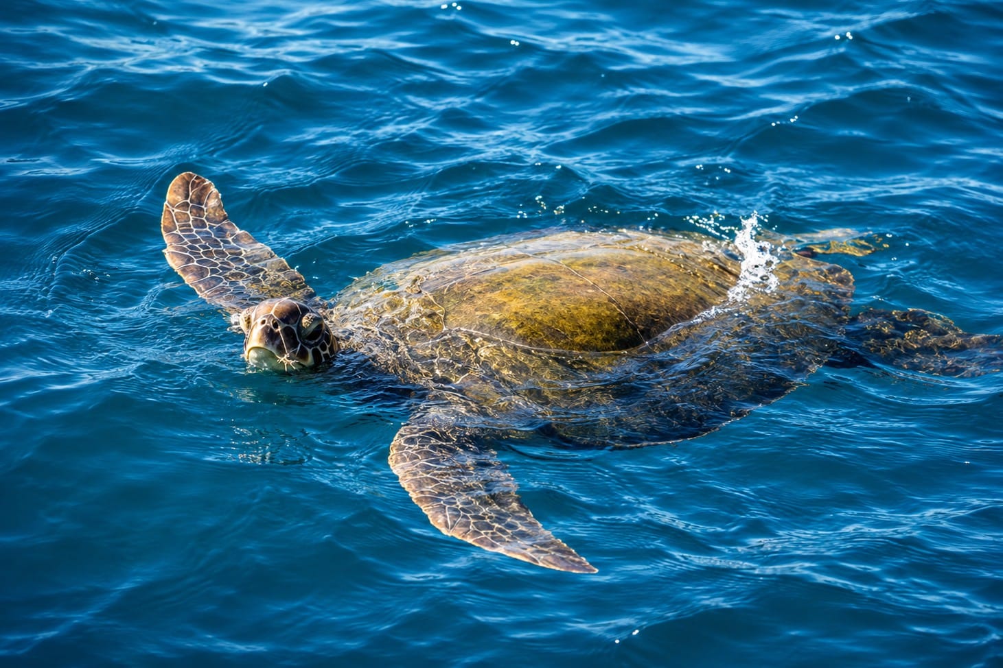
A graceful Loggerhead Sea Turtle (Caretta caretta) glides through the clear waters of Boca Grande Pass, one of Southwest Florida's richest marine ecosystems. Loggerheads are the most common sea turtle species found in Florida and regularly forage in the waters of Charlotte Harbor and the Gulf of America, feeding on crabs, mollusks, and other hard-shelled prey with their powerful jaws. During nesting season, females return to nearby Gulf beaches to lay their eggs, continuing a life cycle that has existed for millions of years. Protected under state and federal law, loggerhead turtles remain one of Florida's most iconic marine wildlife species.
Several sea-turtle species travel through the coastal waters surrounding Boca Grande Pass.
Loggerhead and green sea turtles are especially important along nearby Gasparilla Island, whose Gulf beaches provide documented nesting habitat for both species. Cayo Costa's undeveloped shoreline also supports sea turtles and other coastal wildlife.
Sea turtles may surface briefly to breathe while moving between feeding grounds, offshore waters, and nesting beaches. Because these appearances are often short, boaters should maintain a careful watch and reduce speed when turtles are present.
All sea turtles occurring in Florida are protected. They should be observed from a respectful distance without pursuing, touching, or interfering with their movement.
Rays
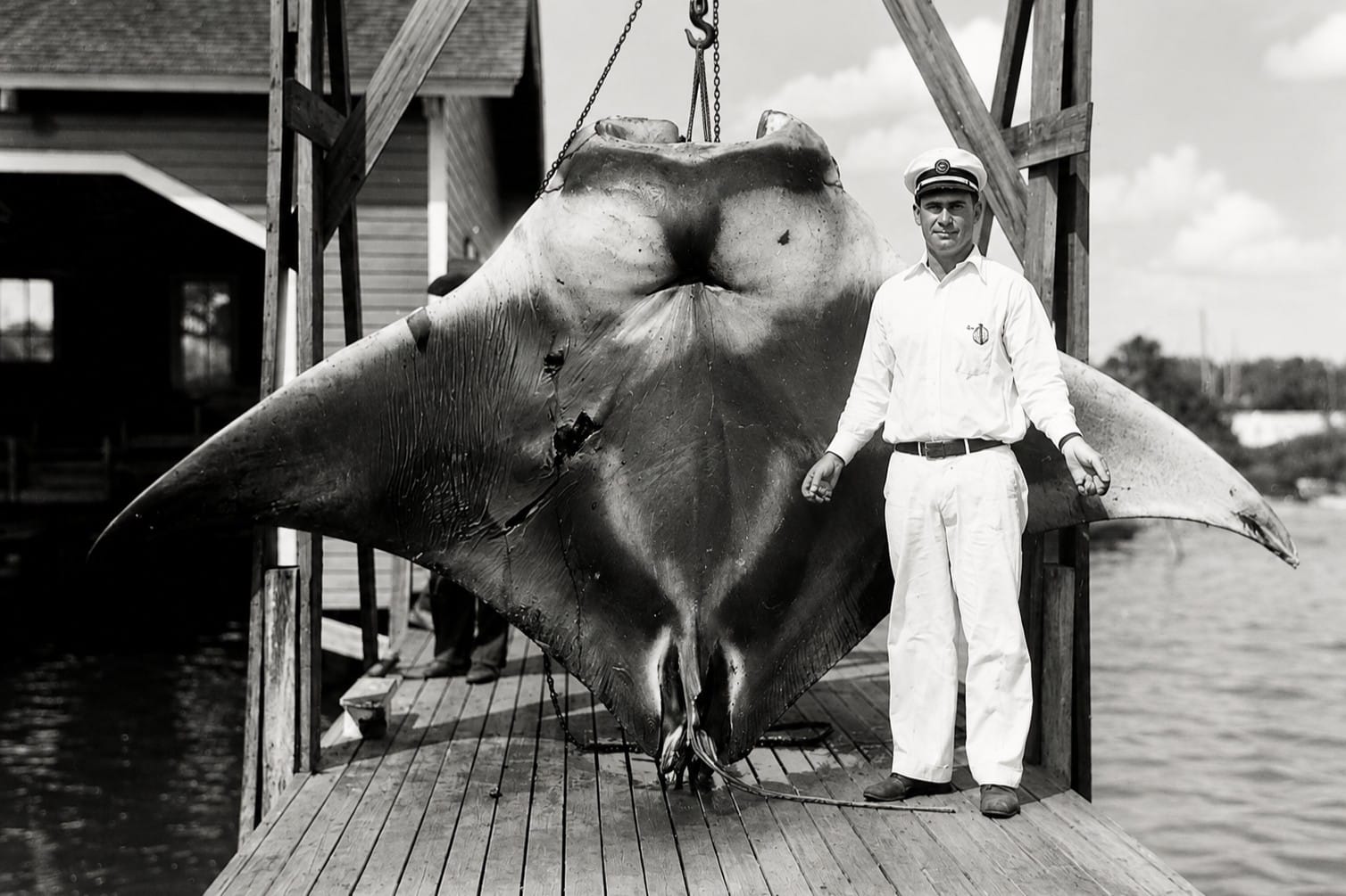
This remarkable historic photograph shows Sam Whidden posing with a giant manta ray (often called a "devil fish" in the early 1900s) near Boca Grande around 1930. During that era, enormous rays occasionally entered the waters of Boca Grande Pass and Charlotte Harbor, where they attracted the attention of local fishermen and visiting sportsmen. Today, giant manta rays are protected marine animals valued for their ecological importance and graceful movements through Florida's coastal waters. This photograph preserves an important chapter in Boca Grande's maritime history and reflects how attitudes toward marine wildlife have evolved over the past century.
Rays are also part of the marine community in and around Boca Grande Pass.
Southern stingrays may rest or feed over sandy areas and shallow flats, while spotted eagle rays may occasionally be seen gliding through deeper coastal waters. Their presence varies with season, water conditions, and prey availability.
Rays are generally nonaggressive and attempt to avoid people. Stingrays use their tail barb defensively, so swimmers and waders should avoid stepping directly onto animals concealed in shallow sand.
Florida Manatees
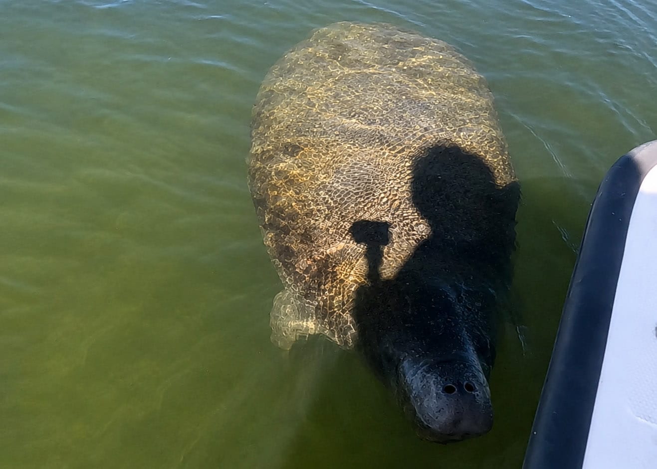
A gentle Florida manatee glides through the calm waters near Mondongo Island off Bokeelia in Pine Island Sound. The island's shallow seagrass flats and protected estuarine waters provide excellent habitat for these endangered marine mammals, which feed primarily on seagrasses and other aquatic vegetation. Boaters exploring the Bokeelia area frequently encounter manatees throughout the warmer months and should always operate at slow speed, giving these peaceful "sea cows" plenty of space to surface and breathe.
The Florida manatee (Trichechus manatus latirostris) is an occasional visitor to Boca Grande Pass and the surrounding waters.
Manatees are more frequently associated with protected bays, canals, rivers, seagrass habitats, and calmer portions of Charlotte Harbor, Gasparilla Sound, and Pine Island Sound. During warmer weather, they disperse through Florida's coastal waters and may be observed around Gasparilla Island or Cayo Costa.
Because manatees surface slowly and may be difficult to detect, boaters should watch for circular surface patterns, a nose breaking the water, or a broad back and paddle-shaped tail.
Ospreys
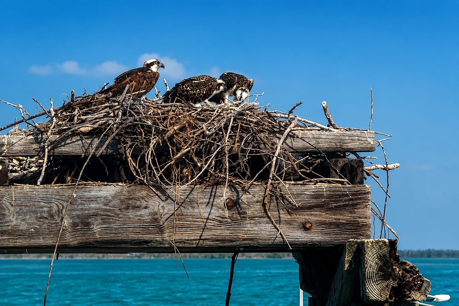
An osprey family watches over its nest near the historic Boca Grande Trestle, one of Southwest Florida's premier wildlife viewing locations. Often called the "Fish Hawk," the osprey feeds almost exclusively on live fish and builds large stick nests on dead trees, channel markers, and other elevated structures overlooking the water. The rich fishing grounds of Gasparilla Sound, Boca Grande Pass, and Charlotte Harbor provide an ideal environment for raising young, making osprey sightings a highlight for visitors exploring the area by boat.
The osprey (Pandion haliaetus) is one of the signature birds of the Boca Grande area.
Often called the “fish hawk,” the osprey is highly adapted for capturing fish. It searches from above before descending feet-first with its talons extended.
Ospreys may be seen resting on trees, nesting structures, docks, or navigation markers around Charlotte Harbor. Their calls and fishing dives are familiar sights and sounds throughout Southwest Florida's coastal waterways.
Brown Pelicans
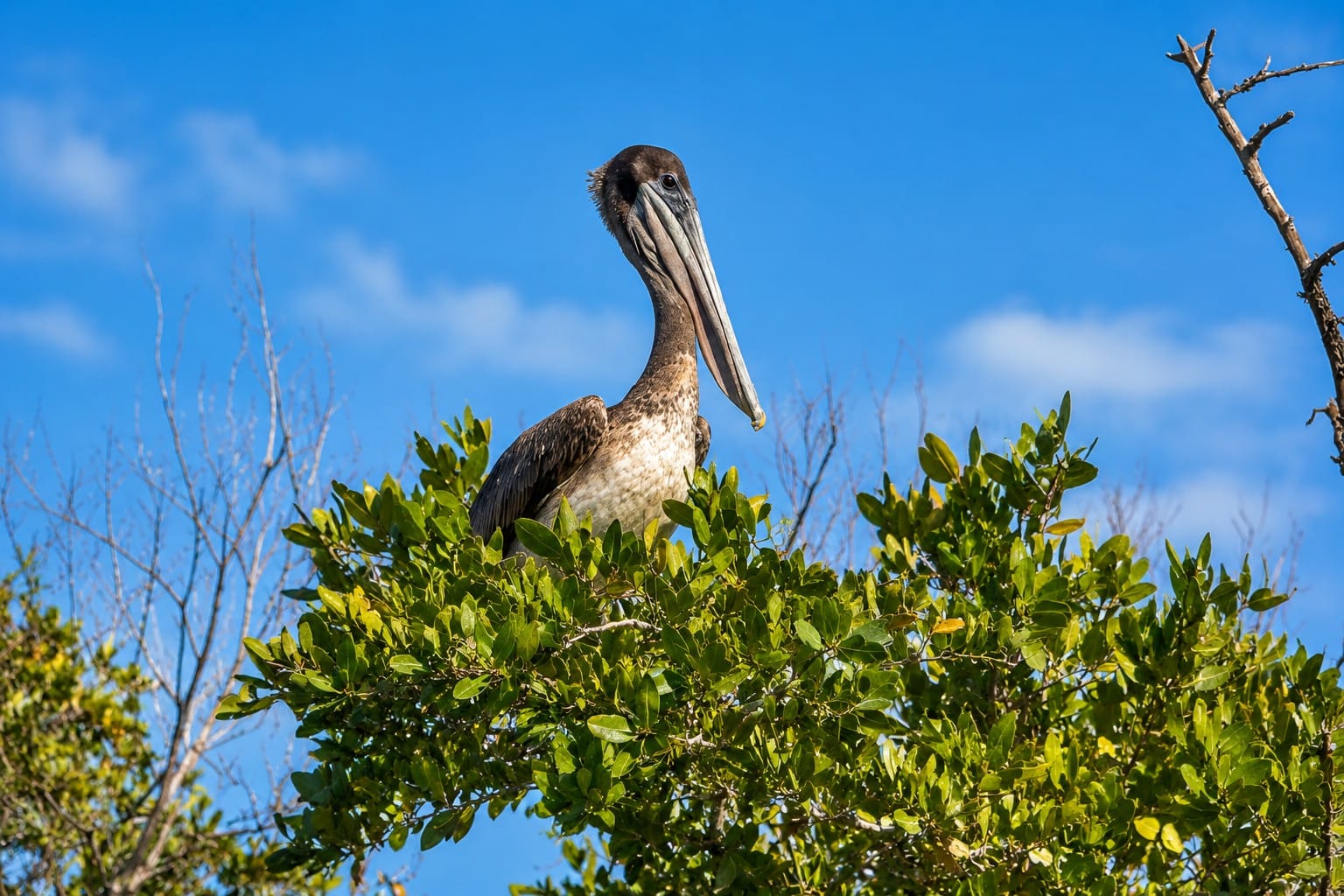
A majestic Brown Pelican rests along the shoreline of South part of Gasparilla Island, one of Southwest Florida's most recognizable coastal birds. Brown pelicans are expert fish hunters, famous for their spectacular head-first dives from heights of up to 60 feet to capture schooling fish. They are commonly seen gliding just above the waves, resting on docks and channel markers, or gathering near passes where tidal currents concentrate baitfish. Once endangered because of DDT, the species has made a remarkable recovery and is now a year-round symbol of Florida's Gulf Coast.
The brown pelican (Pelecanus occidentalis) is another highly visible resident of the pass.
Pelicans often fly low above the water, travel in lines along the shoreline, or plunge headfirst into schools of fish. They frequently rest on sandbars, docks, pilings, beaches, and navigation structures.
Their presence often signals active feeding conditions, although boaters should avoid approaching resting or feeding groups too closely.
Shorebirds, Seabirds, and Wading Birds
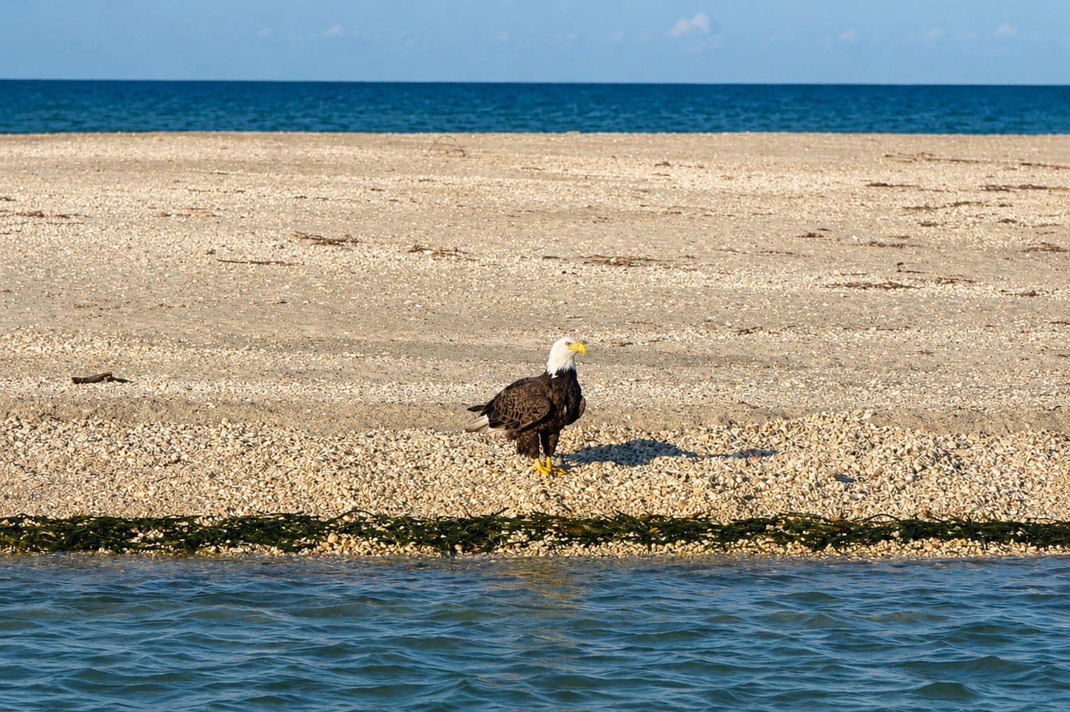
A magnificent Bald Eagle, America's national bird, surveys the waters near Stump Pass Beach State Park on Manasota Key. The productive estuarine waters of Lemon Bay and the nearby Gulf of America provide excellent hunting habitat, where bald eagles feed primarily on fish while sharing the skies with ospreys, pelicans, and other coastal birds. Florida supports one of the highest concentrations of nesting bald eagles in the contiguous United States, making sightings along Southwest Florida's waterways a memorable experience for boaters, kayakers, photographers, and wildlife enthusiasts.
The deep water of Boca Grande Pass is only one part of a much larger wildlife landscape. Nearby beaches, dunes, tidal flats, shallow bays, mangrove shorelines, and seagrass habitats support a wide range of birds.
Species visitors may observe include:
- Great blue herons
- Great and snowy egrets
- Tricolored herons
- Roseate spoonbills
- White ibises
- Brown pelicans
- Black skimmers
- Royal, sandwich, and least terns
- American oystercatchers
- Willets
- Ruddy turnstones
- Gulls and other coastal birds
Gasparilla Island State Park protects habitat used by several tern species, American oystercatchers, and other coastal wildlife, while its Gulf beaches provide nesting areas for shorebirds.
Some birds feed directly over the pass, while others depend primarily on surrounding beaches, flats, mangroves, and shallow estuarine waters.
Wildlife Through the Seasons
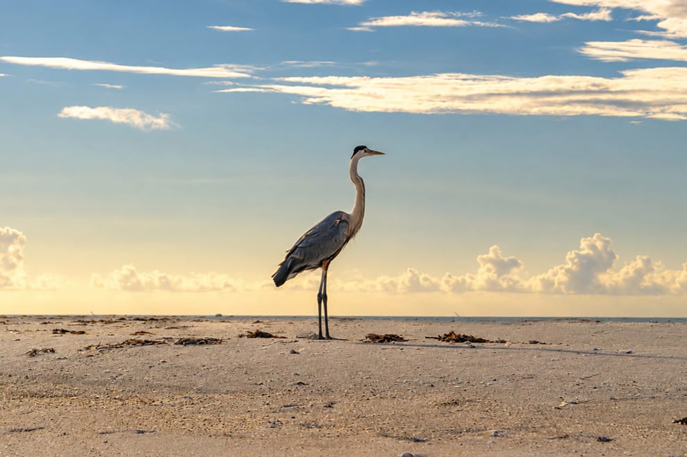
A majestic Great Blue Heron stands motionless at sunrise along the shoreline of Stump Pass Beach State Park, patiently waiting to spear fish in the shallow tidal waters. As one of North America's largest wading birds, the Great Blue Heron is a familiar sight throughout Lemon Bay, the mangrove estuaries, and the beaches of Manasota Key. The park's tidal flats, marshes, and shoreline provide ideal feeding habitat for herons, egrets, pelicans, and many other coastal bird species, making Stump Pass one of Southwest Florida's premier destinations for birdwatching and wildlife photography.
Boca Grande Pass changes throughout the year.
Spring and early summer bring the best-known tarpon aggregations and increasing activity along nearby sea-turtle nesting beaches. Summer is an active period for coastal wildlife, although heat, thunderstorms, and changing water conditions influence daily sightings.
Autumn often brings changing bird movements and shifts in coastal fish activity. During winter, cooler weather can bring migratory birds into the broader Charlotte Harbor region, while manatees become more concentrated around warm-water refuges elsewhere in Florida.
No season guarantees a particular encounter. Tide, wind, water clarity, prey movement, and simple chance all influence what visitors may see.
A Wildlife Corridor in Constant Motion
The wildlife of Boca Grande Pass depends on more than the deep entrance itself. The pass is connected to an extensive network of seagrass meadows, mangrove shorelines, beaches, dunes, shallow flats, oyster habitat, tidal creeks, and open Gulf waters.
Together, these environments provide feeding areas, nursery habitat, migration routes, nesting beaches, resting sites, and protection for numerous species.
For many visitors, the most memorable moments occur unexpectedly: a dolphin surfacing beside the boat, a sea turtle taking a breath, an osprey diving toward the water, an eagle ray passing beneath the surface, or a line of pelicans gliding across the tide.
These encounters are reminders that Boca Grande Pass is more than a navigation channel or historic landmark. It is part of a living coastal ecosystem that deserves careful observation, responsible boating, and continued protection.
12. Tarpon Migration Explained
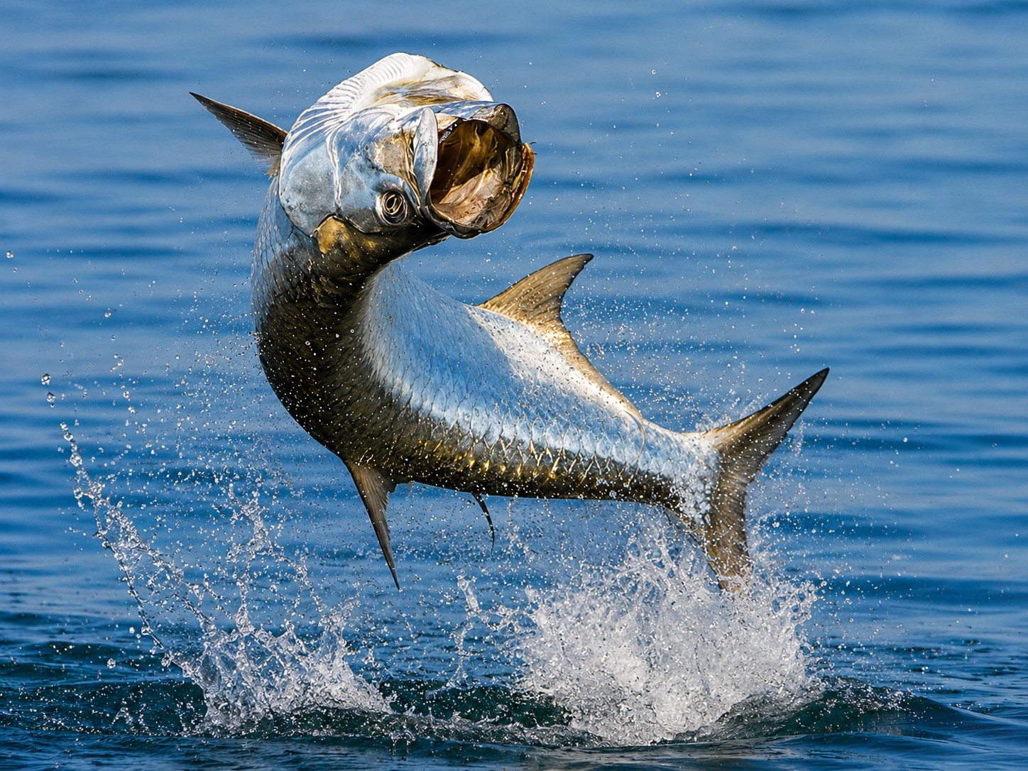
A powerful tarpon, known as the "Silver King," launches high above the water in Boca Grande Pass, creating one of Southwest Florida's most iconic wildlife spectacles. These incredible fish, often weighing more than 100 pounds, are famous for their explosive leaps and acrobatic fights. Each spring and early summer, thousands of migrating tarpon gather in the deep waters where Charlotte Harbor meets the Gulf of America, making Boca Grande Pass internationally recognized as one of the world's premier tarpon destinations. Even for non-anglers, watching these giant fish erupt from the water is an unforgettable experience.
Each spring and early summer, large aggregations of Atlantic tarpon gather in and around Boca Grande Pass, creating one of Southwest Florida's best-known seasonal wildlife events.
The Atlantic tarpon (Megalops atlanticus) is closely associated with the pass, but the gathering is more than a fishing tradition. It is part of a much larger cycle involving seasonal migration, feeding, offshore spawning, larval transport, and juvenile development within protected coastal wetlands.
Understanding this remarkable life cycle helps explain why Boca Grande Pass, Charlotte Harbor, and the surrounding estuaries are so important to the long-term survival of this iconic species.
Meet the "Silver King"
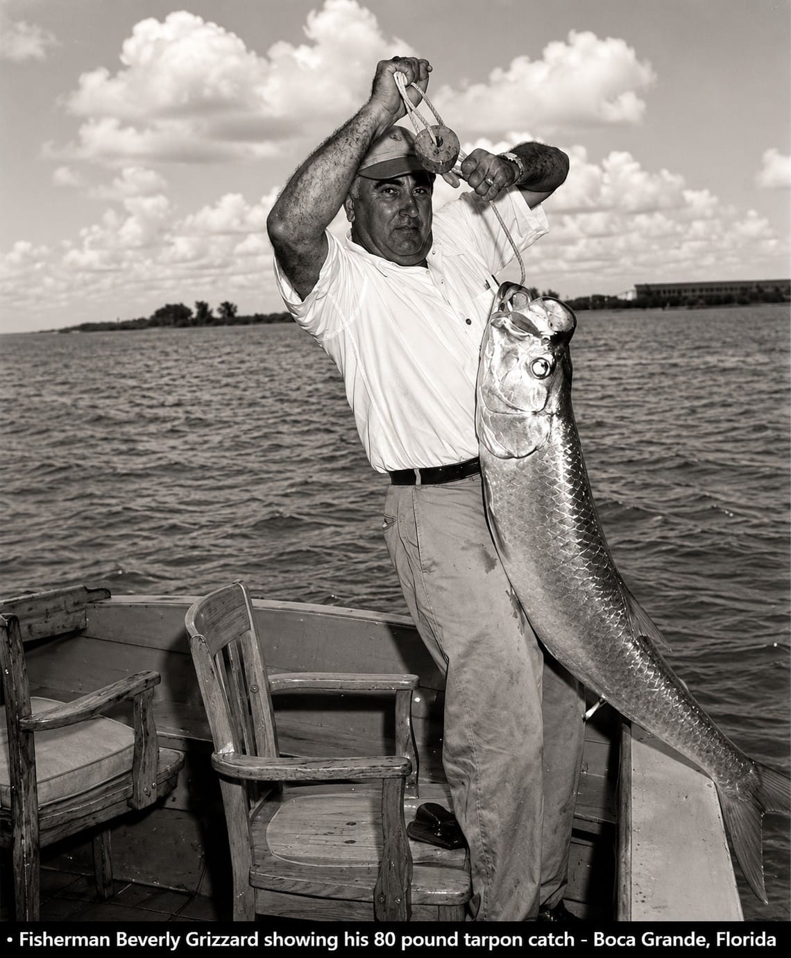
This historic photograph shows Beverly Grizzard proudly displaying an 80-pound tarpon caught in Boca Grande in 1953. During the mid-20th century, Boca Grande Pass had already earned an international reputation as one of the world's finest destinations for pursuing the legendary "Silver King." Historic images like this capture the excitement of Florida's golden age of tarpon fishing and the enduring tradition that continues to attract anglers and wildlife enthusiasts to Boca Grande Pass each spring and early summer.
Atlantic tarpon are among the most recognizable fish in tropical and subtropical waters. Known as the "Silver King" because of their brilliant reflective scales, powerful bodies, and spectacular leaps, they have fascinated naturalists, anglers, and scientists for generations.
Tarpon belong to an ancient lineage of ray-finned fishes and possess one of the most unusual adaptations found in marine fish. Their highly vascularized swim bladder allows them to gulp atmospheric air at the surface, helping them survive in waters with low dissolved oxygen where many other large fish cannot.
Large adults commonly reach four to six feet (1.2–1.8 meters) in length, while exceptional females may exceed eight feet (2.5 meters) and weigh more than 300 pounds (136 kilograms). They are also remarkably long-lived and slow to mature, making the protection of adult fish and nursery habitat especially important.
Why Tarpon Gather at Boca Grande Pass
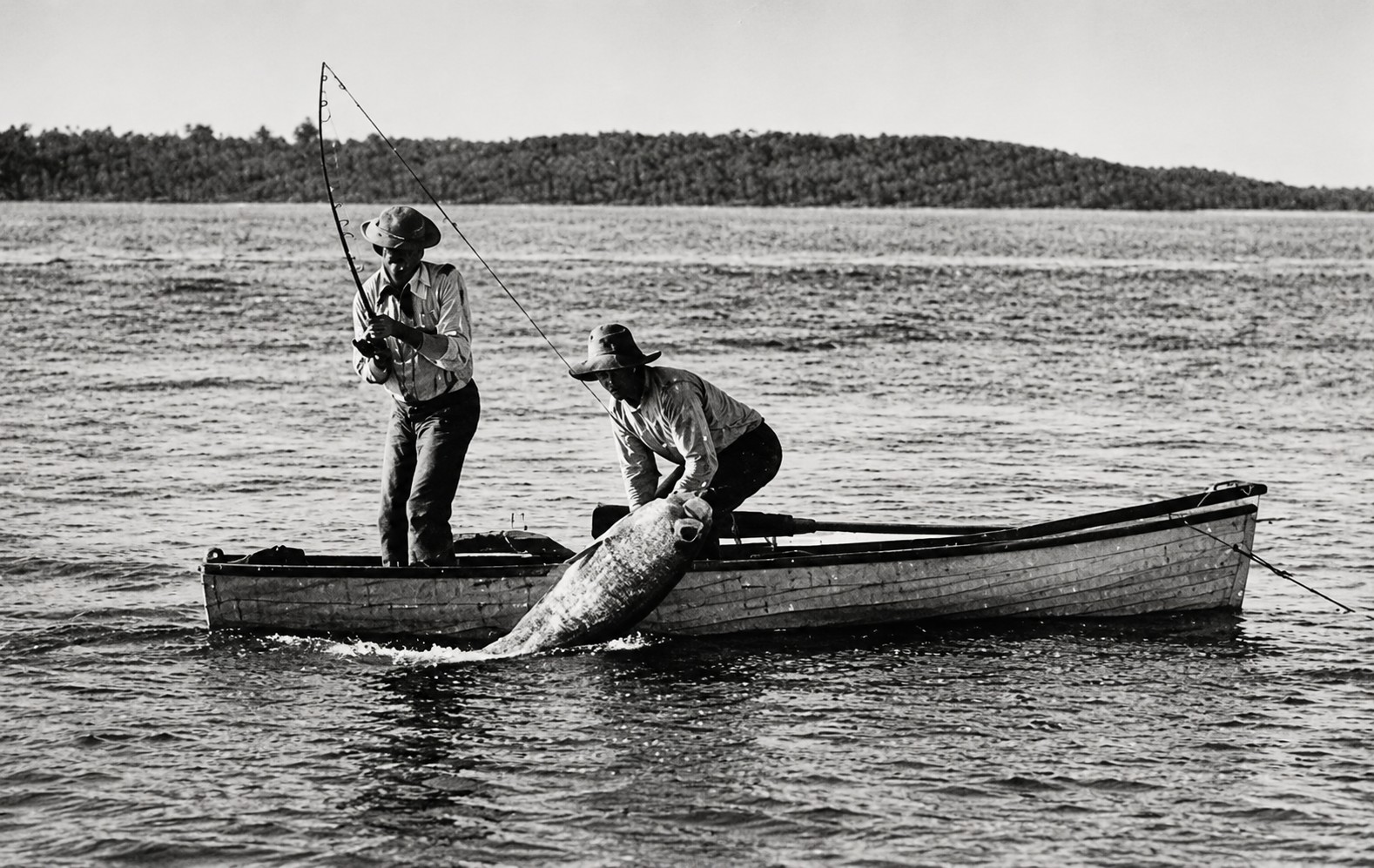
This historic photograph captures the early days of tarpon fishing in Boca Grande Pass, when anglers and local guides gathered over the deep waters off Gasparilla Island in pursuit of the legendary "Silver King." By the early 1900s, Boca Grande Pass had earned an international reputation as one of the world's premier tarpon fishing destinations, attracting sportsmen from across the United States and beyond. The rich marine ecosystem created by the meeting of Charlotte Harbor and the Gulf of America continues to support the annual tarpon migration that defines Boca Grande's maritime heritage.
Boca Grande Pass serves as an important seasonal aggregation area because it connects the productive estuarine waters of Charlotte Harbor with the open Gulf of America.
The pass provides:
- Deep tidal water
- Strong reversing currents
- Direct access to Charlotte Harbor
- Abundant schooling fish and crustaceans
- A transition zone between estuarine and offshore habitats
Together, these conditions create excellent feeding opportunities and make Boca Grande Pass an ideal gathering place before many adult tarpon move offshore to spawn.
Scientists recognize Boca Grande Pass as an important pre-spawning aggregation area. Although the size and location of these gatherings vary from year to year, they may include thousands of fish depending on water temperature, tides, prey availability, and reproductive timing.
The Seasonal Migration
Tarpon numbers around Boca Grande generally begin increasing during spring, often peak during May and June, and may remain elevated into early summer.
The timing changes from year to year. Water temperature, weather, prey movement, currents, and the reproductive condition of the fish all influence when tarpon arrive and how long they remain in the area.
Many tarpon move northward along Florida's Gulf Coast during warmer months. Some remain within estuaries and nearshore waters, while others continue offshore in preparation for spawning.
Boca Grande Pass is therefore not the final destination of the migration. Instead, it is one important stop within a much larger network extending throughout Florida, the Gulf of America, the Caribbean, and parts of the western Atlantic.
Offshore Spawning
After forming pre-spawning aggregations in and around Boca Grande Pass, many adult tarpon move into deeper offshore waters to reproduce.
Direct observations of spawning are uncommon, so scientists continue to study the exact timing and locations where spawning occurs. Current research indicates that spawning takes place offshore during the warmer months, often in association with lunar cycles.
Females release millions of eggs into open water, where fertilization and early development occur before the larvae begin their remarkable journey back toward the coast.
The Tarpon Life Cycle
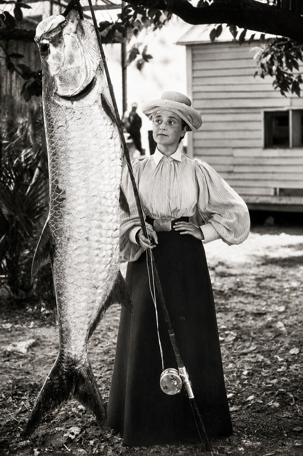
This historic photograph captures a woman proudly posing with a tarpon in Boca Grande, reflecting the growing popularity of sport fishing during the first half of the twentieth century. Boca Grande became internationally famous as the home of the legendary "Silver King," attracting anglers from around the world—including many pioneering women who helped shape the sport's history. Historic photographs such as this preserve the excitement, elegance, and enduring tradition of tarpon fishing in Boca Grande Pass, where annual tarpon migrations continue to draw visitors to Southwest Florida today.
Newly hatched tarpon pass through a transparent, ribbon-like larval stage known as a leptocephalus.
These larvae drift with ocean currents before entering estuaries and coastal wetlands. As they transform into juveniles, they settle into sheltered habitats such as:
- Tidal creeks
- Mangrove wetlands
- Coastal ponds
- Backwater lagoons
- Salt marshes
- Other shallow, protected waters
Many of these nursery habitats experience low oxygen levels, fluctuating salinity, and only temporary connections to larger estuaries. Thanks to their ability to breathe atmospheric air, juvenile tarpon thrive where many predators cannot.
As they mature, young tarpon gradually move into larger creeks, bays, estuaries, and eventually the coastal waters where they join the adult population.
An Important Coastal Predator
Adult tarpon are important upper-level predators within Southwest Florida's coastal food web.
Their diet includes:
- Thread herring
- Sardines
- Menhaden
- Mullet
- Pinfish
- Shrimp
- Crabs
In turn, large sharks occasionally prey upon adult tarpon, particularly when fish are concentrated during the migration season. This relationship illustrates that even one of Florida's largest coastal fish remains part of a complex and interconnected marine ecosystem.
What Scientists Are Learning
Modern tarpon research combines acoustic and satellite tagging, genetic analysis, physiological studies, habitat monitoring, and catch-and-release research.
These studies help scientists better understand:
- Seasonal migration routes
- Estuary use
- Offshore movements
- Spawning behavior
- Juvenile nursery habitats
- Post-release survival
- Population connectivity
- Responses to environmental change
Research has shown that tarpon can travel hundreds of miles during their lives and that fish using different regions of the Gulf do not always follow identical migration routes. Although scientists have learned a great deal in recent decades, important questions remain about spawning, migration decisions, and how environmental change may influence future populations.
Why Conservation Matters
Tarpon remain widely distributed throughout Florida, but several aspects of their biology make them especially vulnerable.
They grow slowly, mature relatively late, and depend upon a series of connected habitats throughout their lives—from offshore spawning grounds and coastal nursery wetlands to estuaries and adult migration corridors.
Important conservation challenges include:
- Loss of nursery habitat
- Declining water quality
- Coastal development
- Changes in freshwater flow
- Vessel traffic
- Fishing-related stress
- Climate-driven environmental change
Florida manages tarpon primarily as a catch-and-release species. Protecting the "Silver King" therefore means protecting not only the fish themselves, but also the wetlands, estuaries, tidal creeks, mangrove forests, and offshore waters that support every stage of their remarkable life cycle.
A Seasonal Event Within a Much Larger Journey
Watching a school of giant silver tarpon rolling across the waters of Boca Grande Pass is an unforgettable experience. Yet the gathering seen each spring represents only one chapter in a far larger biological story.
Some of these fish have already traveled hundreds of miles. Many will soon move offshore to spawn. Their offspring will eventually return to protected coastal wetlands, where the next generation begins life hidden among mangroves, tidal creeks, and quiet estuaries.
Boca Grande Pass is therefore much more than a famous gathering place. It is one link in an international migration network connecting Charlotte Harbor, Florida's Gulf Coast, offshore spawning waters, the Caribbean, Mexico, and the western Atlantic.
The annual return of the "Silver King" reminds us that the future of Boca Grande Pass depends on the health of an entire connected coastal ecosystem.
13. The Port Boca Grande Lighthouse
Standing at the southern tip of Gasparilla Island, the Port Boca Grande Lighthouse has overlooked Boca Grande Pass since 1890. It is the oldest surviving structure on Gasparilla Island, one of the oldest buildings in Lee County, and one of Southwest Florida's most recognizable maritime landmarks.
For generations of mariners, the lighthouse was far more than an attractive coastal building. Its light marked the entrance to Charlotte Harbor and provided an essential visual reference for vessels approaching Boca Grande Pass from the Gulf.
Today, the restored lighthouse houses a museum within Gasparilla Island State Park and preserves an important chapter of Southwest Florida's navigation, shipping, and coastal history.
Why the Lighthouse Was Built
By the late nineteenth century, maritime traffic through Boca Grande Pass was increasing. Fishing vessels, coastal schooners, steamships, supply boats, and other commercial craft used the pass to enter Charlotte Harbor.
Although Boca Grande Pass is naturally deep in places, mariners still faced strong tidal currents, offshore shoals, changing weather, limited visibility, and a coastline that could be difficult to identify at night.
The United States Lighthouse Board therefore established a light at the southern end of Gasparilla Island. Completed in 1890, the structure marked the entrance to Charlotte Harbor and helped vessels identify Boca Grande Pass while approaching from the Gulf.
Under suitable conditions, its light was historically visible from approximately 12 miles away.
A Distinctive Screw-Pile Lighthouse
Port Boca Grande Lighthouse differs from the tall brick and masonry towers commonly associated with coastal navigation.
It was constructed as an iron screw-pile lighthouse with a wood-frame keeper's dwelling. The lantern rises from the center of the roof, combining the navigational light and the keeper's residence within one compact structure.
The screw-pile foundation elevated the building above the low coastal ground and helped address the challenges of tides, flooding, and unstable shoreline conditions.
Inside the residence, lighthouse keepers and their families lived close to the equipment they were responsible for maintaining. The unusual combination of home, workplace, and navigational structure gives the building much of its historic character.
Guiding Mariners Toward Charlotte Harbor
Before radar, satellite navigation, and electronic charts, coastal mariners depended heavily on visible landmarks, lights, soundings, printed charts, buoys, and local knowledge.
The Port Boca Grande Lighthouse helped approaching captains identify the entrance to Charlotte Harbor. Once near the pass, vessels also depended on channel markers, navigational charts, weather conditions, and, for larger commercial ships, experienced harbor pilots.
Lighthouse keepers maintained the lamp and its supporting equipment so that the light would remain dependable through darkness and difficult weather.
The lighthouse therefore formed one part of a larger navigational system rather than serving as the only guide through the pass.
The Phosphate-Shipping Era
The lighthouse was already operating before Boca Grande developed into a major phosphate port.
After the Charlotte Harbor and Northern Railway reached Gasparilla Island in the early twentieth century and the large phosphate-loading terminal entered operation, commercial traffic through Boca Grande Pass increased substantially.
Ocean-going ships passed the lighthouse while entering and leaving Charlotte Harbor. Harbor pilots guided deeper-draft vessels through the maintained channel toward the docks at Port Boca Grande, where phosphate was loaded for domestic and international markets.
For generations of crews, the lighthouse became the first and last recognizable Boca Grande landmark seen during a voyage through the pass.
Decline, Abandonment, and Restoration
The U.S. Coast Guard operated the Port Boca Grande Lighthouse until 1966. The structure then stood abandoned for approximately two decades while exposure to salt air, humidity, storms, and coastal conditions contributed to its deterioration.
Recognition of its historical importance eventually led to preservation efforts. The Boca Grande Lighthouse was listed on the National Register of Historic Places in 1980.
The state assumed ownership and opened the property as part of Gasparilla Island State Park in 1983. Following a major restoration, the lighthouse was rededicated in 1986.
These efforts saved the structure from continued decline and returned one of Gasparilla Island's most important historic landmarks to public use.
The Lighthouse Museum
Today, the Port Boca Grande Lighthouse houses a museum within Gasparilla Island State Park. The park operates the site with support from the Barrier Island Parks Society, a nonprofit citizen-support organization dedicated to protecting the area's natural and historic resources.
Museum displays interpret subjects such as:
- Lighthouse keepers and their families
- Coastal navigation
- Boca Grande Pass
- Port Boca Grande and phosphate shipping
- Gasparilla Island history
- Local wildlife and natural resources
- Historic photographs, maps, and maritime artifacts
The building itself remains the museum's most important exhibit, allowing visitors to experience the compact residence and lighthouse design in its original coastal setting.
A Symbol of Boca Grande
Modern mariners no longer depend on the lighthouse as their primary navigational reference. GPS, radar, electronic charts, depth sounders, channel markers, and current hydrographic information now provide far more detailed guidance.
Nevertheless, the lighthouse continues to symbolize the skill and discipline required to navigate Boca Grande Pass before modern electronics.
It also reflects the transformation of Gasparilla Island from a remote maritime settlement to an international phosphate port, historic resort community, state park, and modern visitor destination.
Visiting the Lighthouse
The Port Boca Grande Lighthouse and Museum is located at the southern end of Gasparilla Island within Gasparilla Island State Park. It overlooks Boca Grande Pass and the waters separating Gasparilla Island from Cayo Costa.
Visitors can experience:
- The restored 1890 lighthouse
- Maritime and local-history exhibits
- Views across Boca Grande Pass
- Nearby Gulf beaches
- Birdwatching and wildlife observation
- Coastal photography
- Picnic areas and other park amenities
Museum hours vary seasonally, so visitors should check the official Florida State Parks schedule before traveling.
From the grounds surrounding the lighthouse, visitors can see the same maritime entrance observed by lighthouse keepers, harbor pilots, commercial crews, and generations of boaters.
The view encompasses Boca Grande Pass, Cayo Costa, the Gulf of America, and the entrance to Charlotte Harbor—a landscape where natural forces and human history remain inseparable.
A Lighthouse That Preserves the Story of the Pass
The Port Boca Grande Lighthouse is more than a picturesque coastal building.
It represents the era of visual navigation, the growth of maritime commerce, the rise and decline of the phosphate port, and the successful preservation of Gasparilla Island's historic heritage.
More than 135 years after its construction, the lighthouse remains an enduring symbol of Boca Grande Pass and the people who lived, worked, and navigated along one of Florida's most important coastal gateways.
14. Historic Maps Through Time
Historic maps offer one of the clearest ways to understand how knowledge of Boca Grande Pass developed over more than two centuries. Long before aerial photography, satellite positioning, and electronic navigation, mariners and surveyors charted Southwest Florida with compasses, astronomical observations, lead lines, measured baselines, and careful visual observations.
Their charts served practical purposes. They identified entrances, shoals, islands, water depths, anchorages, and recognizable landmarks needed for coastal navigation. Today, those same documents provide valuable evidence of how Boca Grande Pass, Gasparilla Island, Cayo Costa, Charlotte Harbor, and the surrounding waterways were understood during different periods.
Historic maps should not be treated as perfectly accurate photographs of the past. Each reflects the technology, terminology, surveying priorities, and geographic knowledge of its era. When examined together, however, they reveal both continuity and change across Southwest Florida's coastline.
The 1760s and 1770s — George Gauld Surveys the Coast
Some of the earliest systematic hydrographic surveys of Florida's Gulf Coast were completed by Scottish surveyor George Gauld for the British Admiralty after Britain acquired Florida in 1763.
During the 1760s and 1770s, Gauld surveyed portions of Florida's coast using astronomical observations, measured positions, lead-line soundings, and traditional maritime surveying methods. His work recorded coastlines, islands, shoals, channels, anchorages, and navigable entrances with unusual detail for the period.
In the Charlotte Harbor region, Gauld's charts helped mariners understand the broad entrance between the barrier islands and the protected waters beyond it. His surveys became important references for later navigators and mapmakers.
Although shorelines were generalized and some features remained imperfectly understood, Gauld's work represented a major improvement over earlier coastal maps and laid the foundation for future charting of Southwest Florida.
1774–1781 — Bernard Romans Documents Charlotte Harbor
Bernard Romans, a surveyor, engineer, naturalist, and cartographer, produced another influential early depiction of Florida.
Romans prepared maps for his 1774 publication about Florida, while the larger surviving map collection, Maps of East and West Florida, was published in 1781. His work included navigational information, coastal features, rhumb lines, soundings, and sailing observations.
His depiction of the Charlotte Harbor region helped introduce the geography of Southwest Florida to mariners and readers throughout Britain, Europe, and the American colonies.
Romans' work used place names and coastal outlines that do not always match modern terminology. Those differences provide valuable insight into how eighteenth-century surveyors interpreted a region that was still being explored and documented.
Nineteenth-Century Coastal Surveys
During the nineteenth century, hydrographic charting became increasingly systematic as the United States expanded its coastal surveying programs.
Survey crews measured shorelines, established reference points, recorded water depths with weighted lead lines, and identified shoals, channels, prominent landmarks, and anchorage areas. These surveys provided mariners with far more detailed information than earlier reconnaissance maps.
The charts documented Boca Grande Pass as a prominent entrance to Charlotte Harbor while also recording the shoals and changing depths surrounding it.
They also provide an important historical baseline for studying:
- Shoreline movement
- Barrier-island evolution
- Shoal development
- Channel position
- Coastal settlement
- Changes in navigational knowledge
Late Nineteenth Century — More Detailed Charting
By the late nineteenth century, charts of Charlotte Harbor and Boca Grande Pass contained increasingly detailed soundings and navigational information.
Depending on the publication date, these charts included:
- Water-depth soundings
- Shoals and shallow banks
- Navigable channels
- Coastal outlines
- Anchorages
- Recognizable landmarks
- Sailing directions
- The Port Boca Grande Lighthouse after its completion in 1890
This period preceded the full development of Port Boca Grande's twentieth-century phosphate terminal. The charts therefore document the transition from a natural harbor entrance and regional trading route toward a more intensively surveyed commercial waterway.
U.S. Coast and Geodetic Survey Charts
By the late nineteenth and early twentieth centuries, the United States Coast and Geodetic Survey was producing increasingly detailed charts of American coastal waters.
These charts combined shoreline surveys, triangulation, water-depth soundings, navigational landmarks, and information about channels and shoals. They provided mariners with a more consistent national charting system and gave later researchers a valuable record of historical coastal conditions.
Rather than relying on a single chart year, it is best to examine successive editions. Each new edition incorporated revised soundings, relocated navigation aids, harbor construction, dredging, shoreline changes, and new maritime infrastructure.
These successive charts are especially valuable for comparing conditions before and after:
- Construction of the Port Boca Grande Lighthouse
- Arrival of the railroad
- Development of the phosphate terminal
- Federal navigation improvements
- Expansion and eventual closure of the industrial port
The Early Twentieth-Century Port Era
The transformation of Port Boca Grande after the arrival of the Charlotte Harbor and Northern Railway created new demands for accurate nautical charts.
Charts from the early twentieth century increasingly reflected:
- The federally improved entrance channel
- Port Boca Grande wharves and loading facilities
- Railroad and industrial infrastructure
- Buoys, lights, and other navigation aids
- Anchorage areas
- Updated channel soundings
- Commercial approaches used by deeper-draft vessels
These editions document the period when Boca Grande Pass became an internationally significant shipping entrance rather than simply a regional coastal passage.
They also illustrate an important distinction: Boca Grande Pass possessed considerable natural depth, but safe commercial navigation depended on surveying, navigation aids, harbor pilots, federal improvements, and ongoing channel maintenance.
Twentieth-Century Surveying Technology
Hydrographic surveying changed dramatically during the twentieth century.
Lead-line soundings were gradually supplemented and then largely replaced by echo sounding, allowing survey vessels to collect depth measurements far more efficiently. Aerial photography improved shoreline mapping, while radio positioning and later satellite-based systems greatly increased positional accuracy.
Chart editions reflected changes such as:
- Revised channel depths
- Relocated buoys and navigation markers
- Port and railroad facilities
- Changing shoreline positions
- Shoaling after storms
- Federal dredging projects
- Expanding recreational boating information
As commercial shipping gradually declined and recreational boating became increasingly popular, charts continued evolving to meet the needs of new generations of mariners.
Modern NOAA Nautical Charts
Today's nautical charts are produced using hydrographic surveys, multibeam sonar, precise satellite positioning, digital databases, and continually updated information about navigation aids and navigational hazards.
Modern NOAA charts display:
- Maintained navigation channels
- Soundings and depth contours
- Shoals and underwater obstructions
- Lights, buoys, and daybeacons
- Anchorage areas
- Shoreline features
- Restricted or regulated areas
- Charted wrecks and hazards
- Precise geographic positioning information
Even with today's technology, charts represent surveyed conditions rather than a guarantee that every depth remains unchanged. Storms, sediment movement, shoaling, and human activity continually reshape portions of the seafloor between surveys.
Comparing Historic Maps with the Present
When historic maps are compared with modern charts and satellite imagery, several broad patterns emerge:
- Boca Grande Pass remains identifiable in approximately the same general location.
- Gasparilla Island and Cayo Costa continue to frame the entrance to Charlotte Harbor.
- Shoals, shorelines, and underwater contours have gradually evolved over time.
- The commercial navigation channel has been improved and maintained for deeper-draft vessels.
- Gasparilla Island experienced significant railroad, port, residential, and tourism development.
- Cayo Costa has remained largely undeveloped and protected.
- Survey accuracy and the amount of recorded detail have improved dramatically over the centuries.
These comparisons help researchers distinguish between long-term geographic stability and the continual movement of beaches, shoals, barrier islands, and channel margins.
How to Read a Historic Chart
Historic charts become even more valuable when interpreted carefully.
Readers should consider:
- The date of the original survey
- The publication or edition date
- The chart scale
- The depth units used
- The tidal reference for soundings
- Handwritten corrections or later updates
- Historical place names
- Generalized shoreline features
- The difference between surveyed data and later map interpretation
A chart printed in one year may incorporate survey work completed years earlier, while later editions often updated only selected soundings or navigation aids rather than the entire map.
Windows into Southwest Florida's Maritime Past
Historic maps are far more than navigation tools. They preserve the changing geographic knowledge of Boca Grande Pass and record how successive generations viewed, measured, named, and used this remarkable waterway.
George Gauld and Bernard Romans documented a remote eighteenth-century coastline. Nineteenth-century hydrographers added increasingly systematic surveys and soundings. Early twentieth-century charts recorded the rise of Port Boca Grande, while modern NOAA products support today's navigation and continued channel management.
Together, these maps demonstrate that Boca Grande Pass has remained an enduring entrance to Charlotte Harbor even as its shorelines, shoals, infrastructure, charting methods, and maritime uses have evolved.
They provide a remarkable visual record of more than 250 years of exploration, surveying, navigation, commerce, and coastal change—preserving the story of one of Southwest Florida's most important natural gateways.
15. Hurricanes That Shaped Boca Grande Pass and the Surrounding Coast
Living along Florida's Gulf Coast means living with tropical storms and hurricanes. For thousands of years, these powerful events have helped shape the beaches, dunes, barrier islands, shoals, and underwater contours surrounding Boca Grande Pass.
A major hurricane can transform the coast within hours. Storm surge inundates low-lying land, waves cut into dunes, overwash carries sand across barrier islands, and strong currents redistribute sediment through passes and bays. Some changes are temporary; others permanently alter the geography of an island or inlet.
Historic maps indicate that Boca Grande Pass has persisted in approximately the same general location for centuries. That does not mean the pass is unchanged. Its beaches, shoals, channel margins, water depths, and navigation conditions continue to respond to storms, tidal currents, sediment movement, dredging, and coastal engineering.
Hurricanes as Coastal Engineers
Hurricanes are among the most powerful forces affecting Florida's barrier-island coast.
During a major storm, surge, waves, wind, and currents may:
- Erode beaches and dunes
- Carry sediment offshore, alongshore, or into protected bays
- Produce overwash across low barrier islands
- Create, enlarge, or close coastal breaches
- Rearrange shoals and sandbars
- Damage mangroves and other coastal vegetation
- Destroy docks, roads, buildings, and navigation aids
- Alter local water depths and navigation conditions
The effects are not uniform. One section of shoreline may lose sand while another gains it. A channel may deepen in one location but shoal in another. Newly opened breaches may become permanent, or they may gradually close as waves and currents return sediment to the area.
Boca Grande Pass has remained a major entrance to Charlotte Harbor, but surrounding barrier islands demonstrate how dramatically hurricanes can reorganize the coast.
The 1921 Hurricane and the Opening of Redfish Pass
A major hurricane crossed Florida in October 1921 and caused widespread damage around the state's Gulf Coast.
Its most enduring geographic effect in the Charlotte Harbor region occurred south of Boca Grande Pass. Before the storm, present-day Captiva and North Captiva formed a largely continuous barrier island. The hurricane cut through the island and opened Redfish Pass, permanently separating North Captiva from Captiva.
The newly formed pass initially measured several thousand feet across before narrowing substantially over later decades. Its opening also changed tidal circulation farther south by capturing part of the tidal exchange that had previously moved through Blind Pass.
The event provides a powerful regional comparison. While the storm created a new inlet between Captiva and North Captiva, Boca Grande Pass continued serving as the principal entrance to Charlotte Harbor.
Hurricane Charley — 2004
Hurricane Charley struck Southwest Florida on August 13, 2004. The compact but extremely intense Category 4 hurricane made landfall near Cayo Costa with maximum sustained winds near 150 mph.
Charley crossed directly through the barrier-island and Charlotte Harbor region, causing severe wind damage, coastal erosion, vegetation loss, and destruction throughout surrounding communities.
On North Captiva Island, the storm opened another breach south of Redfish Pass. The temporary opening became known as Charley Pass. Unlike Redfish Pass, however, it did not remain permanent and had filled again within approximately five years.
This contrast demonstrates an important principle of inlet formation. A hurricane may create an opening, but the breach remains only when tidal flow is strong enough to compete with waves and sediment transport attempting to close it.
Boca Grande Pass remained the principal navigational entrance to Charlotte Harbor after the storm, although nearby beaches, shoals, vegetation, infrastructure, and navigation aids required inspection and recovery.
Hurricane Ian — 2022
Hurricane Ian made landfall near Cayo Costa on September 28, 2022, as a powerful Category 4 hurricane. The storm generated catastrophic surge, destructive waves, intense winds, and widespread flooding across Southwest Florida.
Ian heavily damaged barrier islands and coastal communities throughout the Charlotte Harbor region. Beaches eroded, dunes were overtopped, vegetation was stripped away, and water carried sediment across islands and into adjoining bays.
The storm also caused substantial damage to Lee County beaches, including the Gasparilla Island shoreline. Poststorm assessments determined that restoration work would be required along affected beach segments.
Boca Grande Pass remained open as the entrance to Charlotte Harbor, but continued safe navigation depended on poststorm inspections, updated surveys, functioning navigation aids, and awareness that shoals and controlling depths may have changed.
The lesson from Ian is not that the pass was unaffected. Rather, the principal entrance persisted while the surrounding coast experienced severe and, in some locations, lasting transformation.
Hurricanes Helene and Milton — 2024
The 2024 hurricane season brought two additional storms that affected Florida's Gulf Coast.
Hurricane Helene produced significant storm-surge damage along much of Florida's Gulf shoreline. Hurricane Milton later generated another damaging surge along portions of the central and southwest Florida coast.
Lee County beaches sustained additional damage from both storms. Restoration quantities for the Gasparilla Island shoreline had to be adjusted to account for the combined effects of Ian, Helene, and Milton.
These storms reinforced how cumulative hurricane impacts can weaken dunes, remove recently deposited beach material, damage vegetation, and delay coastal recovery. Even when a storm does not make direct landfall at Boca Grande Pass, distant surge and wave energy can still affect Gasparilla Island, Cayo Costa, and nearby shorelines.
Why Boca Grande Pass Persists
Boca Grande Pass has persisted because it is connected to the large tidal basin of Charlotte Harbor.
During every tidal cycle, a substantial volume of water moves through the entrance. This tidal exchange helps maintain a broad, deep passage and makes the inlet more persistent than many smaller breaches with weaker tidal flow.
Several factors contribute to that persistence:
- The large tidal prism of Charlotte Harbor
- The width of the entrance
- Naturally deep portions of the pass
- Strong flood-and-ebb currents
- Regional coastal geology
- The distribution and movement of sediment
- Federal dredging, surveying, and channel maintenance
Natural processes and human navigation improvements must be considered together. Although tidal currents help keep the entrance open, the commercial navigation route has also depended on federal channel improvements, hydrographic surveys, buoys, markers, and periodic maintenance.
A storm may move sediment into one part of the pass while removing it from another. Continued surveying is therefore essential after major hurricanes.
A Coastline in Constant Motion
Although Boca Grande Pass has remained geographically recognizable, the surrounding landscape never stops changing.
After a major storm, visitors may notice:
- Narrower or wider beaches
- New erosion scarps along dunes
- Overwash deposits behind the beach
- Exposed roots and damaged vegetation
- Rearranged sandbars and shoals
- Relocated or missing navigation aids
- Changed shell deposits
- New shallow areas or altered channel margins
- Temporary coastal breaches
Some changes disappear within months as waves redistribute sand. Others remain visible for decades.
Barrier islands are not fixed landforms. They migrate, narrow, widen, erode, and rebuild as waves, tides, storms, and sediment continually reshape them.
Reading the Hurricane Record Carefully
Historic maps, aerial photographs, satellite imagery, beach profiles, and hydrographic surveys allow researchers to compare conditions before and after major storms.
Together, these records show several consistent patterns:
- Barrier-island shorelines continually evolve.
- Hurricanes can create new passes, but not every breach remains open.
- Shoals and channel margins respond to changing currents and sediment supply.
- A persistent inlet can remain open while still experiencing substantial internal change.
- Navigation conditions must be resurveyed after major storms.
- Human restoration and maintenance increasingly influence developed shorelines.
The history of Redfish Pass and temporary Charley Pass demonstrates how differently nearby breaches may respond. One became a permanent inlet; the other gradually closed.
Boca Grande Pass represents a third pattern: a large, persistent entrance whose general position has endured while its shorelines, depths, shoals, and surrounding islands continue to evolve.
A Gateway Shaped by Every Storm
For visitors standing near the Port Boca Grande Lighthouse or crossing the pass by boat, the surrounding landscape may appear permanent. In geological terms, however, it is always changing.
Every hurricane adds another chapter. Waves cut into beaches, surge crosses low islands, currents redistribute sediment, and vegetation begins a new cycle of damage and recovery.
Boca Grande Pass endures not because hurricanes leave it untouched, but because the tidal system connecting Charlotte Harbor with the Gulf remains powerful enough to preserve a major entrance even as storms repeatedly reshape the coast around it.
It is a landscape defined by both continuity and change—a historic gateway whose general location persists while nearly every feature surrounding it continues to evolve.
16. Captain Pavel's Explorer's Note
"People ask me, 'Captain, what's the fastest way through Boca Grande Pass?' I tell them, 'Easy—don't stop to watch the dolphins, pelicans, sea turtles, tarpon, passing yachts, or the lighthouse.' So far, nobody has made it through quickly."
Captain Pavel's Explorer's Note: "My guests always ask what's the most dangerous thing in Boca Grande Pass. I tell them, 'Running out of phone storage before the dolphins leave.'" Behind the humor is a simple truth—Boca Grande Pass is one of the best places in Southwest Florida to experience wild bottlenose dolphins. Every trip is different, and sometimes the hardest part isn't finding dolphins—it's deciding which unforgettable photos and videos to keep.
I have navigated Boca Grande Pass many times, and every trip reminds me that this is not simply another channel on a chart. It is one of those places where nature, history, boating, and the open Gulf come together in a way that is difficult to rush.
One moment, you may be crossing water far deeper than most natural Gulf Coast inlets. The next, dolphins surface near the boat, brown pelicans glide just above the waves, or an osprey circles overhead. Across the water, the Port Boca Grande Lighthouse still watches over the entrance to Charlotte Harbor, just as it has since 1890.
No two crossings feel exactly the same.
The tide changes.
The current changes.
The wind changes.
Wildlife appears when it chooses.
Even the color and texture of the water can look different as Charlotte Harbor meets the Gulf of America.
That constant movement is what impresses me most. Boca Grande Pass is never completely still, and it is never exactly the same place twice.
That's why I always encourage people to slow down.
- Watch the current around the navigation markers.
- Look toward Gasparilla Island and Cayo Costa.
- Listen for the calls of ospreys and pelicans.
- Keep an eye on the surface for dolphins, rays, sea turtles, or rolling tarpon.
- Notice the lighthouse, the deep channel, the shoals, and the open horizon beyond the pass.
Most importantly, take a moment to appreciate where you are.
You are traveling through a waterway shaped over thousands of years by rising seas, tides, storms, and moving sand. Native peoples, including the Calusa, traveled these waters long before modern charts existed. Spanish mariners later recorded the entrance. Harbor pilots guided commercial ships through it. Phosphate freighters carried cargo to ports around the world. Today, recreational boaters, sailors, researchers, photographers, and wildlife enthusiasts continue to follow this remarkable natural gateway.
Boca Grande Pass deserves more than a quick crossing.
It deserves curiosity.
It deserves respect.
And it deserves to be experienced—not simply passed through.
I hope this guide has helped you see Boca Grande Pass as more than a famous fishing destination or a navigation channel. Whether you arrive by boat, visit the Port Boca Grande Lighthouse, photograph the wildlife, or simply enjoy the view from shore, I hope you leave with a deeper appreciation for the history, natural forces, and marine life that make this one of Southwest Florida's most remarkable waterways.
See you on the water.
— Captain Pavel